LITTLE COON CREEK PARK, AR Campground Reservation, Info, Images, Map, Directions

LITTLE COON CREEK PARK, Arkansas Campground Images, Info & Reservations

Directions

From US-59/71 at Grannis, Arkansas, turn east onto County Rd 3/Frachiseur Rd and stay on this road for 5 miles and then follow the signs on into the park.

Phone

870-385-7126

Activities

BOATING, CAMPING, FISHING

Keywords

COON CREEK

Related Link(s)

Rec Area Info & Images

Arkansas State Road Conditions

Arkansas State Tourism

Overview

Little Coon Creek Campground is located on Gillham Lake in southwestern Arkansas on the Cossatot River. The rugged terrain around the lake creates stunning views and provides for many opportunities for boating, fishing, hunting, and swimming.

Recreation

Visitors enjoy the lake for its vast boating opportunities, and a boat ramp is provided for easy water access.

Anglers will find smallmouth, largemouth, and spotted bass, saugeye, crappie, channel and flathead catfish and various species of sunfish in the river. Fly fishing is also a popular pastime. Hunting is allowed north of Little Coon Creek Park and on the eastern shore of the lake. Check with the Arkansas Game and Fish for Season Dates and Regulations. Lake maps are also available from any Park Attendant at the lake.

Facilities

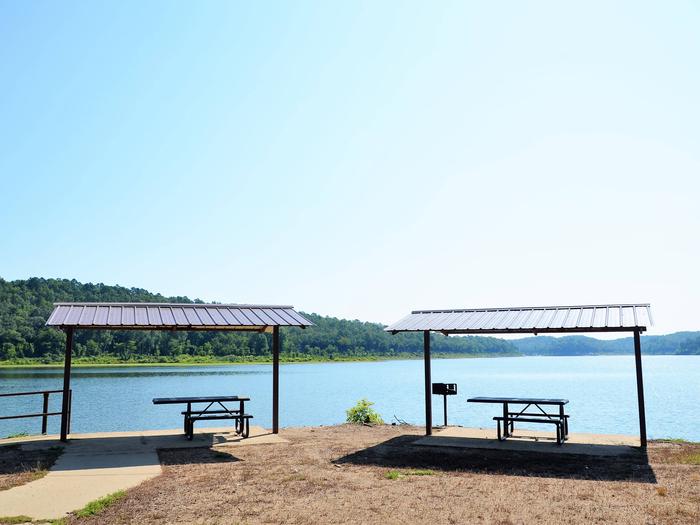
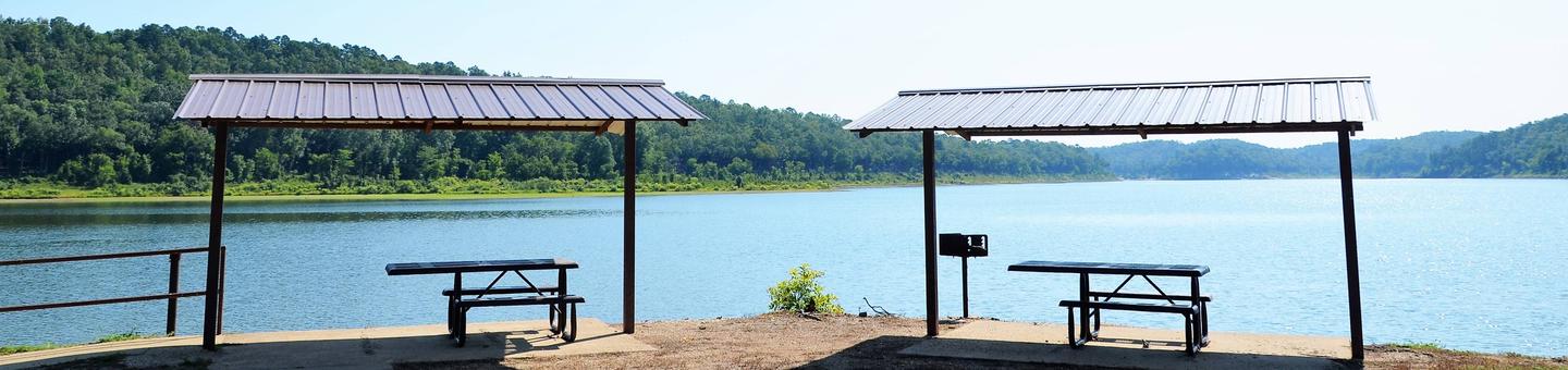
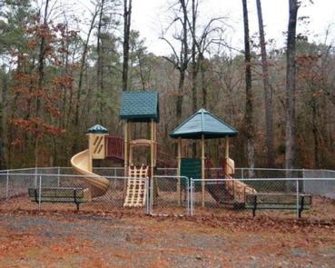
Little Coon Creek provides 10 campsites and a group picnic shelter; each site has water and 50-amp electric hookups available. Additional amenities include hot showers with restrooms, a boat ramp with a handicap accessible fishing pier, a playground and a dump station nearby.

Natural Features

Gillham Lake spans 1,370 surface acres and boasts 36 miles of shoreline. The Dam was completed in 1975 and stems from the Cossatot River, which has been designated as a National Wild and Scenic River.

Nearby Attractions

The Cossatot River State Park-Natural Area and the Queen Wilhelmina State Park are both within driving distance just north of Gillham Lake. Both of these attractions offer great scenery, hiking, and interpretive programs that are fun for all ages.

Reservation

More from CampingHiking.net:

MATHEWS ARM CAMPGROUND, Virginia Campground Images, Info & Reservations

Directions From Washington, D.C. metro area, travel west on Interstate 66 to exit 43A. Take US Highway 29 South to Warrenton, Virginia, then take US Highway 211 west for 28 miles to Shenandoah National Park and Skyline Drive Thornton Gap Entrance. Follow Skyline Drive north approximately 9 miles and turn

SPRINGY POINT, Idaho Campground Images, Info & Reservations

Directions From Sandpoint, Idaho, take US 95 south across the Long Bridge, then turn west onto Lakeshore Drive. After three miles turn right into the campground. Phone 208-437-3133 Activities BOATING, CAMPING, FISHING, PICNICKING, DAY USE AREA, SWIMMING Keywords SPRP,ALBENI FALLS DAM Related Link(s) Rec Area Info & Images Idaho State

AIRPORT PARK, Texas Campground Images, Info & Reservations

Directions From I-35, take the Lake Shore Drive exit (Exit 339) and drive west to Steinbeck Bend Road. Turn right and proceed to second stop light. At the intersection with FM 1637 (China Spring Highway) turn right. Go to next stop light (Flat Rock Road). Turn left and drive approximately

OAK (Navarro Mills Lake), Texas Campground Images, Info & Reservations

Directions From Waco or Corsicana, Texas, take State Highway 31 to the intersection with FM 667. Turn north on FM 667 and travel about 1.5 miles to the park entrance on the left side of the road. Phone 254-578-1431 Activities BOATING, CAMPING, FISHING, SWIMMING SITE Keywords OAK1,NAVARRO MILLS LAKE,NAVARRO MILLS

FLEECER STATION, Montana Campground Images, Info & Reservations

Directions From Butte, travel south on Interstate 15 for 15 miles. Take the Feely exit (no. 111) and turn west on Forest Road 96. Continue about 3 miles to Forest Road 447, turn left and travel about 2 miles to the cabin. The access road is on private land and