LITTLE COTTONWOOD CAMPGROUND, UT Campground Reservation, Info, Images, Map, Directions

LITTLE COTTONWOOD CAMPGROUND, Utah Campground Images, Info & Reservations

Listen

Directions

Travel east of Beaver approximately 6 miles on SR 153.

Phone

435-438-2436

Activities

CAMPING, FISHING, HIKING, VISITOR CENTER, WILDLIFE VIEWING

Keywords

LITTLE COTTONWOOD CAMPGROUND,LITTLE COTTONWOOD,COTTONWOOD,FISHLAKE NATIONAL FOREST

Related Link(s)

Rec Area Info & Images

Utah State Road Conditions

Utah State Tourism

Overview

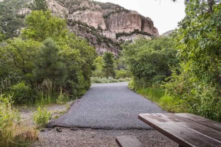
The Little Cottonwood Campground is conveniently located off Utah’s I-15, adjacent to the Beaver River just outside of the community of Beaver in the Fishlake National Forest. At 6,500 feet in elevation, this is a great place to enjoy the mountains where recreation opportunities include stream fishing, hiking, and hunting.

Recreation

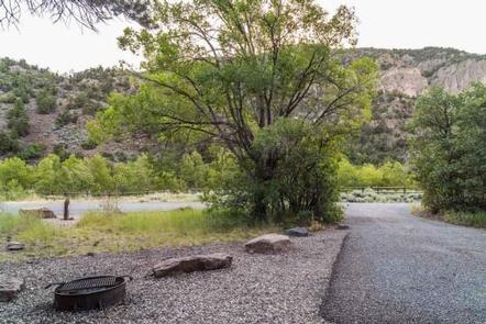
Enjoy fishing in the Beaver River; an accessible fishing path is located within the campground. The Piute ATV Trail is nearby; however there is no access directly from the campground. Be prepared to trailer ATVs to the nearby trailheads for access.

Nearby Cottonwood Trail is a horse and foot trail that is accessed through the lower part of Cottonwood Campground. This rugged trail will lead southwest for about the first two miles and then takes a sharp turn to the east through Horse Flat.

Facilities

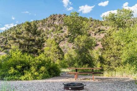
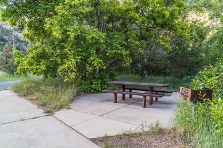
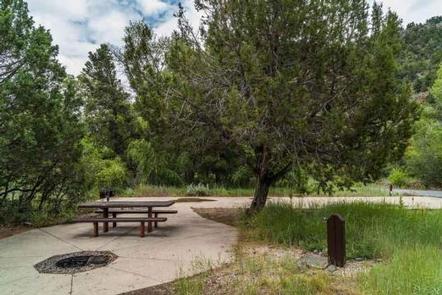
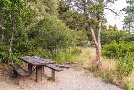
The campground has fourteen single-family campsites, two of which are accessible units available for reservation. All campsites are paved and have picnic tables and grills. An accessible restroom with flush toilets serves the campground. Potable water is available during the summer season. RVs up to 40 feet in length can be accommodated; no hook-ups are available.

Natural Features

Common vegetation includes cottonwood, aspen, pinion, juniper and ponderosa pine trees. A majority of campsites at Little Cottonwood are well-shaded.

The Fishlake National Forest offers spectacular vistas and opportunities to view wildlife in their natural habitat. Elk, deer, black bear, moose, cougar and mountain goats are some of the large animals that call the forest home.

Reservation

More from CampingHiking.net:

SOUTH SANDUSKY CAMPGROUND, Illinois Campground Images, Info & Reservations

Listen Directions From I-57 take exit 71 and turn west onto Route 14. After 3 miles turn right on Rend City Road, then continue for 6 miles to the campground entrance on the right. Phone 618-724-2493 Activities BIKING, CAMPING, INTERPRETIVE PROGRAMS, FISHING, HIKING, WILDLIFE VIEWING, SWIMMING SITE, STAR GAZING Keywords

DEER HAVEN, Utah Campground Images, Info & Reservations

Listen Directions From Cedar City, Utah, take Highway 14 east for 16 miles. Turn south on Webster Flat Road and travel 3 miles to the campground. Phone 801-226-3564 Activities BIKING, CAMPING, HIKING, WILDLIFE VIEWING, DAY USE AREA Keywords DEEH,DIXIE NF – FS Related Link(s) Rec Area Info & Images Utah

UPPER PAYETTE LAKE CAMPGROUND, Idaho Campground Images, Info & Reservations

Listen Directions From McCall, Idaho, take Highway 55 north to Warren Wagon Road/Forest Highway 21. Turn right and continue for 16 miles to gravel Forest Road 495 and follow for a mile into the campground. Phone 208-634-0400 Activities BOATING, CAMPING, FISHING, HIKING, HUNTING, WILDLIFE VIEWING, SWIMMING SITE Keywords UPPA,Upper Payette

ALMANOR, California Campground Images, Info & Reservations

Listen Directions From Chester, take Highway 36 west to Highway 89 South. Turn left on Highway 89 and continue south about 6 miles, to Almanor Drive West (not to be confused with Almanor West development and Almanor West Drive). Turn left on Almanor Drive West (directly across from the Almanor

CASCADE, Montana Campground Images, Info & Reservations

Listen Directions From U.S. Highway 212, go to the south end of Red Lodge. Turn west onto West Fork Rock Creek Road (Forest Road 2071) and travel 11 miles west. The campground is on the left. Phone 406-587-9054 Activities BIKING, BOATING, FISHING, HIKING, WILDLIFE VIEWING, KAYAKING, CANOEING Keywords CASCADE,CASCADE CAMPGROUND,CASD,CUSTER

KANZA VIEW PICNIC SHELTER, Kansas Campground Images, Info & Reservations

Listen Directions 1 mile north of Council Grove, Kansas on Highway 177. Then west 200 yards on Lake Road (goes across dam). Phone (620) 767-5195 Activities HISTORIC & CULTURAL SITE, CAMPING Keywords Related Link(s) Rec Area Info & Images Kansas State Road Conditions Kansas State Tourism Overview Kanza View Picnic