Alpine Meadows Campground, CA Campground Reservation, Info, Images, Map, Directions

Alpine Meadows Campground, California Campground Images, Info & Reservations

Directions

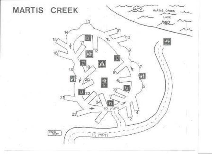
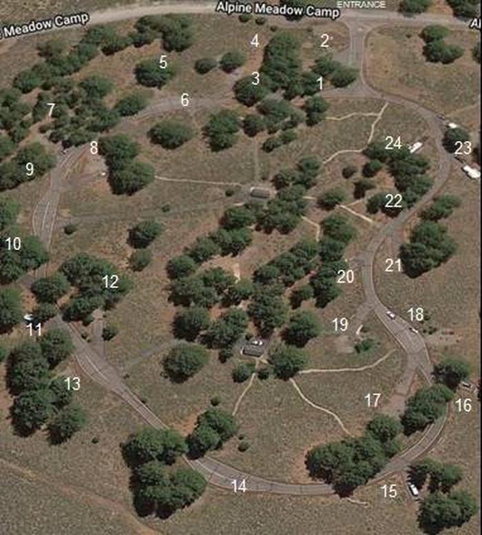
From State Highway 267, turn onto Martis Dam Road. Continue on Martis Dam Road for approximately 1.2 miles. Tur miles. Turn right a 0.2 miles to the campground entrance. You have now arrived at the entrance to Alpine Meadows Campground. 

Phone

(530) 587-8113

Activities

BIKING, CAMPING, FISHING, PICNICKING, WILDLIFE VIEWING, PHOTOGRAPHY, RANGER STATION, KAYAKING, CANOEING, BIRDING, NON-MOTORIZED BOATING, AMPHITHEATER

Keywords

Related Link(s)

Rec Area Info & Images

Martis Creek Lake Website

Overview

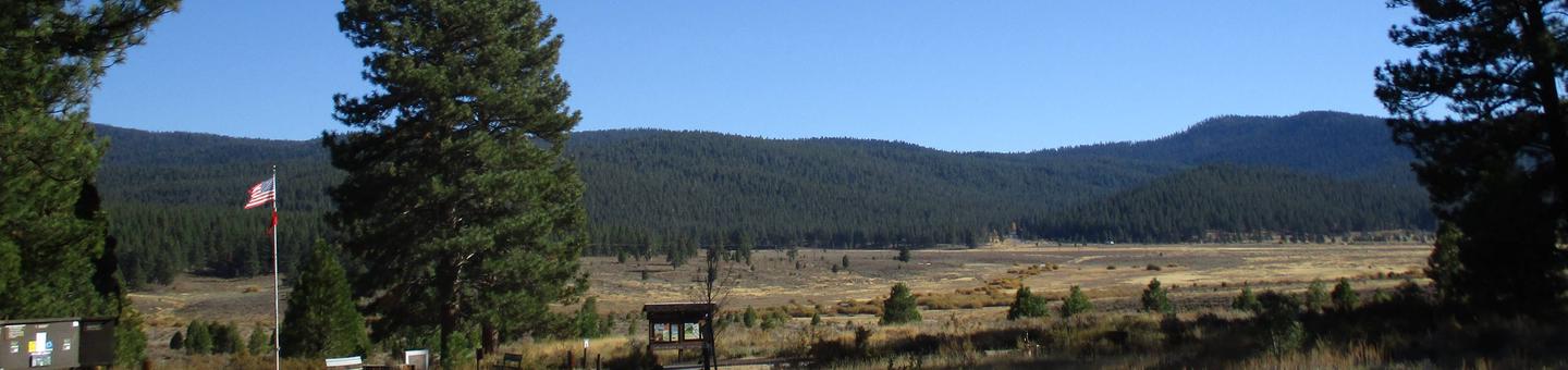
Located close to Lake Tahoe, Truckee, and Reno, Martis has a beautiful, peaceful campground off the beaten path. Martis Creek area features hiking, biking, canoeing, kayaking, and catch and release trout fishing.

Recreation

Fishing, kayaking, canoeing, walking, bicycling, picnicing. And of course camping.

Facilities

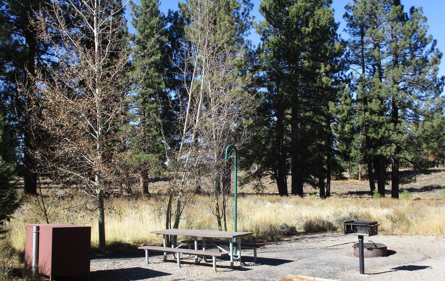
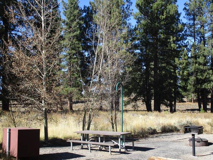
Vault toilets, potable water available at campground entrance, ampitheater.

Natural Features

Mountains, alpine valley, pine trees, lake, wild animals.

Nearby Attractions

Lake Tahoe, Truckee, Northstar, Reno, Virginia City

Charges & Cancellations

As per Recreation.gov policy.

Reservation

More from CampingHiking.net:

SAVENAC COOKHOUSE, Montana Campground Images, Info & Reservations

Directions From Missoula, travel west on Interstate 90 for 90 miles, to Haugan (Exit 16). Turn right at the stop sign. At the frontage road turn right, then take the first left, crossing the cattleguard. Signs are onsite if needed. Maps are available online or for purchase by calling the

Blue Lake Creek Campground, Washington Campground Images, Info & Reservations

Directions Take State Highway 12 to Randle, Washington. Follow State Highway 131 to the fork and and stay left onto Forest Road 23. Follow Forest Road 23 beyond North Fork Campground to Blue Lake Creek. Phone 541-338-7869 Activities BIKING, CAMPING, FISHING, HIKING, HUNTING Keywords BCRE,GIFFORD PINCHOT NF – FS Related

DAM SITE RIVER (BEAVER LAKE), Arkansas Campground Images, Info & Reservations

Directions From Eureka Springs, Arkansas, take Highway 62 West and travel just over 4 miles. Turn left on Highway 187 and continue for about 6 miles. Take the first right after crossing the dam and follow signs to the campground. Phone 479-253-9865 Activities BOATING, CAMPING, FISHING, HIKING, WATER SPORTS, SWIMMING

MONTPELIER CANYON CAMPGROUND, Idaho Campground Images, Info & Reservations

Directions The campground is located three miles east of Montpelier, Idaho, on U.S. Highway 89. Phone 541-351-1182 Activities BIKING, BOATING, CAMPING, FISHING, HIKING, HORSEBACK RIDING, WILDLIFE VIEWING Keywords MTPC,MONTPELIER CAMPGROUND,CARIBOU-TARGHEE NF – FS Related Link(s) Rec Area Info & Images Idaho State Road Conditions Idaho State Tourism Overview Montpelier Canyon

CASCADE, Montana Campground Images, Info & Reservations

Directions From U.S. Highway 212, go to the south end of Red Lodge. Turn west onto West Fork Rock Creek Road (Forest Road 2071) and travel 11 miles west. The campground is on the left. Phone 406-587-9054 Activities BIKING, BOATING, FISHING, HIKING, WILDLIFE VIEWING, KAYAKING, CANOEING Keywords CASCADE,CASCADE CAMPGROUND,CASD,CUSTER NF

ORLEANS TRAIL, Missouri Campground Images, Info & Reservations

Directions From Stockton, Missouri, take State Highway 39 south approximately 1/2-mile to R.B. Road. Take a left and drive approximately 1/2-mile. Turn right on Blake Street, continue about 1/2-mile, and follow signs to the park area. Phone 417-276-6948 Activities BOATING, CAMPING, FISHING, WILDLIFE VIEWING, SWIMMING SITE Keywords ORLE,STOCKTON LAKE,STOCKTON,SECOND BEACH,STOCKTON