OTTER BROOK LAKE BEACH, NH Campground Reservation, Info, Images, Map, Directions

OTTER BROOK LAKE BEACH, New Hampshire Campground Images, Info & Reservations

Directions

Otter Brook Lake Beach is located off of Route 9 East in Keene, NH.

Phone

603-352-4130

Activities

BOATING, FISHING, HIKING, HUNTING, PICNICKING, WILDLIFE VIEWING, DAY USE AREA, SWIMMING, KAYAKING, CANOEING, BIRDING, WATER ACCESS, CROSS COUNTRY SKIING, DISC GOLF, SNOWSHOEING

Keywords

Otter Brook Lake Beach,Otter Brook Beach Rec Area,Otter Brook Lake,Otter Brook Dam

Related Link(s)

Rec Area Info & Images

New Hampshire State Tourism

New Hampshire State Road Conditions

Overview

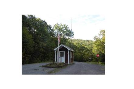
Otter Brook Lake Beach is a U.S. Army Corps of Engineers day use facility offering many outdoor recreation opportunities everyone can enjoy. The park is located in Keene and Roxbury, New Hampshire.

Recreation

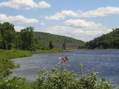
Swimming, sunbathing, picnicking, canoeing, wildlife viewing and fishing are just a few of the summertime favorite activities enjoyed at Otter Brook Lake Beach. If sports are your idea of fun, there are plenty of large areas for volleyball, baseball and other team sports. There is also a disc golf course in the park. If you are planning a family reunion, company party, wedding reception or any group function, the shelters at Otter Brook Lake Beach are a great place to hold your event.

Facilities

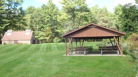
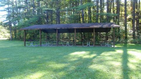
Otter Brook Lake Beach has restrooms with flush toilets, a large sandy beach with a swim area and a boat ramp. Picnic tables and grills are located throughout the park. Three shelters are available for group events. The largest shelter, the Pine, accommodates up to 80 people. It has electricity and is located along the gravel road near the river. The medium size shelter, the Elm, accommodates up to 60 people. It also has electricity. It is located on the entrance road, and is the closest shelter to the restroom. The Alder shelter, is the smallest shelter, it can accommodate up to 16 people. It does not have electricity but it is the closest shelter to the beach.

Natural Features

Otter Brook Lake Beach offers a large sandy beach, open grassy areas as well as shady sites along the river.

Charges & Cancellations

If a customer cancels a group day use facility reservation within the 14 days of scheduled arrival date they will forfeit the total fee.

A $10.00 service fee will apply if you change or cancel your reservation outside of the 14 day scheduled arrival. The $10.00 service fee will be deducted from the refund amount.

Reservation

More from CampingHiking.net:

SPECTACLE LAKE CAMPGROUND, Wisconsin Campground Images, Info & Reservations

Directions From Eagle River, travel 7.6 miles to FR2178 (Military Road). Turn left (north) and continue 2.9 miles to Kentuck Lake Road (FR2465). Turn right (northeast) on FR2465 and continue 1.7 miles to FR2196. Turn left (north) and continue 2.2 miles to Spectacle Lake Road (FR2572). Turn right (east) and

SANTA CRUZ DEL NORTE BACKCOUNTRY, California Campground Images, Info & Reservations

Directions Boat transportation can be arranged with Island Packers from Ventura Harbor. To park headquarters in Ventura, California: Highway 101, exit Victoria or Seaward to Ventura Harbor. Phone 805-658-5730 Activities CAMPING, HIKING, WILDLIFE VIEWING, WILDERNESS, PHOTOGRAPHY, BIRDING, BACKPACKING Keywords CG09,SANTA CRUZ DEL NORTE,DEL NORTE,CHANNEL ISLANDS,SANTA CRUZ,Channel Islands National Park,Channel Island

ROCKLAND RECREATION AREA, Tennessee Campground Images, Info & Reservations

Directions From Nashville, TN, take I-65 North to TN-386/Vietnam Veterans Blvd. Continue East on TN-386/Vietnam Veterans Blvd. to exit 3 for US-31E toward Hendersonville. Turn right onto Rockland Road (1st red light you come to), travel approximately 0.6 miles. Turn right onto Power Plant Road. Turn left onto Overlook Circle.

WHITE RIVER, California Campground Images, Info & Reservations

Directions From Highway 99, turn east onto J22. Proceed on J22 through California Hot Springs to the "T" intersection. Turn right at intersection M56 through Pineflat. Go 3 miles on the gravel road and turn directly across the bridge. The entrance is a quarter-mile past the bridge on the right

ANGEL LAKE, Nevada Campground Images, Info & Reservations

Directions Take Interstate 80 to the West Wells exit. Turn south on Angel Lake Road (State Route 231) and travel 12 miles to the end of the road at Angel Lake. Phone 775-752-3357 Activities BOATING, CAMPING, FISHING, HIKING, WILDLIFE VIEWING Keywords ANGL,RUBY MOUNTAINS,HUMBOLDT-TOIYABE NF-FS Related Link(s) Rec Area Info &

WEST LAKE, Colorado Campground Images, Info & Reservations

Directions From Fort Collins, take Highway 287 north approximately 24 miles to Livermore. Turn west on County Road 74 and continue 24 miles to the campground. Phone 970-295-6700 Activities BIKING, BOATING, CAMPING, FISHING, HIKING, WILDLIFE VIEWING, CANOEING Keywords WLCO,REDFEATHER LAKES,ARAPAHO AND ROOSEVELT NF – FS Related Link(s) Rec Area Info