Stoughton Pond Rec Area, VT Campground Reservation, Info, Images, Map, Directions

Stoughton Pond Rec Area, Vermont Campground Images, Info & Reservations

Directions

Take VT 106 North to Stoughton Pond Road. The facility is about ½ mile to the left in Perkinsville, Vermont.

Phone

802-886-2775

Activities

BOATING, HIKING, HUNTING, WINTER SPORTS, WILDLIFE VIEWING, SWIMMING SITE

Keywords

Stoughton Pond Rec Area,North Springfield Lake

Related Link(s)

Rec Area Info & Images

Vermont State Road Conditions

Vermont State Tourism

Overview

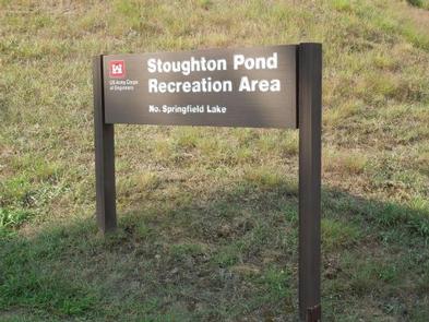
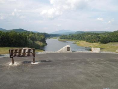
Stoughton Pond Recreation Area is a day use area located to the north of North Springfield Lake. Stoughton Pond is located off State Route 106 on Stoughton Pond Road in Perkinsville, Vermont.

Recreation

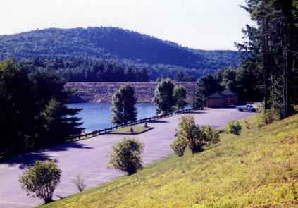
Stoughton Pond Recreation Area offers plenty of activities for visitors of all ages. Many people enjoy canoeing, kayaking, boating and fishing. The state of Vermont Department of Fish and Game annually stock the pond with rainbow trout, and the pond also offers excellent bass fishing. A boat ramp is available, located off Plains Road.

An interpretive trail winds along the side of the pond. Hikers are treated to views of wetlands and uplands, both with a wide diversity of natural habitats. A multi-use trail system is located at the main reservoir, North Springfield Lake.

Facilities

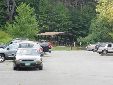
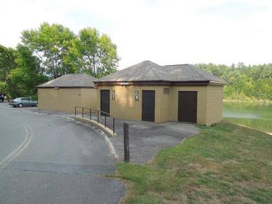
Stoughton Pond Recreation Area offers a group picnic shelter with tables and a large grill. Ten family picnic sites are also available on a first-come, first-served basis. Flush toilets, change house and drinking water are available on site.

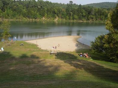
Amenities at this family-friendly park include a swimming area with a great beach, grassy areas for sun bathing and a boat ramp for small boats, canoes and kayaks.

The park is staffed by uniformed park rangers who offer special programs on a variety of nature topics throughout the season.

Natural Features

Stoughton Pond is situated among rolling hills on the North Branch of the Black River. Open lawns cover the park, with hardwood and softwood trees offering areas of shade and wildlife habitat.

Reservation

More from CampingHiking.net:

CAMP HALE EAST FORK GROUP, Colorado Campground Images, Info & Reservations

Directions From I-70, take exit 171 toward Minturn. Turn south on Highway 24 and continue for approximately 19 miles, just beyond Camp Hale Memorial Site. Turn onto Old Highway East and follow for 2 miles to the campground. Phone 970-468-7681 Activities CAMPING, FISHING, HIKING, WILDLIFE VIEWING Keywords EAF1,WHITE RIVER NF

SPRING, Oregon Campground Images, Info & Reservations

Directions From Crescent, Oregon, travel 12.2 miles west on Road 61, then 3.5 miles north on Highway 58, then 8.1 miles west on Road 60 to the campground. Phone 541-323-1746 Activities BIKING, BOATING, CAMPING, FISHING, HIKING, VISITOR CENTER, WATER SPORTS, SWIMMING SITE Keywords None Related Link(s) Rec Area Info &

BOULDER FLAT CAMPGROUND, Oregon Campground Images, Info & Reservations

Directions From Roseburg, OR travel east on OR-138 East/NE Diamond Lake Blvd. for 53 miles to Boulder Flat Campground, located on the left side of the highway. Phone 541-496-3532 Activities BIRDING, WHITEWATER RAFTING Keywords Related Link(s) Rec Area Info & Images Oregon State Road Conditions Oregon State Tourism Overview Situated

APGAR GROUP SITES, Montana Campground Images, Info & Reservations

Directions Located 1 mile northeast of the west entrance near West Glacier, Montana. Access is from U.S. Highway 2, approximately 32 miles northeast of Kalispell, Montana. Phone 406-888-7800 Activities BIKING, BOATING, CAMPING, INTERPRETIVE PROGRAMS, FISHING, HIKING, VISITOR CENTER, WILDLIFE VIEWING, DAY USE AREA, SWIMMING SITE Keywords Apgar Campground,Apgar,Glacier,Glacier National Park,APGAR