Rock Creek Park Group Picnic Areas, DC Campground Reservation, Info, Images, Map, Directions

Rock Creek Park Group Picnic Areas, District of Columbia Campground Images, Info & Reservations

Directions

Rock Creek Park is located in northwest Washington, DC, lying between Connecticut Avenue to the west and 16th Street to the east. For directions to a specific picnic site, please refer to the Rock Creek Park map online at www.nps.gov/rocr .

Phone

202-895-6000

Activities

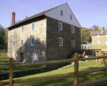
BIKING, HISTORIC & CULTURAL SITE, CAMPING, INTERPRETIVE PROGRAMS, HIKING

Keywords

Rock Creek Park Group Picnic Areas

Related Link(s)

Rec Area Info & Images

District of Columbia State Tourism

District of Columbia State Road Conditions

Overview

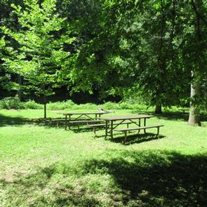
Eight group picnic areas in Rock Creek Park are available for advance reservation from May through October. These picnic areas are available on a first-come, first-served basis from November through April.

Recreation

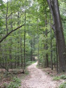
Recreational activities in Rock Creek Park include: soccer, picnics, hiking, biking, roller blading, tennis, fishing, horseback riding and attending a concert or park ranger program.

Facilities

All picnic groves are equipped with multiple picnic tables, some also have fireplaces that can be used for cooking. User must provide a cooking grate or other cooking equipment. Picnic groves 1, 6, 13 and 24 have pavilions. Some sites offer access to toilet facilities, though not all. Please refer to specific grove descriptions for details.
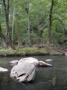
Natural Features

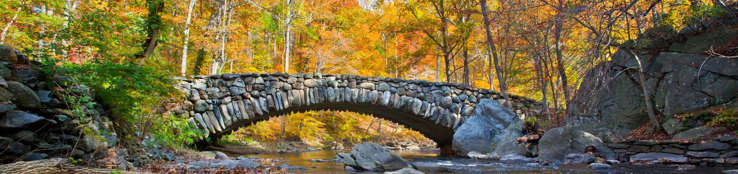
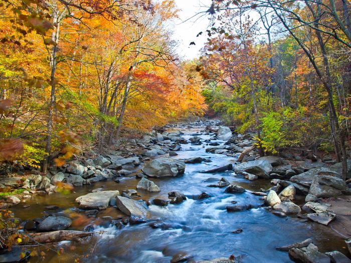
Rock Creek Park is truly a gem in our nation’s capital. Fresh air, majestic trees, wild animals and the ebb and flow of Rock Creek emanate the delicate aura of the forest.

Nearby Attractions

Rock Creek Park is located near many national monuments and museums in the nation’s capital.

Reservation

More from CampingHiking.net:

Sand Island Group Sites, Utah Campground Images, Info & Reservations

Directions Sand Island Campground is located on the north bank of the San Juan River about 3 miles west of Bluff, Utah, on the south side of Highway 191. Phone 435-587-1500 Activities HISTORIC & CULTURAL SITE, CAMPING, PICNICKING, PHOTOGRAPHY, PADDLING, WATER ACCESS, WHITEWATER RAFTING Keywords None Related Link(s) Rec Area

RED CANYON, Utah Campground Images, Info & Reservations

Directions Located on Forest Road 095/Red Canyon Road off Highway 44, approximately 40 miles north of Vernal, Utah. Phone 435-784-3445 Activities BIKING, BOATING, CAMPING, FISHING, HIKING, WILDLIFE VIEWING Keywords RECA,RED CANYON COMPLEX,FLAMING GORGE,ASHLEY NF – FS,Flaming Gorge National Recreation Area Related Link(s) Rec Area Info & Images Utah State Tourism

APPALACHIAN CLUBHOUSE, Tennessee Campground Images, Info & Reservations

Directions Proceed south from Gatlinburg, TN on Newfound Gap Road (aka US 441) 1.7 miles and turn right onto Little River Road towards Cades Cove. Proceed 5 miles to the Elkmont (Campground) Road and turn left. Go. 1.4 miles and turn left just before the campground office (sign says: Elkmont

BUCKALOONS, Pennsylvania Campground Images, Info & Reservations

Directions Take PA-6 to PA-62 South. Take the first right onto National Forge Road, then the first left into the campground. If coming up PA-62 from the south, cross the Allegheny River north of Tidioute and take the first left onto National Forge Road, then the first left into the

NEBRASKA TAILWATERS, Nebraska Campground Images, Info & Reservations

Directions From Yankton, South Dakota, go south on U.S. Highway 81 for 2 miles, then west on Nebraska Highway 121 for 4 miles, campground entrance will be on your right. Phone 402-667-2546. FOR RESERVATIONS, CALL 877-444-6777. Activities BIKING, BOATING, CAMPING, FISHING, PICNICKING, WILDLIFE VIEWING, PHOTOGRAPHY, WATER ACCESS Keywords NEBR,GAVINS POINT,LEWIS