Yakima River Canyon Campgrounds, WA Campground Reservation, Info, Images, Map, Directions

Yakima River Canyon Campgrounds, Washington Campground Images, Info & Reservations

Directions

Located along the Washington State Scenic Byway of Highway 821 “Canyon Road” between the cities of Ellensburg and Yakima: Umtanum will be near Mile Post 16, Lmuma Creek will be near Mile Post 12, Big Pines will be near Mile Post 8, and Roza near Mile Post 7.

Phone

509-665-2100

Activities

BOATING, CAMPING, FISHING, HIKING, HUNTING, PICNICKING, WATER SPORTS, WILDLIFE VIEWING, DAY USE AREA, PHOTOGRAPHY, PADDLING, SWIMMING, WATER ACTIVITIES, CANOEING, STAR GAZING, BIRDING, NON-MOTORIZED BOATING, WATER ACCESS, SCENIC DRIVE, RAFTING, RIVER TRIPS, TUBING

Keywords

Yakima River Canyon,Umtanum,Lmuma Creek,Big Pines,and Roza.

Related Link(s)

Rec Area Info & Images

Washington State Tourism

Washington State Road Conditions

Overview

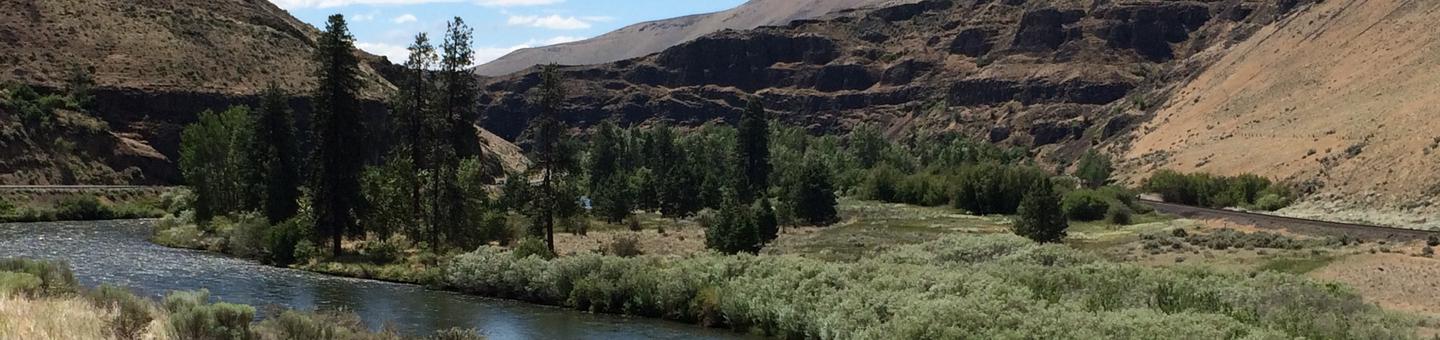
The gentle Yakima River winds for 27 miles through massive basalt cliffs and rolling desert hills between Ellensburg and Yakima, Washington. This area is popular for wildlife viewing, fishing, and floating the river.

Recreation

The Yakima River Canyon is a popular destination for plant and wildlife viewing, including bighorn sheep, various birds of prey, and mule deer. This section of the river is classified as a Blue Ribbon trout stream, but is catch and release only. One of the most popular summer activities is floating the river, which is a family friendly Class 1 river with no rapids. Rafters often put in at Umtanum and take out at Roza.

Facilities

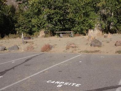
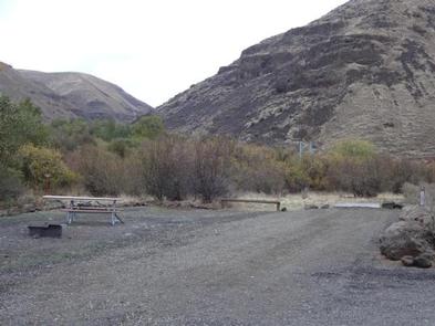
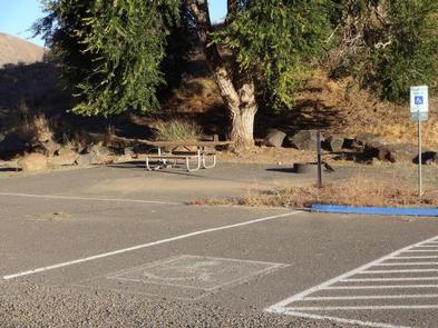
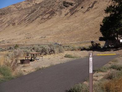
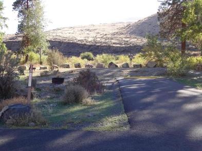
All four BLM-managed recreation sites offer picnic tables, fire rings, nearby dumpsters and vault toilets. Hookups and potable water are not provided. Big Pines campground is where the majority of the campsites are located, and contains two group campsites. Umtanum, Lmuma Creek, and Roza also offer campsites. Umtanum and Roza receive high day-use visitation during the summer months. Roza offers a concrete boat launch. Motorboats are prohibited upstream from Roza.

Natural Features

Within the Yakima River Canyon Campgrounds there are four developed Bureau of Land Management (BLM) sites with river access: Umtanum, Lmuma Creek, Big Pines, and Roza. Visitors have the opportunity to explore the massive basalt cliffs, rolling desert hills, riparian vegetation, and the cool water of the Yakima River.

Nearby Attractions

The cities of Ellensburg and Yakima, Central Washington University, and Cowiche Canyon trails are near by. Umtanum recreation site offers a footbridge to cross the Yakima River and access to Washington State Department of Fish and Wildlife Lands on the west side of the river.

Reservation

More from CampingHiking.net:

WOODS CABIN, Montana Campground Images, Info & Reservations

Directions From Darby, Montana, continue north on Highway 93 for 4 miles. Turn west onto County Road 82/Lake Como Road. Follow signs to the Lake Como National Recreation Area and continue past the swimming area, to a gate at the third lot. Maps of the area can be purchased by

BUCKHORN, California Campground Images, Info & Reservations

Directions From Interstate 5, take the Black Butte Lake exit at Orland, CA. Travel west on County Road 200/Newville Road for 12 miles. Turn left on Buckhorn Road and enter the Buckhorn Recreation area. Phone 530-865-4781 Activities BIKING, BOATING, CAMPING, FISHING, HIKING, WILDLIFE VIEWING, SWIMMING SITE Keywords BHOR,BLACK BUTTE LAKE

WOODRING CAMPGROUND, Georgia Campground Images, Info & Reservations

Directions From Atlanta, take I-75 north to Exit 293; follow Highway 411 north. Turn right on Highway 136, then left on old Highway 411. Turn right on Highway 282/76. Campground is located 4.5 miles off Highway 282. From Ellijay, GA, take Highway 282/76 west for 11 miles to the access

ALLEY CREEK CAMP, Texas Campground Images, Info & Reservations

Directions From Jefferson, TX, travel 3.8 miles northwest on Highway 49. Turn left onto FM 729 and continue for 12 miles to the park entrance on the left. Phone 903-755-2637 Activities BOATING, CAMPING, FISHING, HIKING, HUNTING, WATER SPORTS, WILDLIFE VIEWING, SWIMMING, BIRDING Keywords ACRC,LAKE OF THE PINES,LAKE O THE PINES,FERRELLS

TABLE MOUNTAIN (ANGELES), California Campground Images, Info & Reservations

Directions From Wrightwood, California, take State Route 2 west for 2.4 miles to the Table Mountain Campground sign and continue to follow signs into the campground. Phone 760-249-3526 Activities BIKING, CAMPING, HIKING, WILDLIFE VIEWING, DAY USE AREA, SCENIC DRIVE Keywords TBLE,TABLE MOUNTAIN ANGELES NF,ANGELES NF – FS Related Link(s) Rec

FRENCH GULCH, California Campground Images, Info & Reservations

Directions From Bakersfield, California, take Highway 178 east to the town of Lake Isabella. Turn onto Highway 155 north, following the western edge of the lake, for approximately 3 miles to the campground. Phone 760-376-1815 Activities CAMPING, PICNICKING Keywords FREG,LAKE ISABELLA,KERN VALLEY,SEQUOIA NF – FS Related Link(s) Rec Area Info