BLUE MARSH LAKE (DRY BROOKS DAY USE AREA), PA Campground Reservation, Info, Images, Map, Directions

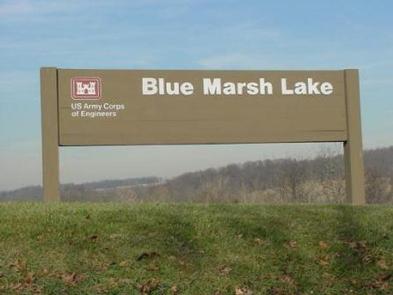
BLUE MARSH LAKE (DRY BROOKS DAY USE AREA), Pennsylvania Campground Images, Info & Reservations

Directions

Blue Marsh Lake is located 7 miles northwest of Reading, PA. Take route 183 north and make a left on Palisades Dr. Travel one mile and the Dry Brooks Day Use Area will be on your right.

Phone

610-376-6337

Activities

BIKING, BOATING, CAMPING, HIKING

Keywords

Blue Marsh Beach,Blue Marsh swimming area

Related Link(s)

Rec Area Info & Images

Pennsylvania State Tourism

Pennsylvania State Road Conditions

Overview

Located at Blue Marsh Lake northwest of Reading, Pennsylvania, three group picnic shelters are available for reservations within the Dry Brooks Day Use Area. With over 36 miles of trails, 5,000 acres of land, 1,147 acres of water, picnic areas, a small beach and boat launches, the Blue Marsh Lake area is appealing to all kinds of outdoor enthusiasts.

Recreation

Blue Marsh Lake is an unlimited horsepower lake for boating and waterskiing. Paddle craft are also very popular. There is a 30 mile multi-use hiking trail that permits hiking, biking, and horseback riding. Other activities include swimming, picnicking, bird watching, and hunting.

Facilities

Blue Marsh Lake is a day use facility only and includes three boat launches and a Visitor Center. The group shelters includes picnic tables, grills, trash receptacles and restrooms nearby. Lakeview and Hillside shelters include water and electricity, but Vista shelter does not.

Natural Features

The group shelters are set within the day use picnic area surrounded by mowed grass and parking lots. The shelters are also within walking distance of the swimming beach.

Nearby Attractions

Visitors to the Blue Marsh Lake area may want to consider a visit to the Mid-Atlantic Air Museum, Berks County Parks System which contains the Berks County Heritage Center, and The Conrad Weiser Homestead located in nearby Hamburg, PA.

Reservation

More from CampingHiking.net:

PIPER ISLAND CABIN, Alaska Campground Images, Info & Reservations

Directions Accessible year round by floatplane or boat, weather permitting. Located 30 miles north of Sitka within Schulze Cove, on the north side of Fish Bay, the northwest coast of Baranof Island. From Sitka, boat access is 90 minutes, air access is 20 minutes. For geographic features surrounding the cabin,

MIDDLE RIDGE CABIN, Alaska Campground Images, Info & Reservations

Directions Middle Ridge Cabin is located on Wrangell Island, approximately 20 miles from Wrangell, Alaska. There are no roads to Wrangell. Access is by the Alaska Marine Highway or via Alaska Airlines. From Wrangell, head south on Zimovia Highway approximately 11 miles to Pat’s Creek Road (Road 6259) and take

BIG TRINITY CABIN, Idaho Campground Images, Info & Reservations

Directions Travel east from Boise, Idaho on I-84 to Mountain Home. At I-84/Highway 20 junction, take Highway 20 east for 35 miles to Pine/Featherville turnoff. Travel north on Forest Highway 61 for 29 miles to Forest Road 172. Travel 15 miles northwest to Forest Road 129. Travel 3 miles to

ONEGUME, Minnesota Campground Images, Info & Reservations

Directions Onegume is located on State Highway 46, approximately 18 miles northwest of Deer River, Minn. Phone 218-246-2123 Activities BIKING, BOATING, CAMPING, INTERPRETIVE PROGRAMS, FISHING, HIKING, WATER SPORTS Keywords ONEG,CHIPPEWA NF – FS Related Link(s) Rec Area Info & Images Minnesota State Tourism Minnesota State Road Conditions Overview Onegume Campground

SPRINGY POINT, Idaho Campground Images, Info & Reservations

Directions From Sandpoint, Idaho, take US 95 south across the Long Bridge, then turn west onto Lakeshore Drive. After three miles turn right into the campground. Phone 208-437-3133 Activities BOATING, CAMPING, FISHING, PICNICKING, DAY USE AREA, SWIMMING Keywords SPRP,ALBENI FALLS DAM Related Link(s) Rec Area Info & Images Idaho State

WILD MARE HORSE CAMP, Oregon Campground Images, Info & Reservations

Directions From Reedsport, Oregon, take Highway 101 south for 22 miles, turn right on Transpacific Lane. Proceed 1 mile, Cross the railroad tracks and turn right on Horsfall Road. Proceed 1.9 miles down Horsfall Road to Wild Mare Campground. Campground is located on south side of road. From North Bend,