Roundup Group Horse Camp, ND Campground Reservation, Info, Images, Map, Directions

Roundup Group Horse Camp, North Dakota Campground Images, Info & Reservations

Directions

The South Unit entrance is in Medora, ND. Medora is accessible via Interstate 94 Exits 24 and 27 in North Dakota. Note exit 27 is westbound exit only. Medora is 133 miles west of Bismarck, ND and 27 miles east of the Montana state line.

Phone

701-623-4466 (NOTE PARK DOES NOT TAKE RESERVATIONS)

Activities

CAMPING, HIKING, WILDLIFE VIEWING, BIRDING

Keywords

Related Link(s)

Rec Area Info & Images

North Dakota State Tourism

North Dakota State Road Conditions

Overview

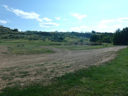
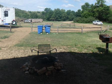
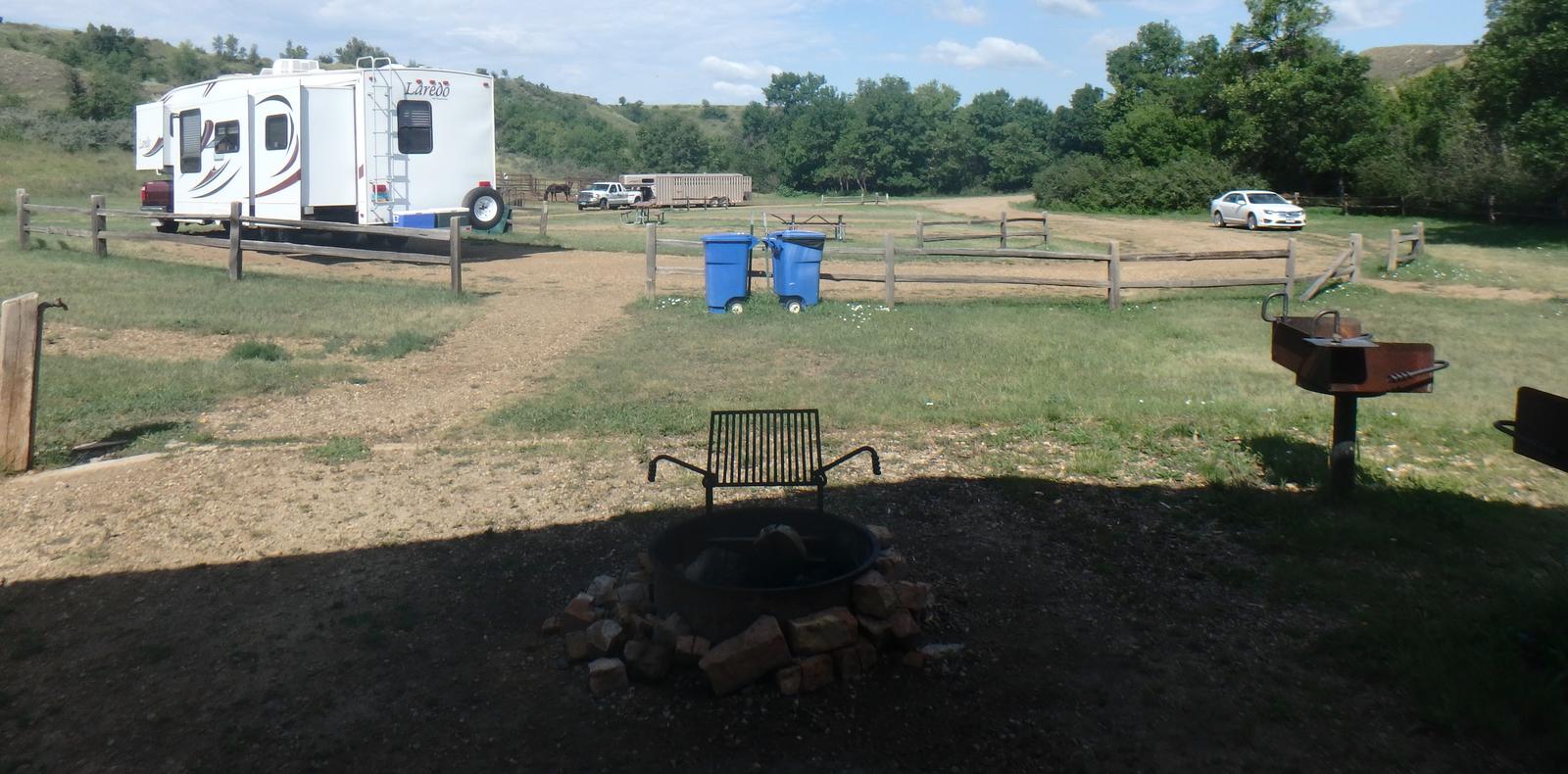
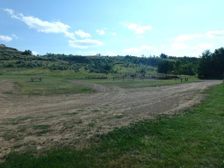
For groups with or without horses visiting the South Unit of Theodore Roosevelt National Park, Roundup Horse Campground is a great place to stay. Located 12 miles from the entrance to the South Unit of the park, the campground is open from May 1 – October 31.

Recreation

Hikers and horseback riders can access the estimated 70 miles of trails within a short distance of the campground; please stop at a Visitor Center for more details.
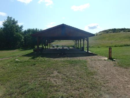
Facilities

Toilets, drinking water and picnic tables are provided at this facility. The site can accommodate tents, trailers and RVs. The site can accommodate up to 20 people with 20 horses or 30 people without horses. There are no hookups or a dump station. Depending on the weather, water may/may not be available during May and October; however a water fill station is available for campers, located in Cottonwood Campground. All wheeled vehicles and trailers must remain on roadways or pads.

Natural Features

The Little Missouri River is the central, unifying feature of this wild and broken land where, as a young man, Theodore Roosevelt ranched and hunted in the 1880s. The park is part of both the Northern Great Plains and the West, blending a rich natural beauty with diverse human history. The rugged topography, with its flora and fauna, also provides an opportunity to discover the badlands environment as Roosevelt once did. It is a place to experience a land and way of life that helped shape Theodore Roosevelt’s attitudes and philosophy regarding conservation. Cottonwood trees surrounding the campsite turn golden in the fall.

Nearby Attractions

The town of Medora has shopping, restaurants, amenities and the Medora Musical is located approximately 12 miles to the south. The Little Missouri National Grasslands is the largest National Grassland in the nation at 1.03 million acres. It is located in western North Dakota and is managed by the Medora Ranger District in Dickinson, ND and the McKenzie Ranger District in Watford City, ND. The National Grassland provides additional recreation opportunities in the area.

Reservation

More from CampingHiking.net:

STOCKTON PASS, Arizona Campground Images, Info & Reservations

Directions From Safford, Arizona: Take State Route 191 south for 17 miles. Turn right onto State Route 266 and continue 12 miles to the Stockton Pass Campground (MM 116.5) on the right. The campground is past the second cattle guard.  From Tucson, Arizona: Take I-10 East for 90 miles. Take

DYERS CREEK, Tennessee Campground Images, Info & Reservations

Directions From Nashville, Tenn, take I-24 West to the Clarksville Exit 8. Take US-79S for 46 miles to Dyers Creek Recreation Area. Phone 931-232-7724 DOVER OFFICE; 270-362-4236 LAKE BARKLEY RESOURCE MANAGERS OFFICE Activities BOATING, HISTORIC & CULTURAL SITE, FISHING, VISITOR CENTER, DAY USE AREA Keywords DYER,LAKE BARKLEY,BARKLEY LOCK & DAM

NORTH OVERLOOK CAMP, Iowa Campground Images, Info & Reservations

Directions 1007 Hwy T-15 Pella, Iowa From Pella, Iowa, take County Highway T-15 southwest for 3 miles, then follow signs to the campground. Phone 641-828-7522 Activities BIKING, BOATING, CAMPING, FISHING, HIKING, VISITOR CENTER, DAY USE AREA, SWIMMING SITE Keywords NORC,LAKE RED ROCK Related Link(s) Rec Area Info & Images Iowa

DAM SITE RIVER (BEAVER LAKE), Arkansas Campground Images, Info & Reservations

Directions From Eureka Springs, Arkansas, take Highway 62 West and travel just over 4 miles. Turn left on Highway 187 and continue for about 6 miles. Take the first right after crossing the dam and follow signs to the campground. Phone 479-253-9865 Activities BOATING, CAMPING, FISHING, HIKING, WATER SPORTS, SWIMMING

PERRY SOUTH CAMPGROUND, Oregon Campground Images, Info & Reservations

Directions From Sisters, travel 5.6 miles northwest on Hwy 20. Continue 20.8 miles north on Forest Road 11, then 5.0 miles east on Forest Road 1170, and then 2.6 miles northwest of Forest Road 64. Phone 503-464-8515 Activities BIKING, BOATING, CAMPING, FISHING, HIKING, WATER SPORTS, WILDLIFE VIEWING, DAY USE AREA,

ALTURAS LAKE INLET, Idaho Campground Images, Info & Reservations

Directions From Highway 75, turn onto Forest Road 205/Alturas Lake Road. Travel approximately 3 miles to the campground. Phone 928-537-8888 Activities BIKING, BOATING, CAMPING, FISHING, HIKING, WATER SPORTS, SWIMMING SITE Keywords ALTL,ALTURAS INLET,SAWTOOTH NF – FS Related Link(s) Rec Area Info & Images Idaho State Tourism Idaho State Road Conditions