Susan Creek Campground, OR Campground Reservation, Info, Images, Map, Directions

Susan Creek Campground, Oregon Campground Images, Info & Reservations

Directions

The campground is located just past milepost 28 on Highway 138.

Phone

541-440-4930

Activities

BIKING, CAMPING, FISHING, HIKING, HORSEBACK RIDING, DAY USE AREA

Keywords

Related Link(s)

Rec Area Info & Images

Oregon State Tourism

Oregon State Road Conditions

Overview

Susan Creek Campground is well known for its beautiful setting along the emerald-green waters of the North Umpqua Wild and Scenic River. Nestled under the canopy of a mature forest, the campsites are surrounded by trees up to seven feet in diameter. It is a short drive from the Umpqua National Forest, which boasts incredible glacial-cut mountain slopes across 984,602 acres of forest. The campground features 29 campsites, 13 of which may be reserved between May 15 – September 15. The other 16 sites are available on a first-come, first-served basis.

Recreation

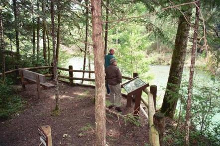
Hiking, picnicking, and relaxing are the primary activities at the campground. Well-developed trails on both the east and the west ends of the campground wind through tall trees and lush green understory providing views of wildlife such as the resident blacktail deer and soaring osprey.

In spring and fall, salmon and steelhead trout come upriver to spawn, providing good fishing opportunities. Fishing on this stretch of the river is limited to fly-fishing only. The river also attracts swimmers and whitewater rafters and kayakers.

Facilities

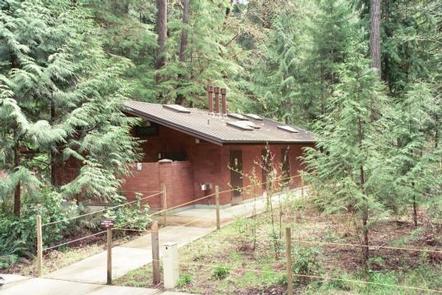
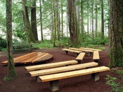
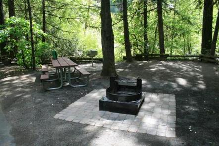
The campground is built on a loop with 29 separate sites. You will have access to amenities including multiple spigots for drinking water, flush restrooms, hot showers, horseshoe pits, nature trails, an emergency phone, and an amphitheater where Bureau of Land Management staff present educational programs on weekend evenings in July and August.

Natural Features

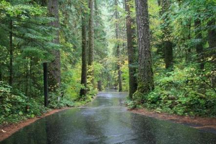
Susan Creek is on the western edge of the Cascade Mountains, set along the famous North Umpqua River. You will be treated to sounds of the rushing river as it weaves its way through volcanic bedrock. majestic fir, cedar, and hemlock trees dominate the mountainous region.

Nearby Attractions

The campground is centrally located, with easy access to nearby rafting, fly-fishing, mountain biking, picnicking and waterfall viewing.

The 79-mile long North Umpqua Trail is a great place to hike or mountain bike, and can be reached from the campground by either trail or road. The Susan Creek Falls trail winds through a forest of diverse tree and plant species, ending at the stunning Susan Creek Falls. Take a drive along the Rogue-Umpqua National Scenic Byway yielding gorgeous views of mountain peaks, forested canyons, and alpine lakes.

Reservation

More from CampingHiking.net:

RIVERSIDE EAST, Kansas Campground Images, Info & Reservations

Directions From Burlington, Kansas, take US 75 north for about 3.5 miles, then turn west onto Embankment Road and continue for 1.5 miles and follow signs to park entrance. Phone 620-364-8613 Activities BIKING, CAMPING, FISHING, HIKING, HUNTING Keywords RIEA,JOHN REDMOND RESERVOIR,JOHN REDMOND RESERVOIR Related Link(s) Rec Area Info & Images

FROG LAKE, Oregon Campground Images, Info & Reservations

Directions From Sandy, travel 62 miles east on Highway 26, then continue 1 mile west through the Sno-Park on Forest Road 2610. Phone 503-630-5721 Activities BIKING, BOATING, CAMPING, FISHING, HIKING, WILDLIFE VIEWING, SWIMMING SITE Keywords FROG,MT. HOOD NF – FS Related Link(s) Rec Area Info & Images Forest Service Concessionaire

ASPEN POINT, Oregon Campground Images, Info & Reservations

Directions From Medford, Oregon, travel 32 miles east on Highway 140, then turn south on Forest Road 3701 and continue .6 miles to the campground. Phone 541-949-8020 Activities BIKING, BOATING, CAMPING, FISHING, HIKING, SWIMMING SITE Keywords APEN,LAKE OF THE WOODS,WINEMA NF – FS Related Link(s) Rec Area Info & Images

RIVER FORKS, Georgia Campground Images, Info & Reservations

Directions From Highway 187, turn onto Old Robert’s Church Road and follow brown directional signs. 710 RIVER FORKS RD, Anderson, SC 29626 Phone 888-893-0678 HARTWELL PROJECT OFFICE Activities BOATING, FISHING, PICNICKING, DAY USE AREA, SWIMMING SITE, SWIMMING, WATER ACCESS Keywords RIVF,HARTWELL LAKE PROJECT Related Link(s) Rec Area Info & Images

SUNSET, Oregon Campground Images, Info & Reservations

Directions From Klamath Falls, go 32 miles northwest on Highway 140. Turn south on Dead Indian Memorial road and continue approximately 2.5 miles to the campground. Phone 866-201-4194 Activities BIKING, BOATING, CAMPING, FISHING, HIKING, SWIMMING SITE Keywords SUSE,LAKE OF THE WOODS,WINEMA NF – FS Related Link(s) Rec Area Info &

WEST HILL PARK, Massachusetts Campground Images, Info & Reservations

Directions Take State Route 146 to the Whitinsville exit and turn left off the ramp. Go straight through Whitinsville to Route 122. Turn right and continue to East Hartford Avenue. Turn left and follow brown Army Corps direction signs. Phone (978) 318-8419 OR (508) 278-2511 Activities BIKING, BOATING, CAMPING, INTERPRETIVE