
Directions
Getting There:
Lost Lake Resort & Campground, Hood River County
GPS Info:
Coordinates: 45.489840 N 121.822578 W
From Portland Oregon: Take Highway 84 for approximately 58 miles, exiting at #62. Take Country Club Road to Barrett Drive turning left on Barrett Drive to Tucker Road. Turn right on Tucker Road which eventually intersects with 281 (Dee Highway); take Dee Highway to the Lost Lake Road exit, Lost Lake Road dead-ends at Lost Lake Resort & Campground.
Phone
541-386-6366
Activities
CAMPING, FISHING, HIKING, DAY USE AREA, OBSERVATION SITE, SWIMMING, PADDLE BOATING, KAYAKING, CANOEING, NON-MOTORIZED BOATING, SCENIC DRIVE
Keywords
Related Link(s)
Overview
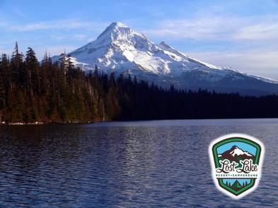
Lost Lake Campground is couched between beautiful Lost Lake and Mount Hood. From Lost Lake Butte, the valley view is breathtaking, and from the viewpoint, guests can revel in the most majestic view of Mt. Hood, its glaciers and Lost Lake. Another one of the many attractions at Lost Lake Campground is the old growth boardwalk, an interpretive trail the meanders through one of Oregon’s large old growth stands.
Recreation
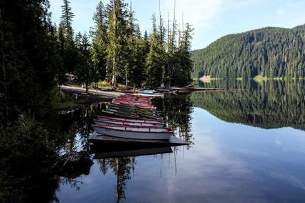
Lost Lake Campground offers an abundance of activities. Campers have access to a resort store, which offers: canoe, kayak, wooden boats, metal fishing boats and stand-up paddleboard rentals. Whether you are a professional angler looking to catch that prized German Brown or a first-timer, there is something for everyone. Additionally, there are a number of trails near the campground ranging in length from 1/4 mile to over 100 miles resulting in numerous hiking and biking opportunities. Other activities include bird watching, berry picking, swimming, waterfall finding or simply enjoying one of the many scheduled activities such as telescoped stargazing, special Forest Service events or live music.
Facilities
Lost Lake Campground is adjacent to a full service resort with a variety of campsites to accommodate all types of visitors, including group, family and single campsites. In addition to the campsites, there are cabins, yurts, lodge rooms and an extensively stocked general store on site.
There is drinking water at designated locations and pit toilets throughout. Each site has a designated tenant location, picnic table and fire ring. Firewood is available for purchase at the general store. This campground has a minimum three night stay on weekends and holidays.
Natural Features
Mother Nature went the extra mile when it came to Lost Lake. The surrounding topography is rugged, mountainous and magical. The flora and fauna is abundant and easily accessible. These attributes culminate in making Lost Lake Campground one of the most popular in Oregon.
Nearby Attractions
Nearby Wahtum Lake offers a great daily excursion or hike to one of the four surrounding waterfalls. On the way up to Lost Lake or on the way down, try stopping at one of the many fruit stands that blanket the Hood River Valley.