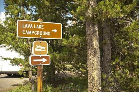
LAVA LAKE CAMPGROUND, OR Campground Reservation, Info, Images, Map, Directions

LAVA LAKE CAMPGROUND, Oregon Campground Images, Info & Reservations

Directions

From Bend, travel 38.4 miles southwest on Cascade Lakes Hwy (46), then 1.0 miles east on Forest Road 4600 500.

Phone

541-323-1746

Activities

CAMPING

Keywords

Related Link(s)

Rec Area Info & Images

Oregon State Tourism

Oregon State Road Conditions

Overview

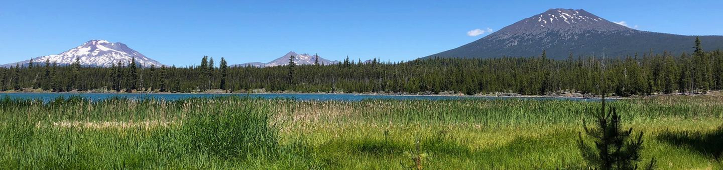
Lava Lake Campground is located along the Cascade Lakes National Scenic Byway within the heart of Central Oregon’s Cascade Range.

Recreation

Lava Lake Campground offers access to hiking, mountain biking, horseback riding, fishing and scenic driving.

Facilities

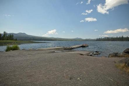
This waterfront campground features 44 sites some of which are designated as tent-only while others provide space for small RV’s and trailers.

Lava Lake Campground also has a day use area and boat ramp.

Natural Features

Lava Lake is located on the eastern slopes of the Cascade Mountain Range at an elevation of 4,740 feet surrounded by mature pine forests with bull rushes and lava outcroppings lining its shores..

Nearby Attractions

Visitors can explore wilderness areas, wild and scenic rivers, lakes and reservoirs and approximately 1,600 miles of trails within the Deschutes National Forest.

Lava Lands Visitor Center in nearby Bend, Oregon, and the unique geological landscape of Newberry National Volcanic Monument draw visitors to the region as well.

Visitors will also enjoy traveling the Cascade Lakes Scenic Byway which climbs into the Cascades from Central Oregon’s high desert valley over a 66-mile drive weaving through snow-capped peaks and alongside alpine lakes.

Reservation

More from CampingHiking.net:

STORM MOUNTAIN, Utah Campground Images, Info & Reservations

Directions From I-215, take the 6200 South exit and travel a mile east to Wasatch Blvd. Take Wasatch Blvd a mile south to junction with Big Cottonwood Canyon/Highway 190. Make a left at the junction and travel up Big Cottonwood Canyon 2.8 miles to the picnic area. Phone SALT LAKE

LIVE OAK, California Campground Images, Info & Reservations

Directions From Bakersfield, take Highway 178 east to the town of Lake Isabella. From Lake Isabella take Highway 155 north approximately 6 miles to the Live Oak campground. Phone 760-376-1815 Activities CAMPING Keywords LIVO,LAKE ISABELLA,KERN VALLEY,SEQUOIA NF – FS Related Link(s) Rec Area Info & Images California State Road Conditions

RIVERSIDE (ID – TARGHEE), Idaho Campground Images, Info & Reservations

Directions From Ashton, Idaho, travel north on Highway 20 for 15 miles, take Riverside Campground turnoff, travel 1 mile to the campground entrance. Phone 208-558-7658 OR 208-270-0094 Activities CAMPING, FISHING, WILDLIFE VIEWING Keywords RIV1,RIVERSIDE TARGHEE,CARIBOU-TARGHEE NF – FS Related Link(s) Rec Area Info & Images Idaho State Road Conditions Forest

BUCKBOARD, Utah Campground Images, Info & Reservations

Directions Located in Southeast Utah, six miles west of Monticello on paved Forest Road 105. Phone 435-587-2041 Activities AUTO TOURING, BIKING, CAMPING, FISHING, HIKING, HUNTING, PICNICKING, WILDLIFE VIEWING, PHOTOGRAPHY, MOUNTAIN BIKING, STAR GAZING, SCENIC DRIVE, OFF HIGHWAY VEHICLE TRAILS Keywords BUCB,BUCKBOARD,BLUE MTN. CAMPGROUND,MANTI-LASAL NF -FS Related Link(s) Rec Area Info

BLIND PASS CABIN, Alaska Campground Images, Info & Reservations

Directions The cabin is located approximately 40 air miles north of Ketchikan on the northwest shore of Hassler Island, across from Black Island. Accessible by float plane or by boat. Mooring buoy in front of cabin is first-come, first-serve. Refer to USGS topographic map, Ketchikan D-5, and check local tide