EAST ROLLING HILLS PARK (KS), KS Campground Reservation, Info, Images, Map, Directions

EAST ROLLING HILLS PARK (KS), Kansas Campground Images, Info & Reservations

Directions

Take I-70 to exit 295, then 4.5 miles north to Hwy. 57, then east approximately 1.5 miles to park entrance.

Phone

785-238-5714

Activities

CAMPING, WILDLIFE VIEWING, SWIMMING SITE

Keywords

Related Link(s)

Rec Area Info & Images

Kansas State Tourism

Kansas State Road Conditions

Overview

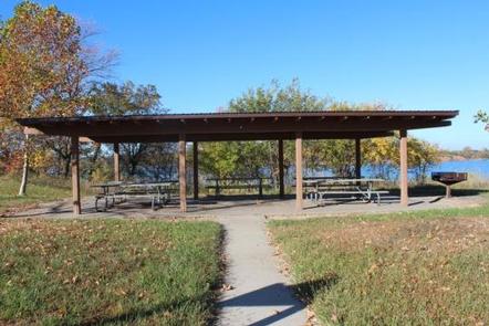
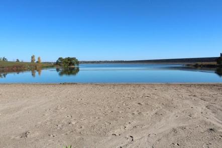
East Rolling Hills day use park is the largest day use park the Corps of Engineers offers at Milford Lake with six shelters available for reservations. Each shelter location is unique but all offer a beautiful view of Milford Lake. Inside the park a swim beach and free boat ramp are also offered to the public.

Click here for the Milford Lake Virtual Tour.

Recreation

Activities at Milford Lake include boating, swimming, fishing, hunting, hiking, wildlife viewing and biking. Milford Lake is known to have great sail boating opportunities as well.

Facilities

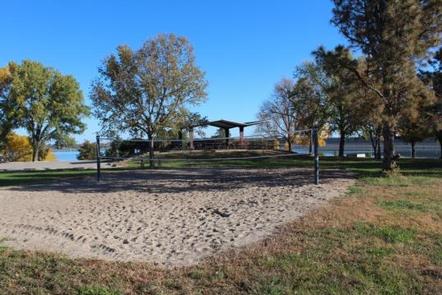
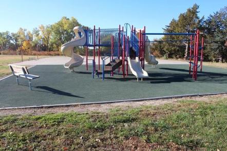
Each shelter has a vault toilet and grill available for use and several of the shelters have playgrounds, horseshoe pits and sand volleyball courts nearby. The park offers a full size basketball court as well.

Natural Features

Milford Lake is nestled on the edge of the Kansas Flint Hills and is fed by the Republican River. Milford Lake stands as the largest man-made lake in Kansas, with a surface area of 15,700 acres and 163 miles of shoreline. Milford Lake is also the home of the states third largest wetland and is known for a variety of wildlife.

Nearby Attractions

The Milford Nature Center and Fish Hatchery is nearby just below the dam. There you can find live animal exhibits as well as learn about the ecosystems of Kansas. A golf course is adjacent to the nature center on the north end of the Dam and the town of Junction City is approximately five miles from North Overlook Shelter.

Reservation

More from CampingHiking.net:

ELK CREEK CAMPGROUND (SAWTOOTH NF), Idaho Campground Images, Info & Reservations

Directions From Stanley, Idaho, take State Highway 21 west approximately 8 miles. Turn north at milepost 123 onto Forest Road 892 and follow the road to the campground. Phone 928-537-8888 Activities BIKING, CAMPING, FISHING, HIKING, WILDLIFE VIEWING Keywords ELK2,ELK CREEK CAMPGROUND IDAHO,SAWTOOTH NF – FS Related Link(s) Rec Area Info

SNAKE CREEK, Oklahoma Campground Images, Info & Reservations

Directions From Gore, OK, go 15 miles northeast on Highway 100, then turn left and go 1/2 mile west on paved access road. Phone 918-487-5252 Activities BOATING, CAMPING, SWIMMING SITE Keywords SANK,TENKILLER LAKE,TENKILLER FERRY LAKE,TENKILLER FERRY Related Link(s) Rec Area Info & Images Oklahoma State Road Conditions Oklahoma State Tourism

FLOUR LAKE CAMPGROUND, Minnesota Campground Images, Info & Reservations

Directions From Grand Marais, Minnesota, take Gunflint Trail (County Road 12) 27 miles north, turn right on County Road 22 (previously CR 66) and travel 3 miles to the campground road. Turn right and follow the campground road 1/2 mile to the campground. Phone (218)388-2203 Activities BIKING, BOATING, CAMPING, FISHING,

SANTIAM FLATS CAMPGROUND, Oregon Campground Images, Info & Reservations

Directions Travel 2.6 miles northeast of Detroit, Oregon. From Detroit, follow Highway 22 east for 2.6 miles to Blowout Road/Forest Service Road 10 on the right. Santiam Flats Campground in on the right. Phone 503-854-3366 Activities BOATING, FISHING, HIKING, SWIMMING, WATER ACTIVITIES Keywords Related Link(s) Rec Area Info & Images

TUTTLE CREEK COVE, Kansas Campground Images, Info & Reservations

Directions From the intersection of US-24 and K-13 at the west end of the dam, turn east onto K-13, then immediately turn north onto Tuttle Cove Road and continue 3 miles to the campground entrance. Phone (785)539-6523 Activities BIKING, BOATING, CAMPING, FISHING, HIKING, HUNTING, WILDLIFE VIEWING, SWIMMING SITE Keywords TTLE,TUTTLE