
Directions
From Roseburg, Oregon, travel east on Highway 138 East (North Umpqua Highway)/ NE Diamond Lake Blvd. for 50.5 miles. Turn left into Eagle Rock Campground. Once in the campground, just after the fee kiosk turn right for the reservable sites and left for the first come first serve sites.
Phone
541-496-3532
Activities
FISHING, WILDLIFE VIEWING, BIRDING, WHITEWATER RAFTING
Keywords
Related Link(s)
Overview
Nestled along the bank of the Wild and Scenic North Umpqua River, Eagle Rock Campground offers an excellent setting for the perfect camping excursion.
Popular with both fly anglers and whitewater enthusiasts, this campground is situated in a stand of old growth Douglas fir and deciduous trees.
Recreation
Eagle Rock Campground is in a prime location for hiking, mountain biking, fishing, and whitewater rafting in late spring and summer months. The North Umpqua River runs adjacent to the campground and drains portions of the western side of the Cascade Range. Renowned for outstanding salmon and steelhead fishing as well as exhilarating whitewater challenges, the river beckons to those staying at the campground. The popular 79-mile North Umpqua Trail, with multiple trailheads in the vicinity, offers hikers and bikers of all abilities the opportunity to gain some serious mileage or to just take a leisurely stroll or ride. Nearby Twin Lakes offers some of the most spectacular and breathtaking views in the area and makes for a great get-away to have a picnic or do some wildlife viewing.
Facilities
This campground has 27 sites, with one loop of 16 sites available for reservation. The campground is equipped with picnic tables and fire rings at all the sites. Three double vault toilets are dispersed throughout the campground. Roads and spurs within the campground are paved. A majority of the campsites have river access.
Natural Features
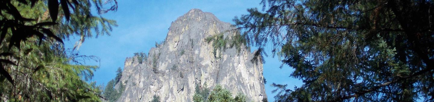
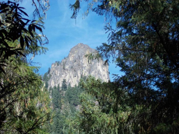
Visitors to the Umpqua National Forest are often taken aback by the unique landscapes of southwestern Oregon.
Explosive geologic events have shaped the distinctive landscape on the nearly 1 million-acre forest that provides spectacular scenery as well as an abundance of natural and cultural resources.
The translation of the word “Umpqua” meaning “thundering waters,” defines the area. High mountain lakes, heart-stopping rapids, peaceful ponds and thundering waterfalls, including the 272-foot Watson Falls on the North Umpqua Highway, offer visitors plenty of pastimes. Diverse ecosystems support a wide range of habitat for wildlife common to the area. From eagles and owls, to salamanders and salmon, these species, along with many others, depend on surrounding undeveloped wilderness, clean streams, and diverse forests to live and thrive.
Nearby Attractions
Opportunities for hiking and mountain biking are within 10 miles of the campground. Visitors may also want to take some time to visit nearby Crater Lake National Park, the only national park in Oregon! The amazing Crater Lake area offers a glimpse into the volcanic history of the area. Experience 172 miles of diverse river and mountain landscapes along the Rogue-Umpqua National Scenic Byway. Travel from rolling oak-covered hills and towering coniferous forests, amid some of the most unique geologic features. From roaring white water rapids to inter-canyon lava flows, this drive will take your breath away. The highway travels alongside the Upper Rogue and North Umpqua Wild and Scenic Rivers that contain world-class fisheries.