
Directions
On US Highway 191, drive 40 miles (60 km) south of Moab or 14 miles (22 km) north of Monticello, then take Utah Highway 211 roughly 35 miles (56 km) west. Highway 211 ends in the Needles, and is the only paved road leading in and out of the district.
Phone
(435) 259-4711
Activities
BIKING, HISTORIC & CULTURAL SITE, CAMPING, INTERPRETIVE PROGRAMS, HIKING, WILDERNESS, PHOTOGRAPHY, STAR GAZING, EVENING PROGRAMS, BACKPACKING
Keywords
Squaw Flat Campground
Related Link(s)
Overview
The Needles Campground and group sites are located deep within the southern portion of Canyonlands National Park in southeastern Utah. The Needles District is 1.25 hours driving time from Monticello, Utah, and 1.5 hours from Moab, Utah, at an elevation of approximately 4,900 feet. You may book individual campsites and group sites up to six months in advance for dates within the peak season. There are three group sites. The Squaw Flat group site is situated in the main part of the campground, and the Wooden Shoe and Split Top group sites are in separate areas of the district, isolated from other campsites. This campground is best suited to tents and small, self-contained campers and RVs.
Recreation
The Needles District’s extensive trail system provides many opportunities for long day hikes and overnight backpacking trips. Foot trails and four-wheel-drive roads lead to such features as Confluence Overlook, Druid Arch, the Joint Trail and Chesler Park.
Facilities
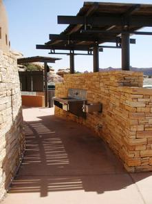
The Needles Campground and group sites are best suited to tents and small, self-contained campers and RVs. A seasonal campground host (spring and fall) is located in Loop A of the campground. Individual Campsites: Drinking water and flush toilets are located in the campground. Picnic tables and fire rings are provided at each site. There are no RV hook-ups. The campground does not have electricity, showers or a dump station. Group Sites: Three group campsites offer groups of 11 or more an opportunity to stay in a remote setting in a unique national park. RVs and trailers over 25 feet will have difficulty accessing these sites. Water and non-flush toilets are available. Picnic tables and fire rings are provided.
Natural Features
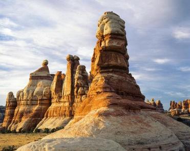
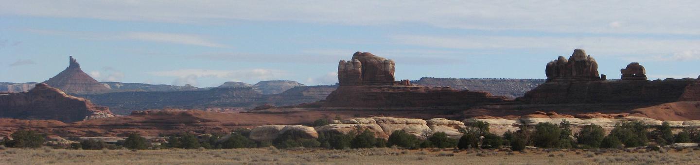
The campground and group sites contain stands of Utah juniper and pinyon pine. Flowering prickly pear cacti, yucca and other desert wildflowers dot the landscape in the spring, adding to the vivid colors of the surrounding red rock desert. The Needles District forms the southeast corner of Canyonlands National Park and was named for the colorful spires of Cedar Mesa Sandstone that dominate the area. The park is within an arid, high desert environment with hot summers and cold winters.
Nearby Attractions
Southeastern Utah offers breathtaking scenery, hiking, road and mountain biking opportunities, rafting and scenic driving routes. Arches and Mesa Verde National Parks, the Island in the Sky district of Canyonlands National Park, Hovenweep and Natural Bridges National Monuments and Dead Horse Point and Edge of the Cedars State Parks are all within three hours drive of the Needles Campground. Moab, Utah, (1.5 hours away) offers numerous restaurants, shops and museums.