LITTLE CULTUS CAMPGROUND, OR Campground Reservation, Info, Images, Map, Directions

LITTLE CULTUS CAMPGROUND, Oregon Campground Images, Info & Reservations

Directions

From Bend, OR: Travel 46.0 miles southwest on Cascade Lakes Hwy (46), then 0.8 miles west on Forest Road 4635, then 1.7 south on Forest Road 4630, and then 1.0 miles west on Forest Road 4636

Phone

541-323-1746

Activities

BOATING, CAMPING

Keywords

Related Link(s)

Rec Area Info & Images

Oregon State Road Conditions

Oregon State Tourism

Overview

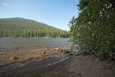
Little Cultus Lake Campground is located on Little Cultus Lake just south of Cultus Lake proper.

Recreation

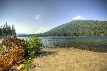
Little Cultus Lake has a gentle sloping bottom making it ideal for wading and swimming while nearby hiking offer acces to the Three Sisters Wilderness. There is a boat launch area within this campground.

Facilities

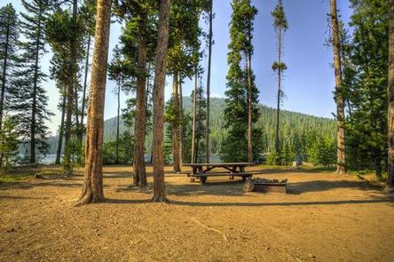
There is a boat ramp at the campground, but please note there is a 10 mph speed limit on the lake. Most of the campsites are located under the tree canopy in close proximity to the lakeshore.

Natural Features

The lake spans 175 acres hosting rainbow and brook trout.

Reservation

More from CampingHiking.net:

Laurel River Lake Picnic Area, Kentucky Campground Images, Info & Reservations

Directions From London, Kentucky, head west on HWY 192 for approximately 15 miles. Turn slight left onto KY-1193. Continue on KY-1193 until arrive at destination on left. Area is marked by "Laurel Dam Picnic Area" signs. Phone 606-864-6412 Activities HIKING, SWIMMING SITE Keywords Laurel River Lake Picnic Area,Laurel Picnic Area

QUINN RIVER CAMPGROUND, Oregon Campground Images, Info & Reservations

Directions From Bend, travel about 50 miles southwest on Cascade Lakes Hwy (46). Campground will be on left-hand side of the highway. Phone 541-323-1746 Activities CAMPING Keywords Related Link(s) Rec Area Info & Images Oregon State Road Conditions Oregon State Tourism Overview Quinn River Campground is located on the western

ROCKY REST, California Campground Images, Info & Reservations

Directions From Downieville, take Highway 49 south for about 11 miles. The campground is on the left side of the highway. Phone (530)478-6253 Activities BIKING, CAMPING, FISHING, HIKING, HUNTING, PICNICKING, SWIMMING, MOUNTAIN BIKING, WATER ACTIVITIES, WATER ACCESS, SCENIC DRIVE, RAFTING, WHITEWATER RAFTING Keywords RORE,TAHOE NF – FS Related Link(s) Rec

OBEY RIVER PARK, Tennessee Campground Images, Info & Reservations

Directions From Byrdstown, Tennessee, take Highway 111 south for 3 miles. After crossing the bridge turn right and follow the signs into the campground and day-use area, located to the left of Sunset Marina (2040 Sunset Dock Road, Monroe, TN 38573). From Livingston, Tennessee, take Highway 111 north for 15

Stoughton Pond Rec Area, Vermont Campground Images, Info & Reservations

Directions Take VT 106 North to Stoughton Pond Road. The facility is about ½ mile to the left in Perkinsville, Vermont. Phone 802-886-2775 Activities BOATING, HIKING, HUNTING, WINTER SPORTS, WILDLIFE VIEWING, SWIMMING SITE Keywords Stoughton Pond Rec Area,North Springfield Lake Related Link(s) Rec Area Info & Images Vermont State Road