Grandview Shelter 1, WV Campground Reservation, Info, Images, Map, Directions

Grandview Shelter 1, West Virginia Campground Images, Info & Reservations

Directions

To reach Grandview from Beckley follow I-64 East five miles to Exit 129 B. From Lewisburg follow I-64 West forty miles to Exit 129. From either exit, turn right and follow Route 9 North six miles to Grandview.

Phone

304-465-0508

Activities

HIKING, PICNICKING, DAY USE AREA

Keywords

Grandview State Park

Related Link(s)

Rec Area Info & Images

West Virginia State Tourism

West Virginia State Road Conditions

Overview

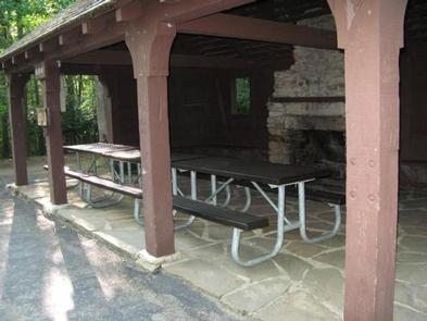
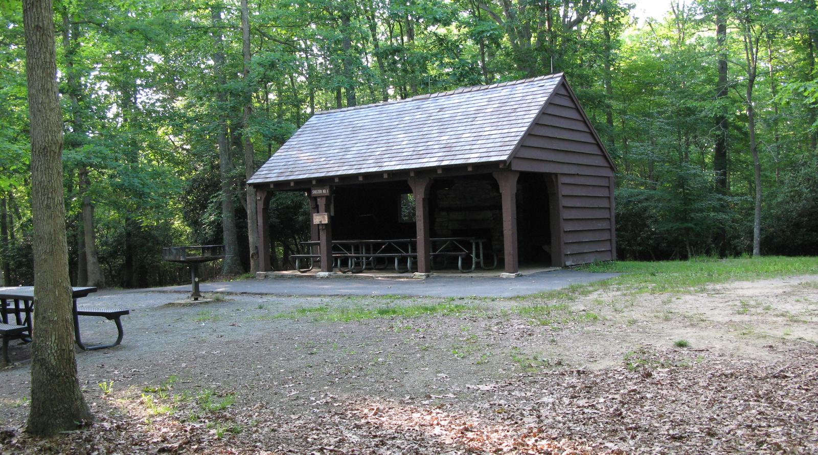
Grandview Shelter #1 is a smaller shelter located on a hill just off the Grandview Rim Trail near the North Rim Overlook. It can accommodate 40 people inside the shelter and approximately 35 people outside. This shelter is not handicapped accessible. It requires climbing up a small set of stone stairs and a short walk up a small hill.

Recreation

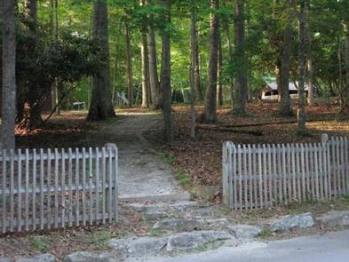
The Grandview area of New River Gorge National River features five hiking trails, overlooks, a seasonal visitor center, ranger-led activities, summer outdoor dramas (Theatre West Virginia), playgrounds, volleyball court, baseball field, and basketball court.

Facilities

Shelter #1 is enclosed on three sides with a stone fireplace inside. It offers two electrical outlets, one charcoal grill plus a fireplace grate. Playground equipment, horse shoe pit, drinking fountain with side spigot, and restrooms are nearby. This shelter is not handicapped accessible and is not easily accessible for the elderly. Additional chairs, tables, and canopy tent are allowed.

Natural Features

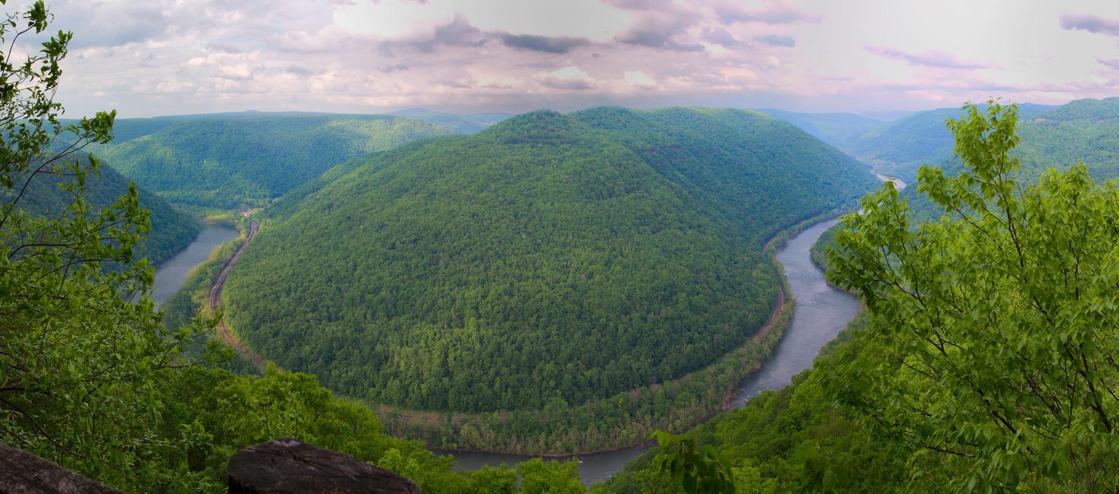
Grandview became part of New River Gorge National River in 1990, after more than 50 years as one of West Virginia’s most popular day use state parks. The area offers spectacular views of the New River and beautiful displays of rhododendron. At the Main Overlook, 1,400 feet above the river, you see an active railway and the town of Quinnimont, where the first coal was shipped out of the gorge in 1873.

Nearby Attractions

The city of Beckley is approximately 12 miles from Grandview. It offers a wide variety of shopping, restaurants, and hotels. Popular attractions include a children’s museum, and Exhibition Coal Mine.

Reservation

More from CampingHiking.net:

TIPSAW LAKE, Indiana Campground Images, Info & Reservations

Directions From St. Croix, Indiana, travel south on State Route 37 about 5 miles to the Tipsaw Lake sign. Turn right and continue about 3 miles to the campground. Tipsaw Lake is only 3 miles from Interstate 64. Phone 812-843-4891 Activities BIKING, BOATING, CAMPING, FISHING, HIKING, HUNTING, SWIMMING SITE Keywords

OWENS CREEK CAMPGROUND, Maryland Campground Images, Info & Reservations

Directions For GPS Use Only: The street address is 15882 Foxville Deerfield Road, Sabillasville, MD. This is not the mailing address. The Park mailing address is: Catoctin Mountain Park, 6602 Foxville Road, Thurmont, MD 21788. From Washington DC Take the George Washington Memorial Parkway north to I495 to I270 north

TIMPANOGAS, Oregon Campground Images, Info & Reservations

Directions From I-5, take Exit 188A onto Highway 58 and proceed just past MP 37 (east of Oakridge), turning right onto Kitson Springs Road. Proceed 0.5 mile to junction with Forest Service Road (FSR) 21, also signed as Diamond Drive. Turn right onto FSR 21 and continue approximately 32 miles,

Sand Flats Recreation Area, Utah Campground Images, Info & Reservations

Directions Directions from Your Location: The Entrance Station for the Sand Flats Recreation Area is located around 3000 Sand Flats Rd. We say “around” because there is no actual mailing address for the Entrance Station. Don’t worry though, we have detailed directions. From the South: If heading north on Highway

BEAR CANYON, Utah Campground Images, Info & Reservations

Directions From I-15, take Nephi exit 225. Travel about 5 miles east on Highway 132 to the Nebo Loop Scenic Byway. Turn left onto the byway and travel 3.5 miles to the Bear Canyon turnoff. Turn left. Bear Canyon Campground is located at the end of the road, just past

WRIGHTS LAKE, California Campground Images, Info & Reservations

Directions Take Highway 50 east of Placerville, California, for 11 miles. Turn left onto Ice House Road and continue for 9 miles, then turn right onto Wrights Lake tie road. After 2 miles, turn left onto Wrights Lake Road. Phone 831-245-6891 Activities CAMPING, FISHING, HIKING, DAY USE AREA, SWIMMING SITE,