Horsethief Group Sites, UT Campground Reservation, Info, Images, Map, Directions

Horsethief Group Sites, Utah Campground Images, Info & Reservations

Directions

From Moab, drive 9 miles north on Highway 191, turn west on Highway 313. Drive 12 miles and then turn right and drive in the short entrance road to the campground.

Phone

435-259-2100

Activities

AUTO TOURING, BIKING, CAMPING, HIKING, PHOTOGRAPHY, MOUNTAIN BIKING, STAR GAZING, SCENIC DRIVE

Keywords

Related Link(s)

Rec Area Info & Images

Utah State Road Conditions

Utah State Tourism

Overview

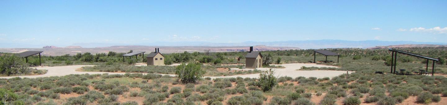
The five reservable Horsethief Group Sites are ideal for smaller gatherings (10-20 people & 6 sedans/trucks/vans only—no trailers or RVs). Group Site #39 is located in the main campground and Group Sites A, B, C, D are located in the adjacent campground which is designed to accomodate tent and van campers only. Horsethief Campground is ideal for those wishing to be close to The Island in the Sky District of Canyonlands National Park and Dead Horse Point State Park. The area also offers outdoor enthusiasts many options for hiking, mountain & road biking and four-wheel drive tours. The town of Moab is 25 minutes away and has dining, shopping, sports rentals, tour companies and museums.

Recreation

From Horsethief Campground, there are multiple options for mountain & road biking, hiking, scenic tours, four-wheeling and photography. The area has many mountian bike trails and four-wheel drive roads leading to canyons and vistas. Nearby Canyonlands National Park and Dead Horse Point State Park have many scenic overlooks and trails for hiking, biking and exploring.

Facilities

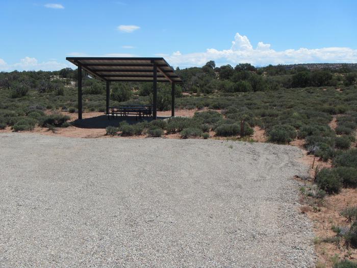
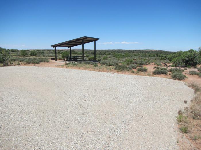
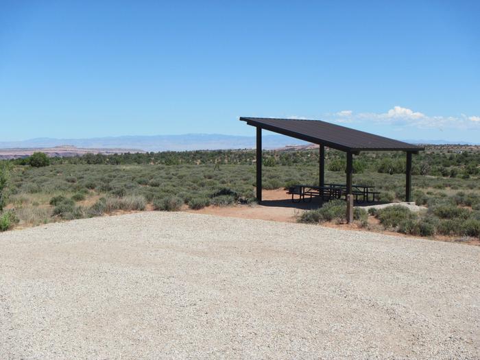
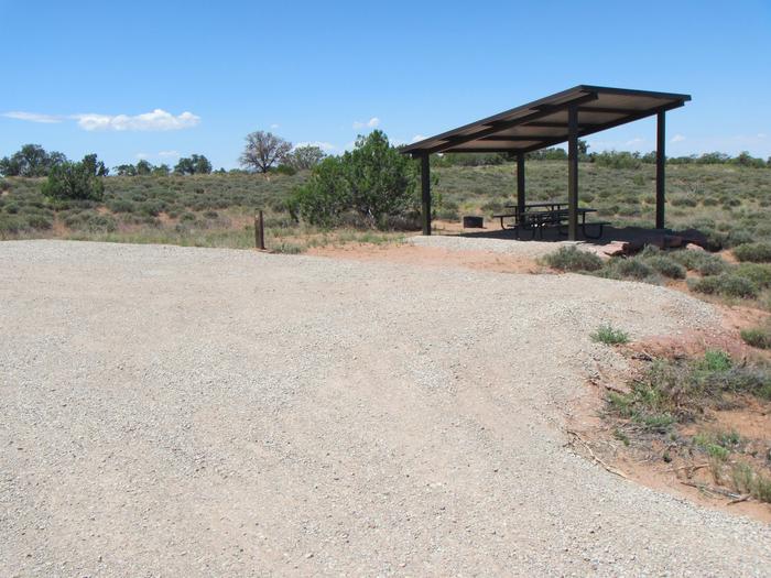
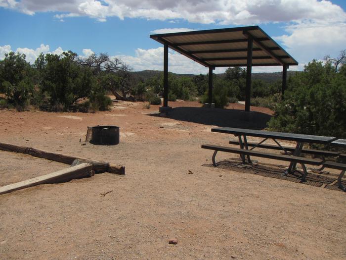
The group areas have shade shelters, picnic tables, a fire rings with grate and nearby vault toilet. These are relatively small group sites with limited parking and cannot accomodate RV/motorhomes, campers or trailers (parking accomodates up to six sedans or small vans only). (RVs, campers and trailers should use Lone Mesa Group Sites on SR 313, just six miles back towards Hwy. 191.) The group site does not have water, a dump station or electric hook-ups.  

Natural Features

Tucked among pinyon and juniper trees on a high mesa west of Moab, Horsethief Campground offers open vistas with great sunrises and sunsets. The higher elevation (5500 feet) allows for slightly cooler temperatures in the summer.

Nearby Attractions

Arches and Canyonlands National Parks as well as Dead Horse Point State Park are within a 15-minute drive. Groups heading into Canyonlands to ride the White Rim trail often use this site for camping before and after their trip. Horsethief Campground is also near the Gemini Bridges Road and the Mineral Bottom Boat Ramp.

Reservation

More from CampingHiking.net:

CASTLE BUTTE LOOKOUT, Idaho Campground Images, Info & Reservations

Directions From Missoula, MT: Take US Highway 12 West for about 65 miles. All roads from this point are gravel or dirt and a vehicle with high clearance is suggested. Turn right onto Forest Service Road 108 (Waw’aalamnime Rd), go about .5 miles, turn left onto Forest Service Road #566

COLD CREEK, California Campground Images, Info & Reservations

Directions From Truckee, California, take Highway 80 north to Highway 89 approximately 20 miles. The campground is on the left side of the highway. From Sierraville, head south on Highway 89 approximately 5 miles, the campground will be on the right side of the highway. Phone (530) 994-3401 Activities CAMPING,

JOHNSON CREEK CAMP, Texas Campground Images, Info & Reservations

Directions From Jefferson, Texas, travel 3.8 miles northwest on Highway 49. Turn left onto FM 729 and continue for 8.5 miles to the park entrance on the left.. Phone 903-755-2435 Activities BOATING, CAMPING, FISHING, WATER SPORTS, WILDLIFE VIEWING, SWIMMING Keywords JOCC,LAKE OF THE PINES,LAKE O THE PINES,FERRELLS BRIDGE DAM Related

CAMPBELL POINT, Missouri Campground Images, Info & Reservations

Directions From Cassville, Missouri, take Highway 76 to Highway 39, then turn southeast onto the Highway YY access road and follow to the campground. Phone 417-858-3903 Activities BIKING, BOATING, CAMPING, FISHING, HIKING, PICNICKING, VISITOR CENTER, WATER SPORTS, WILDLIFE VIEWING, DAY USE AREA, SWIMMING SITE, PHOTOGRAPHY, SWIMMING, RANGER STATION, KAYAKING Keywords

SIGNAL CREEK CAMPGROUND, Alaska Campground Images, Info & Reservations

Directions From the State ferry terminal, take Tongass Highway north 4.8 miles to milepost 7. Turn right onto Revila Road. Go 1.4 miles and turn right at the Ward Lake Road Intersection. Travel 1.1 miles past Ward Lake Day Use Area to the entrance sign for Signal Creek Campground. Phone

MOSER ISLAND CABIN, Alaska Campground Images, Info & Reservations

Directions Accessible year round, weather permitting. Located 48 air miles north of Sitka, within Hoonah Sound on the north end of Moser Island, north of Peril Strait. Access from Sitka is 30 minutes by floatplane, or 2 hours by boat. For geographic features surrounding the cabin, refer to USGS topographic