SPILLWAY PARK - CHINOOK SHELTER (OR), OR Campground Reservation, Info, Images, Map, Directions

SPILLWAY PARK – CHINOOK SHELTER (OR), Oregon Campground Images, Info & Reservations

Directions

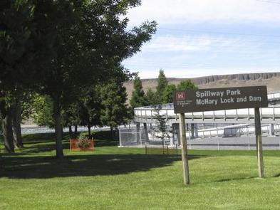
From Highway 730 turn north on Devore Road, at the stop sign turn left and continue down the hill past McNary Dam’s main parking lot and the Spillway Park Shelter will be on your right once get into the park.

Phone

541-922-2268

Activities

FISHING, HIKING, PICNICKING, DAY USE AREA, OBSERVATION SITE, INFORMATION SITE, DISC GOLF

Keywords

Related Link(s)

Rec Area Info & Images

Oregon State Road Conditions

Oregon State Tourism

Overview

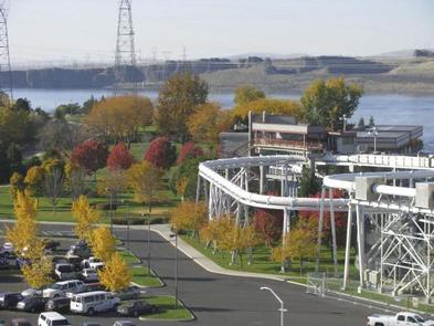
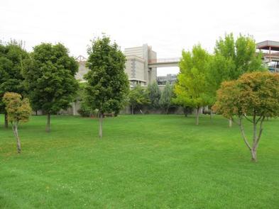
Spillway Park is located on Lake Umatilla just downstream of McNary Lock and Dam in eastern Oregon on the Mid-Columbia River.

Recreation

The park provides two overlooks to watch McNary Dam, a volleyball court and access to the McNary Dam Wildlife Area trail system.

Facilities

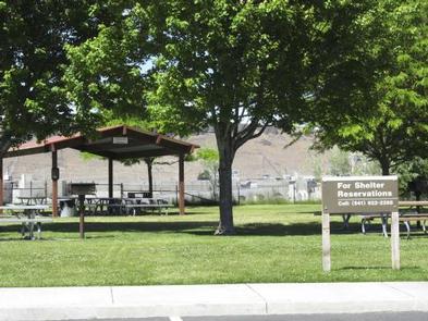
Spillway Park offers one day-use group shelter with eight tables and two fire grills.

Natural Features

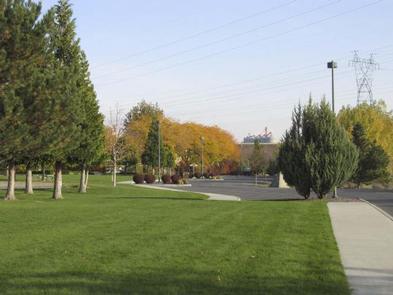
The park is situated along the bank of the Columbia River. Day users can enjoy the relaxing shade as they get a beautiful look at McNary Dam.

Nearby Attractions

The Pacific Salmon Visitor Center, Oregon Fish Viewing Room and the McNary Dam Wildlife Area with its beautiful natural trails are all in close proximity to Spillway Park.

Reservation

More from CampingHiking.net:

SANTA BARBARA ISLAND, California Campground Images, Info & Reservations

Directions Boat transportation can be arranged with Island Packers from Ventura Harbor. To park headquarters in Ventura, California: Highway 101, exit Victoria or Seaward to Ventura Harbor. Phone 805-658-5730 Activities BOATING, CAMPING, INTERPRETIVE PROGRAMS, FISHING, HIKING, PICNICKING, VISITOR CENTER, WATER SPORTS, WILDLIFE VIEWING, WILDERNESS, INFORMATION SITE, PHOTOGRAPHY, SWIMMING, SNORKELING, RANGER

NORTH RIM CAMPGROUND, Arizona Campground Images, Info & Reservations

Directions North Rim Campground is 210 driving miles (4.5 hours) north of Mather Campground on the South Rim. This facility is located at the end of State Highway 67, about 41 miles south of Jacob Lake, Arizona, 87 miles south of Kanab, Utah and 120 miles southwest of Page, Arizona.

SHRODE LAKE CABIN, Alaska Campground Images, Info & Reservations

Directions Access by float plane is 45 minutes from Anchorage and 55 minutes from Cordova. By boat the trip is 25 miles from Whittier into Long Bay, then an additional one-mile hike on a trail to reach the lake. The trailhead at Long Bay is very tidal dependent and best

POSEY LAKE CAMPGROUND, Utah Campground Images, Info & Reservations

Directions From Highway 12 in Escalante, turn north at 300 East at the elementary school at the Posey Lake/Hell’s Backbone sign. Travel 14 miles to junction of Forest Roads 153 and 154, keep left and travel 2 miles to Posey Lake Campground. Site access can be difficult; about 14 miles