


Directions
Traveling north from Fairbanks, take the Steese Highway on through Fox. There is a trailhead at Milepost 42 and 57 of the Steese Highway to access some of the cabins. Traveling north on the Elliott Highway from Fox, there are two trailheads at Milepost 28 and 57 of the Elliott Highway to access the White Mountains from the west side. For further information contact BLM district office.
Phone
(907)-474-2200
Activities
CAMPING, HIKING, HORSEBACK RIDING, HUNTING, WINTER SPORTS, WILDLIFE VIEWING
Keywords
Related Link(s)
Overview
Located just an hour’s drive from Fairbanks, Alaska, the one-million-acre White Mountains National Recreation Area offers stunning scenery, peaceful solitude and outstanding opportunities for year-round recreation including hiking, snowmobiling, snowshoeing, skiing, wildlife and scenic viewing. There are 12 beautiful log cabins throughout the White Mountains offering many opportunities to enjoy the outdoors. Be sure to carry your cabin permit at all times while in the White Mountains National Recreation Area. Also located in the White Mountains National Recreation Area are two trail shelters that are available on a first-come, first-served basis only.
Recreation
Summer visitors to the White Mountains pan for gold, fish, hike and camp under Alaska’s midnight sun. The Nome Creek Road provides access to two campgrounds, trails, a gold-panning area and a departure point for float trips on Beaver Creek National Wild River. In winter, visitors travel by ski, snowshoe, dog team and snowmobile to enjoy the 12 public-use cabins and 250 miles of groomed trails that make the White Mountains one of Interior Alaska’s premier winter destinations. Learn more about current trail conditions or call the Fairbanks District Office at (907) 474-2200. For a trails condition report, go to, https://www.blm.gov/visit/white-mountains
Facilities
Summer Recreation / Nome Creek Valley:
Nome Creek valley is one of the prime access points for summer recreation in the White Mountains National Recreation Area. It can be reached via the US Creek Road at milepost 57 on the Steese Highway.
The area has a rich mining history, the remnants of which remain visible in places like the Maze, where a gold-mining dredge left Nome Creek in a sinuous path between piles of gravel tailings. Today visitors come to the recreational gold-panning area to try their hand at recovering the gold the miners missed.
The Table Top Mountain Trail and Quartz Creek Trail both start in Nome Creek valley, or you can find your own way up one of the ridges behind the Mt. Prindle Campground.
Nome Creek valley is also a departure point for float trips down Beaver Creek National Wild River. The put-in is located next to the Ophir Creek Campground.
Note: Not all trails are accessible to ATV’s in the summer. Please contact the BLM Fairbanks District Office for further information at (907)474-2200
Note: Not all trails are suitable for hiking in the summer. They may be wet and boggy. Check with the Fairbanks District Office for more information.
Note: All lands to the north of the Nome Creek Rd. from the Bear Creek Trail, west to Ophir Creek Campground and the Beaver Creek Put-In are closed to the use of motorized vehicles in the summer from May 1 – October 14 or until there is adequate snow cover for use by snowmobiles.
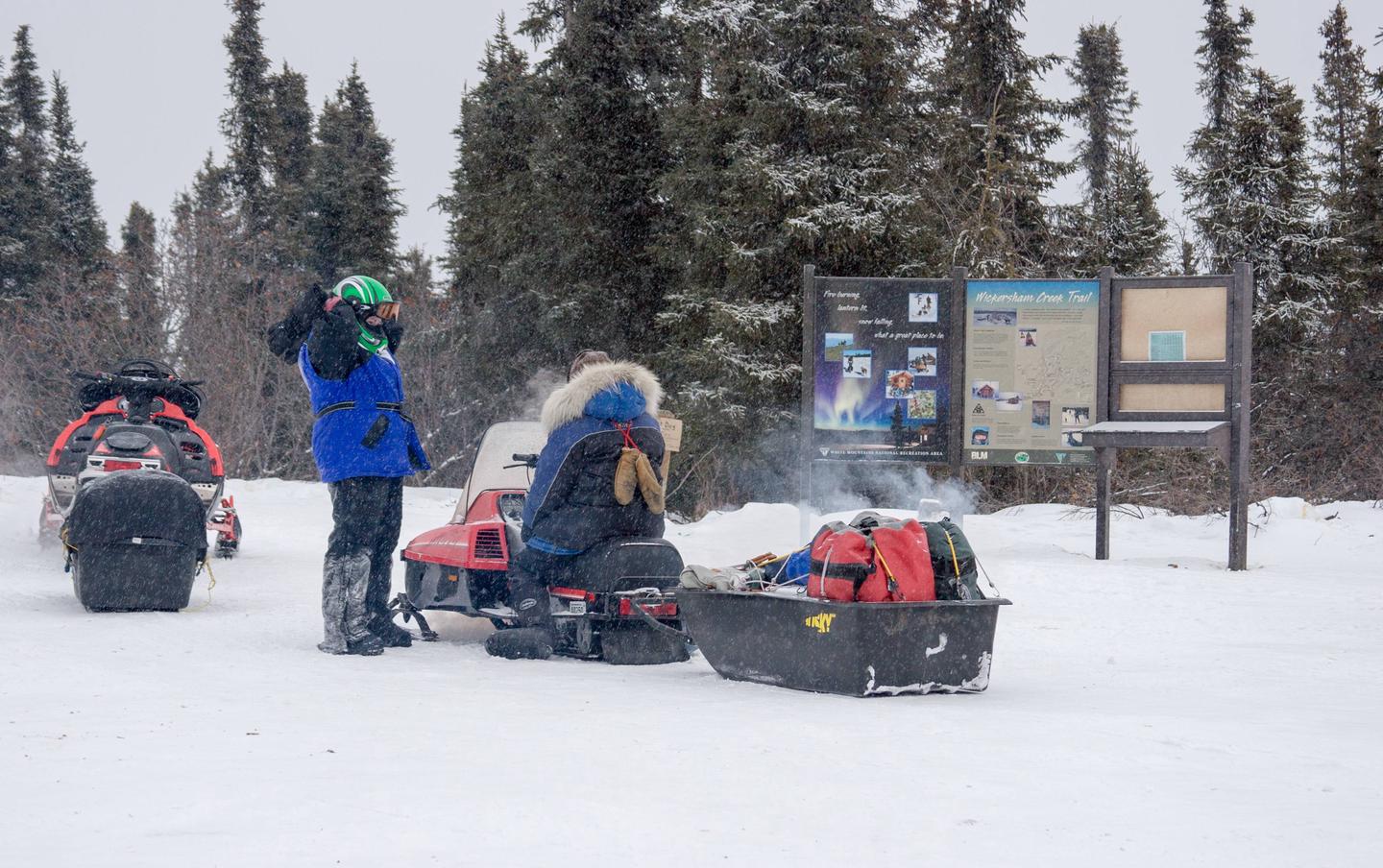
Winter Recreation:
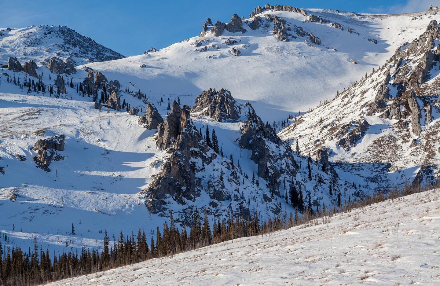
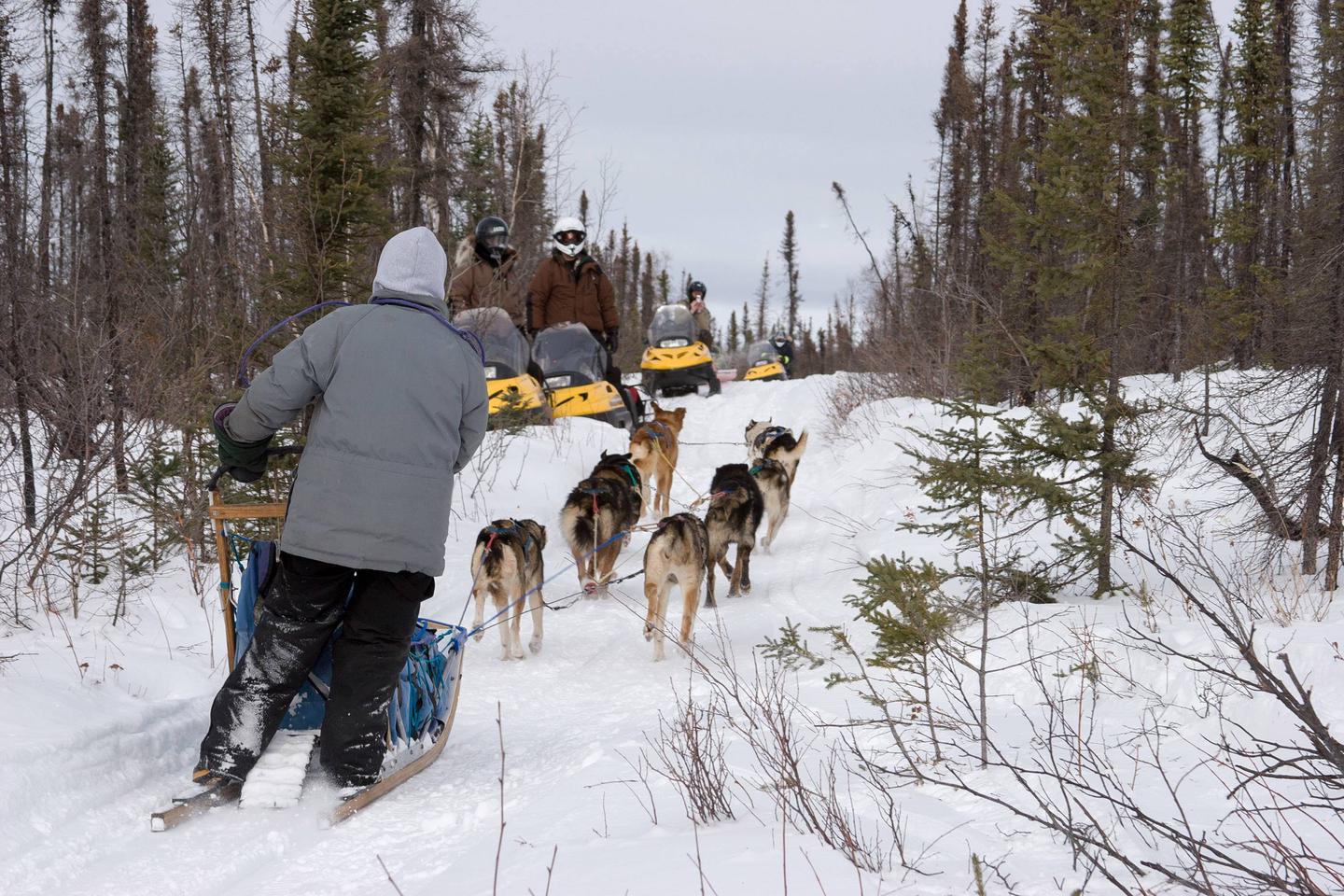
The White Mountains National Recreation Area offers 250 miles of maintained winter trails and 14 public recreation cabins and trails shelters surrounded by jagged limestone mountains and cliffs, high mountain passes, and broad, rounded valleys. Whether you choose to explore by ski, snowshoe, snowmobile, or dog team, you’ll find crisp, clean air, dazzling views, and if you’re lucky, shimmering northern lights against a star-studded sky.
One of the highlights of a tour through the White Mountains is an overnight stay at one of Bureau of Land Management’s 12 public recreation cabins and two trail shelters — the perfect place to warm up, dry out gear, and enjoy a hearty dinner after a day on the trail.
Nearby Attractions
The cabins are surrounded by vast amounts of land you can venture on to and view the scenery around the area.