Lower Onion Creek Group Sites, UT Campground Reservation, Info, Images, Map, Directions

Lower Onion Creek Group Sites, Utah Campground Images, Info & Reservations

Directions

From Moab drive north to the junction with Highway 128. Drive 22 miles on Highway 128 to the entrance to Lower Onion Creek campground, then 1.5 miles north on the gravel road. The group sites are located on the southwest side of the campground.

Phone

(435)259-2100

Activities

CAMPING, OFF HIGHWAY VEHICLE, RECREATIONAL VEHICLES, OFF ROAD VEHICLE TRAILS, STAR GAZING, RAFTING, WHITEWATER RAFTING

Keywords

Related Link(s)

Rec Area Info & Images

Utah State Tourism

Utah State Road Conditions

Overview

The Lower Onion Creek Group Sites are located along the banks of the Colorado River. The sites are ideal for small family or group gatherings of 15-30 people (parking is limited and can accomodate only one large RV or truck w/trailer). Lower Onion is also a launch site for river trips. Within close proximity to national parks and open space, outdoor enthusiasts will enjoy hiking, mountain biking, whitewater rafting and four-wheel drive tours in the surrounding area. The town of Moab is approximately 40 minutes away and has dining, shopping, sports rentals, tour companies and museums.

Recreation

This location is close to hiking, mountain biking and four-wheel driving opportunities and is a launch site for river running on the Colorado River.

Facilities

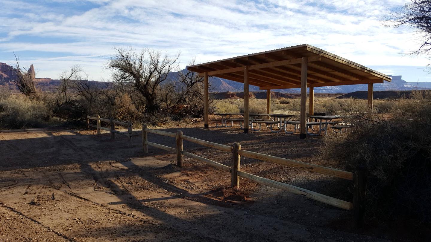
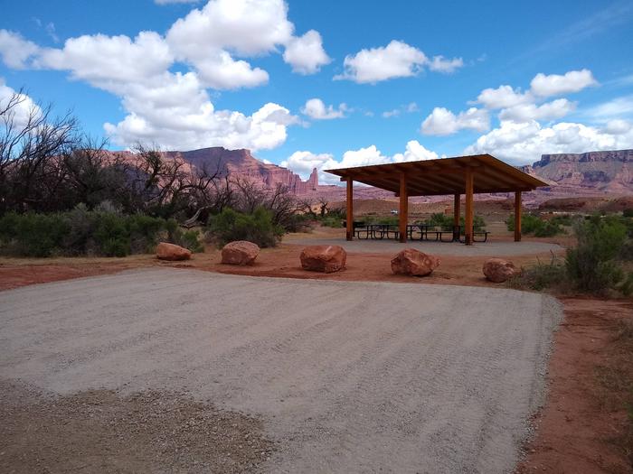
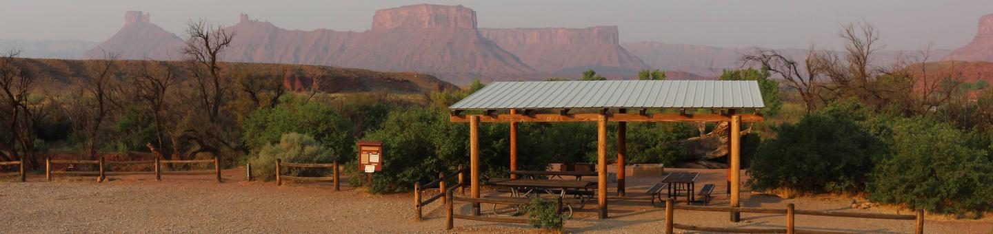
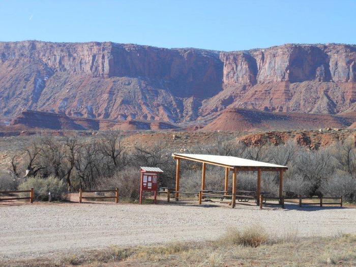
Group sites have fire grates, picnic tables, vault toilets and shade shelters. The group sites do not have water, dump stations or electric hook-ups. A boat ramp is in the campground and near the group sites.

Natural Features

The group sites are located along the Colorado River offering spectacular view of the red rock canyons, buttes, mesas and spires against the backdrop of the nearby La Sal Mountains. A dry creek runs along the back of Group Site A (watch for flash-flooding)!

Nearby Attractions

There are many hiking, mountain biking and four-wheel drive trails along Hwy. 128. The Fisher Towers area offers hiking, rock climbing and scenic vistas. Lower Onion Creek is about 40 minutes from Arches National Park and one hour from Canyonlands National Park.

Reservation

More from CampingHiking.net:

ELWOOD CABIN, Colorado Campground Images, Info & Reservations

Directions From Del Norte, take U.S. Highway 160 west to South Fork. Continue west on U.S. Highway 160 for 8 miles to Park Creek Road. Travel 15 miles on Park Creek Road to Summitville Road. Turn right on FSR 380, the cabin is about 2 miles on the left. From

TURKEY RUN RIDGE GROUP, Virginia Campground Images, Info & Reservations

Directions From Washington, D.C., and points north, take I-95 south to exit 150-B toward VA Route 619/Joplin Road. The park entrance is the second right. It is an additional 5-minute drive from the park entrance to Turkey Run Ridge Group Campground. From Fredericksburg, Virginia, and points south, take I-95 north

HEADQUARTERS, California Campground Images, Info & Reservations

Directions From Bakersfield, take Highway 178 East to Lake Isabella. From Lake Isabella, take Highway 155 around the west side of the lake to the town of Kernville. From Kernville, go 4 miles north on Sierra Way (Mountain 99) to the campground. Phone 760-376-1815 Activities BOATING, CAMPING Keywords HEAD,KERN RIVER,UPPER

ACKER ROCK LOOKOUT, Oregon Campground Images, Info & Reservations

Directions Important note regarding GPS use: please be advised that GPS units can, and have sent guests down the wrong roads to access the Lookout. Please consider following the directions below rather than your GPS unit. Directions: From Canyonville take West 1st Street and turn onto SE 3rd St/OR-227. Continue

FOX CREEK GROUP CAMP, Oregon Campground Images, Info & Reservations

Directions From Detroit, Oregon, drive east on State Highway 22. After crossing the bridge, take a left onto Forest Service Road (FSR) 46/Breitenbush. Follow FSR 46 for about 6.5 miles to Fox Creek Group Camp. Phone 503-854-3366 Activities CAMPING, FISHING, SWIMMING SITE Keywords Fox Creek,Fox Creek Group,Fox Creek Camp,FCGC,Fox Creek

MEDICINE POINT LOOKOUT, Montana Campground Images, Info & Reservations

Directions From Missoula, Montana, travel south on Highway 93 to Laird Creek Road/Forest Service Road 370, which is approximately 34 miles south of Hamilton. Turn right and continue about 4 miles to Bear Creek Saddle. At Bear Creek Saddle, turn north onto Forest Service Road 5731 and continue 2 miles