
Directions
Right Bank Recreation Area is located approximately 11 miles northwest of Ashland City, Tenn. To reach the area, take Cheatham Dam Road off State Route 12 in the Cheap Hill Community. Right Bank Recreation Area is on the right bank of the lake, just upstream from Cheatham Lock and Dam.
Phone
615-792-5697
Activities
BIKING, BOATING, CAMPING, FISHING, WATER SPORTS, WILDLIFE VIEWING, DAY USE AREA, SWIMMING SITE
Keywords
Cheatham Dam
Related Link(s)
Tennessee State Road Conditions
Overview
The relaxing family friendly atmosphere at Right Bank Recreation Area will have campers wanting to return as often as possible. Right Bank also known as Cheatham Dam is located about 11 miles northwest of Ashland City, TN and is a 30 minute drive to Nashville.
Recreation
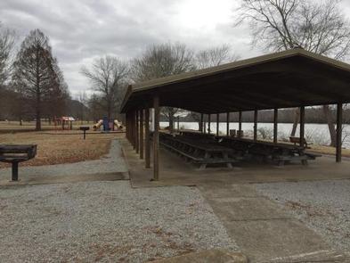
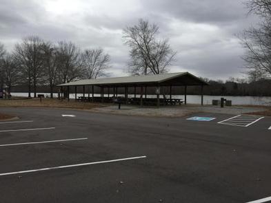
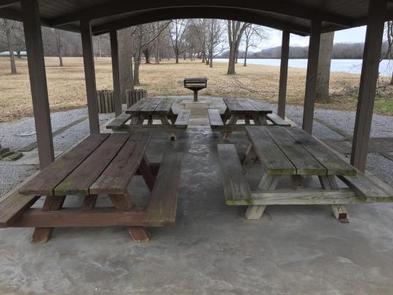
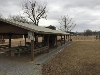
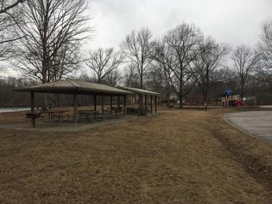
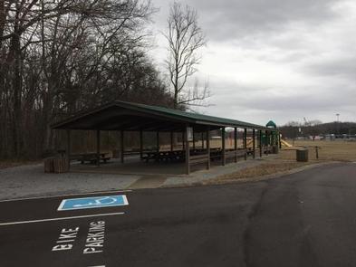
The temperate climate here allows for a lengthy recreation season, including boating, canoeing, swimming and fishing. Camping is also available in the adjacent Lock A Campground. There are several playgrounds for the children and horseshoe pits for the adults. The area also provides numerous individual picnic tables with grills, a designated swimming area with sand beach (no life guard, swim at your own risk), two boat launching ramps, two volleyball courts, a softball field, and three public restrooms. The large pavilions offer a nice location for family get-togethers.
Facilities
Within Right Bank Recreation Area there a four group shelters available for advanced reservation — Cottonwood, Beachside, Willey’s and Red Bud. Cottonwood shelter is smaller than the rest with four picnic tables. Willey’s offers seven picnic tables, and Sycamore Creek has eight picnic tables. The largest shelters are Red Bud with 12 picnic tables and Beachside with 16 picnic tables. All of the shelters have multiple BBQs, parking to accommodate the group, as well as water and garbage service. Red Bud and Willey’s are the only shelters with a fire pit and Willey’s also has a fireplace. All visitors to the park between Memorial Day and Labor Day will be charged a day use fee of $5.00.
Just down the road from Right Bank Recreation Area is another shelter known as Sycamore Creek, which also accommodate groups.
Natural Features
Right Bank Recreation Area is located on the right bank of the Cumberland River, hence the name. The park follows the contour of the Cumberland River (Cheatham Lake) for two miles. Beautiful old trees litter the area and provide cool shade on even the hottest days.
Nearby Attractions
Nearby attractions include the Ashland City Bicentennial Trail, Riverbluff Park, Lock A Campground, Harpeth River Bridge Campground, Cheatham Lake Wildlife Management Area, Doziers Dock, and Pardue Recreation Area. All the sights and sounds of Nashville, TN are just a 30 minute drive away.
Charges & Cancellations
A $10.00 service fee will apply if you change or cancel your reservation. Late cancellations are subject to additional fees. For full details see NRRS Reservation Policy.