Big Meadow Campground, CA Campground Reservation, Info, Images, Map, Directions

Big Meadow Campground, California Campground Images, Info & Reservations

Directions

Take Highway 180 east to the Kings Canyon National Park entrance, where you will be required to purchase a forest/park permit. After entering the park, continue 2 miles where you will stay to the right as though you were going to Sequoia National Park. Continue on the General’s Highway approximately 6 miles to the turn off to Big Meadows. The Big Meadows Road (Forest Road 14S11) is located on the left-hand side of the road. Follow this road approximately 5 miles, where you will find the campground on right side of the road. Please refer to the small scale map, or contact the Hume Lake District office for more specific directions.

Phone

559-325-2232

Activities

CAMPING, FISHING, WILDLIFE VIEWING, SWIMMING SITE

Keywords

Related Link(s)

Rec Area Info & Images

California State Tourism

California State Road Conditions

Overview

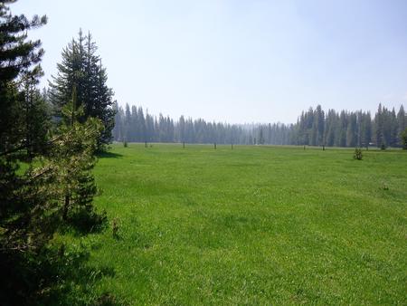
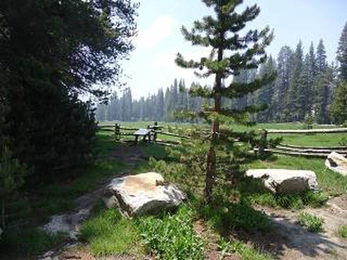
Big Meadows Campground is located 75 miles east of Fresno, California, in the Sequoia National Forest and Sequoia National Monument. The campground sits at an elevation of 7,500 feet and has views of the meadow and surrounding mountains. 

Please note, this campground IS NOT within Shenandoah National Park.

Recreation

Hiking into the Jennie Lakes Wilderness and fly fishing in Big Meadows Creek are popular options.

Horseback riders have access to the nearby Horse Corral Pack Station. Numerous trailheads provide access to popular wilderness areas including Jennie Lakes, Monarch and National Park wilderness destinations.

Guests looking for water activities can visit Hume Lake, only 15 miles away.

Facilities

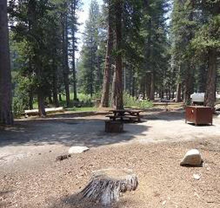
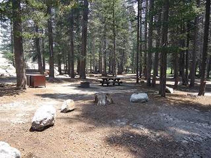
The campground offers 43 single campsites and one double-family campsite. Picnic tables and campfire rings are provided, as are vault toilets.

Natural Features

An open meadow that is surrounded by a variety of pines, including lodgepole, Jeffery and red fir. A creek runs through the meadow.

A trailhead nearby leads into the Jennie Lakes Wilderness.

Buck Rock Lookout, perched at an elevation of 8,500 feet, is a short drive away. Hume Lake is approximately 15 miles from the campground.

Reservation

More from CampingHiking.net:

OAK CABIN, Colorado Campground Images, Info & Reservations

Directions From Grand Junction, head south on Highway 50. Take a right on County Road 141 heading south for 14.5 miles. Make a sharp left on Divide Road. This road is not marked, but prior to turn, a sign reads "National Forest Access Divide Road, Uncompahgre Plateau." Follow this road

PAINTED ROCKS, Colorado Campground Images, Info & Reservations

Directions From the I-25 and Highway 24 intersection in Colorado Springs, Colorado, travel west on Highway 24 for about 18 miles to the junction with Highway 67 in Woodland Park. Turn right (north) on Highway 67 and drive about 7 miles to Painted Rocks Road and turn left (west). Take

ALMANOR, California Campground Images, Info & Reservations

Directions From Chester, take Highway 36 west to Highway 89 South. Turn left on Highway 89 and continue south about 6 miles, to Almanor Drive West (not to be confused with Almanor West development and Almanor West Drive). Turn left on Almanor Drive West (directly across from the Almanor Group

KATHLEEN LAKE CABIN, Alaska Campground Images, Info & Reservations

Directions Access to the cabin is by floatplane. It is about a 30-minute flight from Juneau. In fall, winter and early spring, the cabin may be inaccessible due to frozen lake surface (floatplanes cannot land). The lake is normally ice free from mid-May through November. Refer to USGS topographic map

SANTA CRUZ DEL NORTE BACKCOUNTRY, California Campground Images, Info & Reservations

Directions Boat transportation can be arranged with Island Packers from Ventura Harbor. To park headquarters in Ventura, California: Highway 101, exit Victoria or Seaward to Ventura Harbor. Phone 805-658-5730 Activities CAMPING, HIKING, WILDLIFE VIEWING, WILDERNESS, PHOTOGRAPHY, BIRDING, BACKPACKING Keywords CG09,SANTA CRUZ DEL NORTE,DEL NORTE,CHANNEL ISLANDS,SANTA CRUZ,Channel Islands National Park,Channel Island

WOLF CREEK (KS), Kansas Campground Images, Info & Reservations

Directions From US 75 and K-268 junction proceed east on K-268 for 7 miles to Pomona Dam Road; turn north and proceed 2.5 miles across the dam. After crossing the dam, turn west on Wolf Creek Pkwy and remain on this road for 1.2 miles to the park entrance. Phone