Directions
From Phoenix, Arizona: Traveling Northbound on I-17 take Exit 262 onto Hwy 69 North to Prescott and cointnue on Hwy 69 for 30 miles to S Walker Rd. Turn left and proceed South on S. Walker Rd. (by Costco, Petsmart, and AM/PM gas station). Drive about 3.8 miles and then turn East (left) into Hill Top Campground.
Alternate route from Flagstaff, Arizona: Traveling Southbound on I-17 take Exit 278 onto Westbound Highway 169 and continue for 15 Miles until reaching the junction of Hwy 69, turn right onto Northbound Hwy 69 and continue for 12 miles to S. Walker Rd. Turn left and proceed South on S. Walker Road (by Costco, Petsmart, and AM/PM gas station). Drive about 3.8 miles and then turn East (left) into Hill Top Campground.
Phone
1 (877) 444-6777
Activities
BIKING, BOATING, CLIMBING, CAMPING, FISHING, HIKING
Keywords
Related Link(s)
Overview
Hilltop Campground is located in the Prescott Basin at 5,712 feet in elevation and just over three miles south of Hwy 69 and east of Walker Road. Campers will appreciate the mild weather and the cool ponderosa pine forest. The facility’s attractive and convenient location allows opportunities for pursuing a variety of recreation activities that will satisfy anyone’s interests. Activities include boating, fishing, hiking, mountain biking and bird watching. Connector and loop trails allows access to most of the Prescott Basin and most trails allow for multiple modes of travel. The Tri-City Community comprising Prescott, Chino Valley and Prescott Valley has events and attractions throughout the year, all within a few minutes’ drive.To make reservations click on the availability button to the right to book this site or call 1 (877) 444-6777. For general campground questions contact the Bradshaw Ranger District at 1 (928) 443-8000.
Recreation
Hilltop Campground is available during the summer season and is enjoyed by people of all age groups and of diverse backgrounds. Campsites are designed for RV, trailer or tent camping. Many popular outdoor activities abound. Visitors may enjoy fishing, bird-watching, boating, backpacking, hiking, horseback riding, rock climbing, mountain biking, picnicking, camping and just plain relaxing.
Facilities
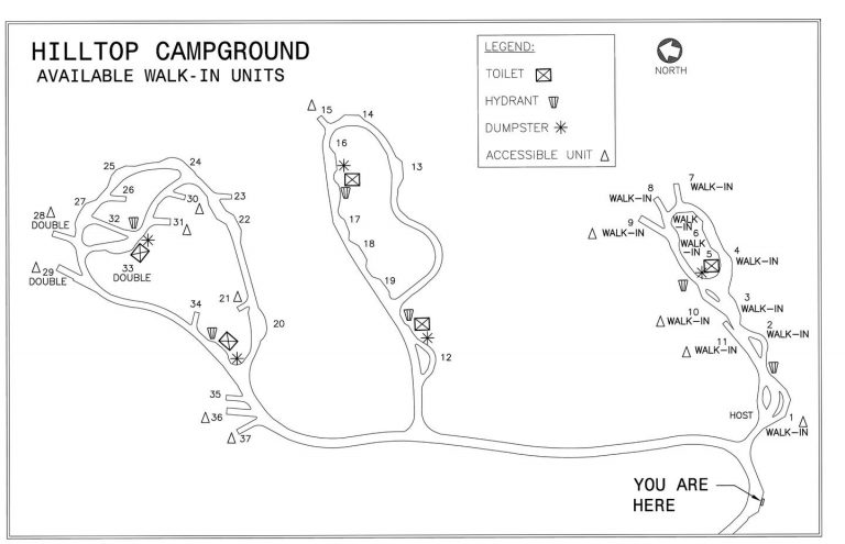
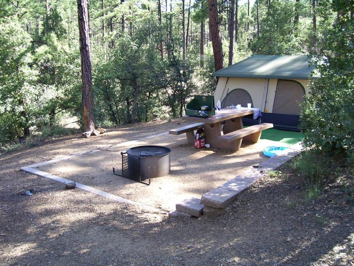
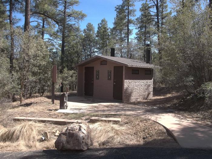
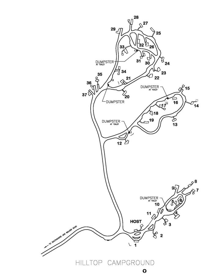
Hilltop Campground has 34 single and three double occupancy campsites, with 23 single and three double campsites available for advanced reservations. Campsites generally allow a camp unit (RV, or tow vehicle and trailer). A limited quantity will allow for an extra vehicle. Each campsite has a picnic table, steel fire ring and an established tent pad. Universally accessible campsites are available. There are five pull-through, 16 back-in and 16 parallel parking asphalt-surfaced driveways in the campground. Services include five vault restrooms, five trash dumpsters and six water faucets. There are no RV hook-ups or dump station. SEE PHOTOS FOR A SITE MAP.
Natural Features
Similar to several recreation facilities in the Lynx Lake Recreation Area, Hilltop Campground is located in ponderosa pine, oak, manzanita and a variety of shrubs and grasses. The facility is near Lynx Lake, Thumb Butte, Granite Basin Recreation Area, Granite Mountain Wilderness Area and Granite Basin Lake. Access to these areas can either be made by several interlocking hiking trails or by driving a short distance.
Nearby Attractions
North of Hilltop Campground, within walking distance is Lynx Lake. This lake at 55 acres is an immensely popular attraction on the Prescott National Forest. It offers a variety of recreation opportunities for all age groups. Activities include fishing, boating and hiking among many. West of Hilltop Campground, across the Prescott Basin about 11 miles distant, is the Thumb Butte Recreation Area. Thumb Butte’s 6,515 foot prominence is quite visible in the Prescott Basin. The Butte is very popular for its scenic vistas, jogging and hiking. Rock climbing is allowed, but only between July 16 and January 31. Climbing is prohibited during the peregrine falcon nesting period. Birdwatching is popular. Mountain bikes have access to trails from the parking area. To the Northwest, within 13 miles, is the Granite Basin Recreation Area. This recreation area has several day-use areas, Yavapai Campground and Granite Basin Lake (5 acres). The lake is known for channel catfish, large-mouth bass and sunfish. Rising prominently north of Granite Basin Lake is Granite Mountain at 6,874 feet. The Granite Mountain Wilderness Area is comprised of the mountain’s rugged topography and mixed vegetation suite. Also to the northwest at fifteen miles, is Alto Pit Off-Highway Vehicle (OHV) Campground and Day-Use Area. OHV riders of all skill levels can ride the several miles of trails that meander through the area’s challenging terrain and vegetative cover. The City of Prescott offers several day-use recreation facilities within ten miles of Hilltop Campground. To the northwest are Watson (70 acres) and Willow Lakes and to the southwest Goldwater Lake (15 acres). Each have unique qualities and recreation opportunities including boating, fishing, birdwatching and hiking.

