


Directions
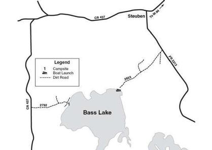
From Manistique drive north on M-94 22 miles to County Road 437. Turn left (west) on CR 437 and drive 4.6 miles to Forest Road 2792. Turn left (east) on FR 2792 and drive about 0.75 mile to the campsite.
Phone
906-474-6442 OR 906-387-2512
Activities
CAMPING
Keywords
Dispersed campsites,Manistique,Rapid River,lyman lake,swan lake,bass lake,bear lake,camp cook,carr lake,chicago lake,clear lake,crooked lake,east lake,gooseneck lake,ironjaw lake,jackpine lake,lake nineteen,leg lake,little bass lake,minerva lake,mowe lake
Related Link(s)
Michigan State Road Conditions
Overview
The campsites on the Rapid River/Manistique Ranger District are located on inland lakes and are in a rustic forest environment with few, if any amenities. The rustic environment offers a wonderfully serene and peaceful setting for your next campout
Recreation
Visitors will be able to enjoy swimming, berry picking, and fishing at these dispersed campsites. Licenses are required for fishing in Michigan waters. Some of these campsites offer only one site on these inland lakes allowing for a very peaceful and wilderness-like experience.
Facilities
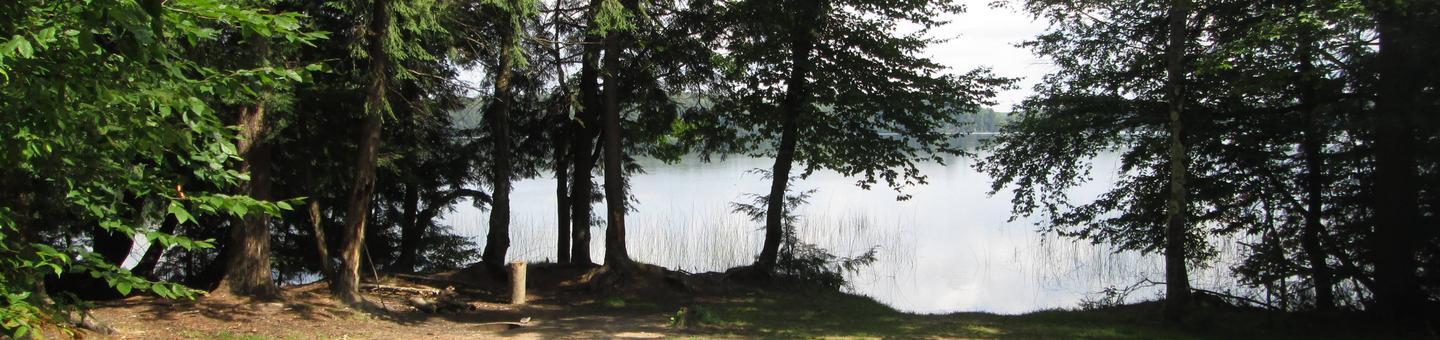
This enormous, 290 acre lake features one campsite on its western shore and an improved boat launch on its eastern shore, approximately 4 miles away. Known for its excellent fishing, Bass Lake contains northern pike, largemouth and small- mouth bass, and bluegills. This campsite is nestled among hardwoods, is approximately 35 x 50 feet in size, and is suitable for only one family trailer. Swimming is considered to be poor. There is no back in boat access at the campsite. Gasoline, groceries, fishing and camping supplies, boat rentals, ice and MDNR licenses are available at Steuben, approximately three miles northeast, on County Road 437.
Natural Features
All of these sites are nestled in hardwood trees and pines. All of them are on small inland lakes, which offer a wide variety of fishing opportunities. There is one exception; Camp Cook, which is close to the Fishdam River and provides opportunities for good brook trout fishing.
Nearby Attractions
There are a number of horse, bike, and hiking trails within minutes of several of the sites. In over a mile from these campsites, visitors can expect to find: bait shops, general and grocery stores, gas, a pay phone, trailheads, a fishing pier, biking, and kayak/canoe rentals.