

Directions
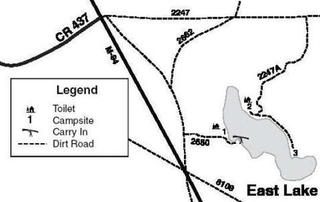
From Manistique drive north on M-94 22.5 miles to the intersection with CR 437. Turn right at the big parking lot opposite CR 437. To get to site #1 take the immediate right on FR 2723, drive 0.7 mi to FR 2650. Turn left (east) on FR 2650 and drive 0.2 mi to site 1. To get to sites 2 and 3 proceed directly through the parking lot on FR 2247 and drive about 1 mile to FR 2247A. Turn right (south) on 2247A and drive less than a mile to the campsites.
Phone
906-474-6442 OR 906-387-2512
Activities
CAMPING
Keywords
Dispersed campsites,Manistique,Rapid River,lyman lake,swan lake,bass lake,bear lake,camp cook,carr lake,chicago lake,clear lake,crooked lake,east lake,gooseneck lake,ironjaw lake,jackpine lake,lake nineteen,leg lake,little bass lake,minerva lake,mowe lake
Related Link(s)
Michigan State Road Conditions
Overview
The campsites on the Rapid River/Manistique Ranger District are located on inland lakes and are in a rustic forest environment with few, if any amenities. The rustic environment offers a wonderfully serene and peaceful setting for your next campout
Recreation
Visitors will be able to enjoy swimming, berry picking, and fishing at these dispersed campsites. Licenses are required for fishing in Michigan waters. Some of these campsites offer only one site on these inland lakes allowing for a very peaceful and wilderness-like experience.
Facilities
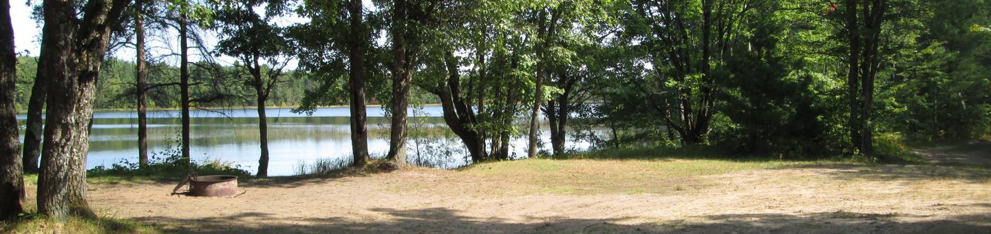
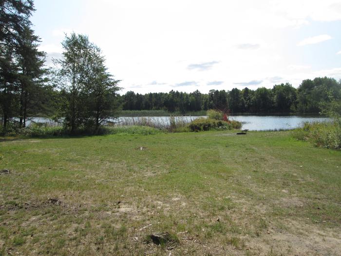
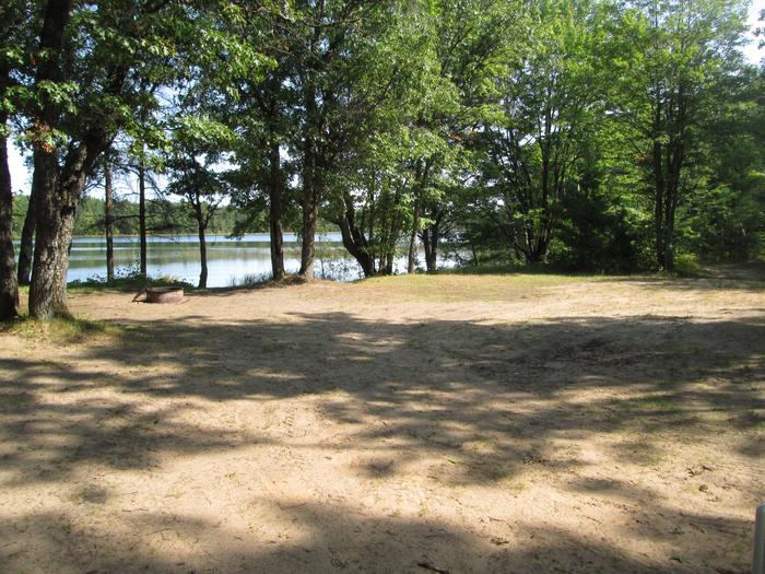
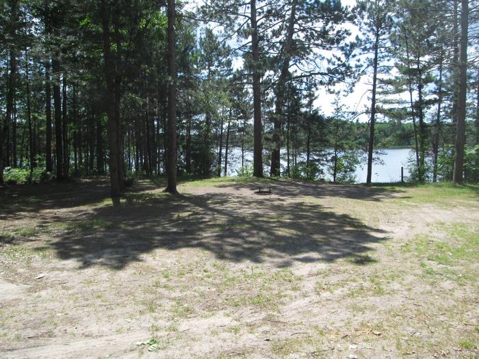
Three primitive campsites are located on the 53 acre East Lake. East Lake has fishing for largemouth bass, perch, bluegill and bullheads. There is no drinking water at this location. Site #1 is a wooded area on a hill overlooking the lake. The site is 100 ft. by 75 ft. and is suitable for three families. It is on the west side of the lake. A primitive toilet is at this site. Site #2 is a small wooded site on the northeast side of the lake. It is approximately 45 ft. by 35 ft. and would be suitable for one family. The access road is narrow and winding but can be traversed by small trailers. A primitive toilet is located at this site. Site #3 is on an open point of land that extends into the lake. It is 55 ft. by 50 ft. and is suitable for one family. Trailers are not recommended due to the very narrow winding road. Swimming at site #3 is excellent but is not recommended at sites #1 or #2. A boat access is located just past site #1. It is unimproved, shallow and sandy. Carry-in access is recommended. Gasoline, groceries, fishing and camping supplies, boat rentals, ice and MDNR licenses are available at Steuben, approximately two miles northwest, on County Road 437 Lake Name Number of Sites Maximum number of people per site Toilets Boat Access Lake Size (acres) East Lake 3 Site 1 (24) Sites 2 and 3 (8) Yes Back In 53
Natural Features
All of these sites are nestled in hardwood trees and pines. All of them are on small inland lakes, which offer a wide variety of fishing opportunities. There is one exception; Camp Cook, which is close to the Fishdam River and provides opportunities for good brook trout fishing.
Nearby Attractions
There are a number of horse, bike, and hiking trails within minutes of several of the sites. In over a mile from these campsites, visitors can expect to find: bait shops, general and grocery stores, gas, a pay phone, trailheads, a fishing pier, biking, and kayak/canoe rentals.