SANTA BARBARA CAMPGROUND, NM Campground Reservation, Info, Images, Map, Directions

SANTA BARBARA CAMPGROUND, New Mexico Campground Images, Info & Reservations

Directions

From the junction with State Road 75, follow SR 73 1.4 miles to the Santa Barbara Road. Turn left onto the Santa Barbara Road. Then travel 6.2 miles to the campground. Santa Barbara Road becomes Forest System Road 116 when the pavement ends.

Phone

435-245-6521

Activities

CAMPING, HIKING, HORSEBACK RIDING, WILDLIFE VIEWING

Keywords

Related Link(s)

Rec Area Info & Images

New Mexico State Tourism

New Mexico State Road Conditions

Overview

Santa Barbara Campground is situated nicely on the edge of the Pecos Wilderness area and next to Rio Santa Barbara, a beautiful and healthy trout stream.

Recreation

This is a great drop off point for hikers and horseback riders seeking close access to the Pecos Wilderness and Jicarita Peak.

Facilities

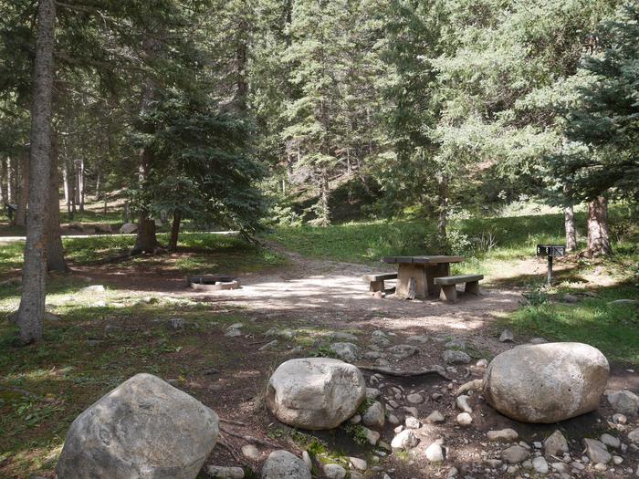
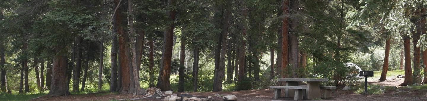
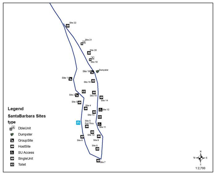
The campground has 15 single sites, each containing a table and fire ring; two double sites, each containing two tables and a fire ring; one triple site containing three tables and a fire ring; and two quad sites containing four tables and a fire ring. Vault toilets, drinking water from faucets and trash removal are provided. There are no horse facilites within the campground. First-come, first-served sites are available.

Natural Features

Santa Barbara is located in a mixed forest of spruce, fir and aspen trees, which provide some shade throughout the day. At an altitude of 8,900 feet, temperatures can cool off during the summer nights.

Nearby Attractions

Trail access to Jicarita Peak, with close access to North Truchas Peak, Sipapu Ski Resort, the town of Vadito, and the town of Penasco are all nearby. All are within 8-15 miles from the campground. Most services are available in Taos, NM, 25 miles north of the campground or Espanola, NM, 45 miles southwest.

Reservation

More from CampingHiking.net:

MOOSE CREEK FLAT CAMPGROUND, Montana Campground Images, Info & Reservations

Directions From Bozeman, take Highway 191 south for 32 miles. From West Yellowstone, take Highway 191 north 57 miles. The campground is on the west side of the highway. Phone (406)646-1012 Activities CAMPING, FISHING, WILDLIFE VIEWING, DAY USE AREA, PHOTOGRAPHY, KAYAKING, STAR GAZING, BIRDING, WATER ACCESS, RAFTING Keywords MOOS,GALLATIN NF

MOUNTAIN PARK, Colorado Campground Images, Info & Reservations

Directions From Fort Collins, travel west on Colorado Highway 14, to Ted’s Place, and continue up the Poudre Canyon to mile marker 98.8. Phone 970-295-6700 Activities BIKING, BOATING, CAMPING, FISHING, HIKING, WATER SPORTS, WILDLIFE VIEWING, BIRDING, RAFTING, WHITEWATER RAFTING Keywords MOUT,POUDRE RIVER,CACHE LA POUDRE RIVER,ARAPAHO AND ROOSEVELT NF – FS

PLATTER FLATS, Texas Campground Images, Info & Reservations

Directions From Colbert, Oklahoma, travel 5 miles north on US 75, turn west 5 miles to Platter Flats, OK, then follow signs to the campground. Physical address: 867 Trail Ride Road, Platter, OK 74753. Phone 580-434-5864 Activities CAMPING Keywords PLAT,TEXOMA LAKE,TEXOMA LAKE Related Link(s) Rec Area Info & Images Oklahoma

EDSON CREEK GROUP CAMPGROUND, Oregon Campground Images, Info & Reservations

Directions Edson Creek campground is located off of Highway 101 between Bandon and Port Orford, Oregon. From U.S. Highway 101, turn east onto Sixes River Road. Travel approximately four miles, and turn left into the campground just before you cross the Edson Creek Bridge. Phone 541-756-0100 Activities BOATING, CAMPING, FISHING,

ROCK CREEK RECREATION AREA, Tennessee Campground Images, Info & Reservations

Directions From I-26 take exit 34 to Main Street (TN107) in Erwin, take TN 395 east for 3.5 miles to Rock Creek Recreation Area. Phone 423-638-4109 Activities BIKING, HISTORIC & CULTURAL SITE, CAMPING, FISHING, HIKING, PICNICKING, RECREATIONAL VEHICLES, WILDLIFE VIEWING, FISH HATCHERY, WILDERNESS, DAY USE AREA, PLAYGROUND PARK SPECIALIZED SPORT