LAKE GILLETTE CAMPGROUND, WA Campground Reservation, Info, Images, Map, Directions

LAKE GILLETTE CAMPGROUND, Washington Campground Images, Info & Reservations

Directions

From Colville, WA: Head north on N Maple St toward E 2nd Ave for 0.1 miles. Turn right at the 2nd cross street onto WA-20 E/E 3rd Ave Continue to follow WA-20 E for 24.5 miles. Turn right onto NF-200/Pendoreille Lake Rd for 0.4 miles. Turn left and continue for 236 feet. Destination will be on the right.

Phone

435-245-6521

Activities

BIKING, BOATING, CAMPING, FISHING, HIKING, WILDLIFE VIEWING, DAY USE AREA, SWIMMING SITE

Keywords

Related Link(s)

Rec Area Info & Images

Washington State Tourism

Washington State Road Conditions

Overview

Lake Gillette campground lies on the east shore of Lake Gillette, a popular spot for boating and fishing.

Recreation

With plentiful trails, visitors to the area will enjoy hiking and bicycling and those looking for water recreation can access swimming and boating in nearby Gillette Lake.

Facilities

Lake Gillette campground has 14 campsites, vault toilets, drinking water and a bear proof garbage containers. The campground offers paved interior roads and parking spurs.

Natural Features

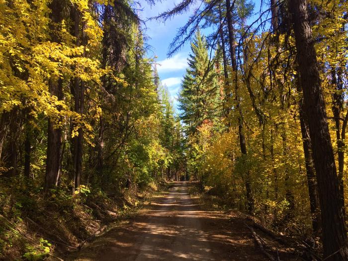
Lodgepole pine and tamarack are found throughout the campground, providing shade to many campsites. A wonderful campground for the entire family, the area offers hike-in access to Gillette Lake and Rufus Trail #148. An amphitheatre is also close and can be reached by one of the many trails.

Nearby Attractions

Gillette Lake and access to Rufus Trail for hikers.

Reservation

More from CampingHiking.net:

OLD POST ROAD, Arkansas Campground Images, Info & Reservations

Directions From SR-7, take Lock and Dam Road for one mile and follow signs into campground. Phone 479-968-7962 Activities BOATING, CAMPING, FISHING, VISITOR CENTER, MOUNTAIN BIKING, BIRDING, DISC GOLF, SOCCER FIELDS Keywords OLDP,DARDANELLE LAKE – ARK.RIV.NAV.,DARDANELLE LAKE Related Link(s) Rec Area Info & Images Arkansas State Tourism Arkansas State Road

DEVILS ELBOW, Idaho Campground Images, Info & Reservations

Directions From I-90, take Exit 43 (Kingston) and travel 20 miles north on FH9 to Prichard. Continue 11 miles north on Forest Road 208 to the campground. Phone 435-245-6521 Activities CAMPING, FISHING, SWIMMING SITE Keywords DEV2,DEVIL S ELBOW,IDAHO PANHANDLE NF – FS Related Link(s) Rec Area Info & Images Forest

SKULL CREEK, Utah Campground Images, Info & Reservations

Directions Located off Highway 44, just west of the junction of Highways 44 and 191 in the Flaming Gorge area, about 35 miles north of Vernal, Utah. Phone 435-784-3445 Activities BIKING, BOATING, CAMPING, FISHING, HIKING, WILDLIFE VIEWING Keywords SKUL,SKULL CREEK,FLAMING GORGE,ASHLEY NF – FS,Flaming Gorge National Recreation Area Related Link(s)