JEMEZ FALLS CAMPGROUND, NM Campground Reservation, Info, Images, Map, Directions

JEMEZ FALLS CAMPGROUND, New Mexico Campground Images, Info & Reservations

Directions

From Alburquerque: Take Interstate 25 north for 12 miles; exit onto NM State Highway 550 northwest for approximately 20 miles then exit onto NM Highway 4. The campground is accessed off NM Highway 4, approximately 15 miles northeast of Jemez Springs.

Phone

(575) 829-3535

Activities

BIKING, HISTORIC & CULTURAL SITE, CAMPING, WILDLIFE VIEWING, FIRE LOOKOUTS/CABINS OVERNIGHT, DAY USE AREA

Keywords

Related Link(s)

Rec Area Info & Images

New Mexico State Road Conditions

New Mexico State Tourism

Overview

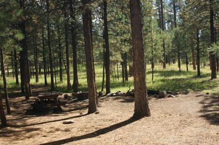
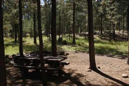
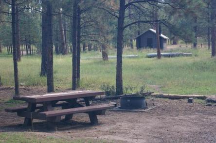
Jemez Falls Campground is located in a stunning Ponderosa Pine and forest meadow environment. The campground elevation is 7,880 feet above sea level. Come prepared for warm days and cool nights. Excellent hiking opportunities are available, including a short hike to Jemez Falls or a longer hike along the East Fork Trail, both of which can be accessed from the campground . Thank you for choosing USFS Jemez Falls Campground for your visit. Please remember that this campground is special. Help keep it clean and beautiful by using the trash dumpsters and recycle bins for paper, plastics and metals and do not place trash in the recycle bins. Have a wonderful stay camping in the Jemez Mountains.

Recreation

Overnight camping, fishing, and hiking are main attractions. Other recreational activities include outdoor photography and nature viewing. The campground is within the heart of the Jemez National Recreation Area.

Facilities

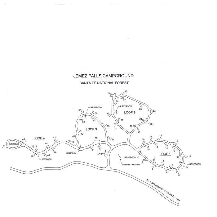
The campground contains 51 overnight tent and RV/trailer campsites. There is paved access from the highway and paved internal roads to individual campsites. There are no RV hook-ups at the campground. Drinking water is provided from spigots conveniently located throughout the campground. Vault toilets provide basic sanitation needs. A campground host is on duty during the summer camping season.

Natural Features

The East Fork Jemez Wild and Scenic River runs close to the campground. The campground is situated on rolling terrain shaded by pines and sunny in open meadows.

Nearby Attractions

Jemez Falls, the largest waterfall in the Jemez Mountains, is a half mile hike from the campground. The Valles Caldera National Preserve and Bandelier National Monument are within short driving distance along the Jemez Mountain Trail National Scenic Byway.

Charges & Cancellations

Reservation

More from CampingHiking.net:

BROOKEN COVE, Oklahoma Campground Images, Info & Reservations

Directions From Enterprise, Oklahoma, take Highway 71 north for 5 miles and follow signs to the campground. Phone 918-799-5843 Activities BOATING, CAMPING, FISHING, HIKING, SWIMMING SITE Keywords BRCO,EUFAULA LAKE,EUFAULA LAKE Related Link(s) Rec Area Info & Images Oklahoma State Tourism Oklahoma State Road Conditions Overview Brooken Cove Campground sits along

SPINREEL, Oregon Campground Images, Info & Reservations

Directions From Reedsport Oregon, travel 11 miles south on Highway 101 to Spinreel Road. Turn right on Spinreel Road and proceed for a half mile to the campground entrance which will be on the left. Phone 541-271-6000 Activities CAMPING, HIKING, WILDLIFE VIEWING Keywords SPIN,TEST,SIUSLAW NF – FS Related Link(s) Rec

BERGER, California Campground Images, Info & Reservations

Directions From Sierraville, drive 18 miles south on Highway 49, turn right at Bassett, and drive approximately 1.5 miles to the Sardine Lake turnoff. Turn right at the Packer Lake turnoff (Forest Road 93) and continue to the campground. Phone (530)478-6253 Activities BIKING, BOATING, CLIMBING, CAMPING, HIKING, HORSEBACK RIDING, HUNTING,

LIVE OAK SOUTH, California Campground Images, Info & Reservations

Directions From Bakersfield, take Highway 178 east to the town of Lake Isabella. From Lake Isabella, take Highway 155 north approximately 6 miles to Live Oak South campground. Phone 760-376-1815 Activities CAMPING Keywords LIOA,LIVE OAK,LIVE,OAK,OAK SOUTH,LIVE SOUTH,SEQUOIA NF – FS Related Link(s) Rec Area Info & Images Forest Service Concessionaire

CEDAR RIDGE (TX), Texas Campground Images, Info & Reservations

Directions From Interstate 35 in Temple, Texas take State Highway 36 west towards Gatesville. Turn left on Cedar Ridge Park Road and continue into the park and campground area. Phone 254-986-1404 Activities BOATING, CAMPING, SWIMMING SITE Keywords CEDR,BELTON LAKE,LAKE BELTON,BELTON LAKE Related Link(s) Rec Area Info & Images Texas State