Directions
From the West: Take U.S. Rt. 50/301 East across the Chesapeake Bay Bridge ($2.50 toll). Continue on Rt. 301 North after Rts. 50 and 301 split. Exit Rt. 301 onto Rt. 213 North towards Chestertown. In Chestertown, turn left from Rt. 213 onto Rt. 291. At the end of this short bypass, turn right onto Rt. 20. Follow Rt. 20 South for 12 miles into Rock Hall. At the caution light, turn left onto Rt. 445. Follow Rt. 445 approximately 7 miles from Rock Hall to the refuge entrance bridge.
Phone
410-639-7056
Activities
BIKING, BOATING, HISTORIC & CULTURAL SITE, INTERPRETIVE PROGRAMS, FISHING, HIKING, HUNTING, VISITOR CENTER, WILDLIFE VIEWING, ENVIRONMENTAL EDUCATION, PHOTOGRAPHY, PADDLING
Camping Reservations
Reserve your campsite at these camping areas:
Hiking Trails
Looking for nice hiking areas to take a hike? Choose from these scenic hiking trails:
Related Link(s)
More Maryland Recreation Areas
Eastern Neck National Wildlife Refuge
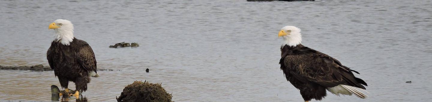
Eastern Neck National Wildlife Refuge, a part of the Chesapeake Marshlands National Wildlife Refuge Complex, is a 2,286-acre island located at the confluence of the Chester River and the Chesapeake Bay. Established in 1962 as a sanctuary for migratory birds, Eastern Neck NWR provides natural habitat for over 240 bird species – including American bald eagles and transitory peregrine falcons – and is a major staging site for tundra swans. Eastern Neck NWR serves as a land-use model within the Chesapeake Bay watershed through its sustainable agriculture, wetland restoration, native landscaping, and renewable energy demonstration projects. An easy day-trip from the metropolitan areas of Baltimore, Philadelphia, and the nation’s capital, Eastern Neck NWR is an increasingly popular nature tourism destination on Maryland’s upper Eastern Shore, attracting over 70,000 visitors annually to its waterfront vistas, peaceful walking trails, and “watchable wildlife.”