Directions
From Highway 137, turn south on Forest Road 540 following it nearly to its end where it intersects Forest Road 3008. Continue on to a short spur, signed 202, which is the trailhead to the Devils Den Trail, #200. Hike trail #200 to its end on a gentle ridge within the WSA. The infrequently maintained trail drops into a wash, and you must be careful to watch for rock cairns marking where it climbs back out of the wash near the mouth of the canyon on the north side. Since the middle section of the trail is on the bottom of a wash, avoid hiking here during times of heavy rain.
Phone
575-234-5972
Activities
HIKING
Camping Reservations
Reserve your campsite at these camping areas:
Hiking Trails
Looking for nice hiking areas to take a hike? Choose from these scenic hiking trails:
Related Link(s)
More New Mexico Recreation Areas
BLM New Mexico YouTube Channel
BLM New Mexico YouTube Channel
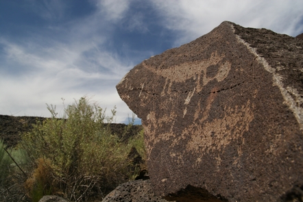
The Devil’s Den Canyon WSA is located in southern New Mexico, approximately 40 miles southwest of Carlsbad and is contiguous with the Guadalupe Escarpment WSA (managed by the U.S. Forest Service). Devil’s Den Canyon contains the mouth of a major drainage on the west side of Guadalupe Escarpment and has a variety of vegetation including desert shrubs and grasses, piÑon and juniper woodlands, and sub-riparian trees and shrubs in the canyon bottom.


