Directions
The Salmon Pass Trail is located in the southern part of the Headwaters Forest Reserve, and is accessible only through BLM led guided hikes. This trail is located near the city of Fortuna.
Phone
707-825-2300
Activities
HIKING, WILDLIFE VIEWING
Camping Reservations
Reserve your campsite at these camping areas:
Hiking Trails
Looking for nice hiking areas to take a hike? Choose from these scenic hiking trails:
Related Link(s)
More California Recreation Areas
The Salmon Pass Trail (south end) is accessible for guided hikes only. Guided hikes can be scheduled between May 15 and November 15 (weather permitting) by requesting a tour online http://discovertheredwoods.com/headwaters-hike or by contacting the BLM Arcata Field Office at 707-825-2300.
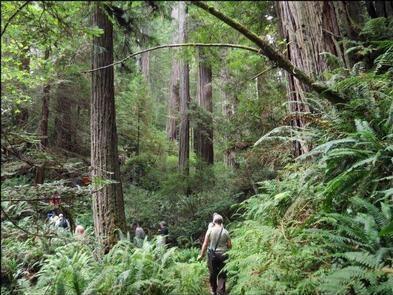
The first mile passes through a young to mid-aged forest with views of restored watershed areas. The next 2 miles ascend through the old-growth redwood forest with a view across Salmon Creek to the largest stand of Douglas-fir within the Reserve. The trail then loops back as it descends through the old-growth.
Distance and difficulty: This 2 1/2 mile hike is considered moderately strenuous and takes 3 to 4 hours.

