Directions
From Kanab, Utah: Take Highway 89 north for 10 miles to Hancock Road, designated a Scenic Backway. Hancock Road is seven miles long and meets at a “T” with Yellowjacket Road. Turn left (south) onto Yellowjacket. The main park entrance is five miles up on the left.
Phone
435-644-1200
Activities
AUTO TOURING, CAMPING, HIKING, HORSEBACK RIDING, HUNTING, WILDLIFE VIEWING, ENVIRONMENTAL EDUCATION, PHOTOGRAPHY
Camping Reservations
Reserve your campsite at these camping areas:
Hiking Trails
Looking for nice hiking areas to take a hike? Choose from these scenic hiking trails:
Related Link(s)
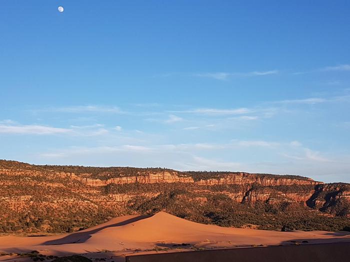
A popular off-roading venue is the Coral Pink Sand Dunes, located about 20 miles west of Kanab. Dunes enthusiasts can travel over 1500 acres of open sand dunes covering the Coral Pink Sand Dunes State Park and the extreme northern end of BLM’s Moquith Mountain Wilderness Study Area.
The dunes are co-managed by the BLM and Utah State Parks. Please observe proper OHV etiquette and Wilderness Study Area (WSA) regulations when travelling in the Moquith Mountain WSA.


