Directions
From Interstate 95 Northbound: Take exit 43 to Walnut Street. Turn right onto Walnut Street. Dive 2.3 miles, then turn right onto Central Street. Stay on Central Street for 1.1 miles. Turn left to stay on Central Street (road makes a sharp turn). From Interstate 95 Southbound: Take exit 43 to Walnut Street. Turn left onto Walnut Street. Drive 2.3 miles and turn right onto Central Street. Stay on Central Street for 1.1 Miles. Turn left to stay on Central Street (road makes a sharp turn).
Phone
(781) 233-0050
Camping Reservations
Reserve your campsite at these camping areas:
Hiking Trails
Looking for nice hiking areas to take a hike? Choose from these scenic hiking trails:
Related Link(s)
More Massachusetts Recreation Areas
Saugus Iron Works National Historic Site Official Website
Saugus Iron Works National Historic Site Map
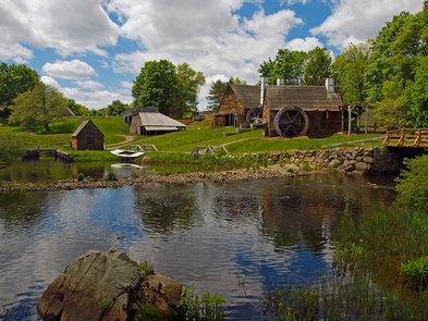
In the 1600’s, on the banks of the Saugus River, something extraordinary happened. Explore the place where European iron makers brought their special skills to a young Massachusetts colony. This nine-acre National Park includes working waterwheels, forges, mills, an historic 17th century home, and a lush river basin.

