Directions
Carrizo Plain National Monument is west of Bakersfield, California.
This area is very remote and undeveloped, therefore it is recommended that you do not rely on GPS or other mapping programs to lead you to the park.
Phone
Visitor Center: 805-475-2131
Office: 661-391-6000
Activities
BIKING, CAMPING, HORSEBACK RIDING, HUNTING, WILDLIFE VIEWING, ENVIRONMENTAL EDUCATION, PHOTOGRAPHY
Camping Reservations
Reserve your campsite at these camping areas:
Hiking Trails
Looking for nice hiking areas to take a hike? Choose from these scenic hiking trails:
Related Link(s)
More California Recreation Areas
Carrizo Plain National Monument Recreation Map and Guide
Download the Carrizo Plain National Monument Recreation Map and Guide
Carrizo Plain National Monument
Carrizo Plain National Monument National Conservation Lands
Currently as of March 29, 2019
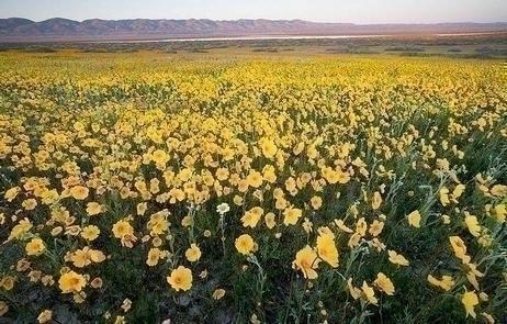
The wildflowers are stunning at Carrizo Plain National Monument with more blooming daily on the valley floor and mountain ranges. Gold fields, Tidy Tips and Phacilia continue to bloom.
REMINDER: Campgrounds fill up fast or are already full so plan accordingly. Please follow warning signs and respect private property when visiting your public lands. This is a remote area with limited towing services, no fuel, food or water nearby.
ROADS: Rain showers continue, please be cautious on dirt roads! Don™t drive into the flowers, park alongside the road (parallel) as not to obstruct other traffic and watch for pedestrians. Currently Simmler Road and Panorama Road are open. High clearance vehicles are recommended, especially in muddy areas. Soda Lake Road and Elkhorn Road are also open.
Don™t forget to check the visitor center wildflower info line (805) 475-2035.
Click here for more information on the latest wildflower conditions
Overview
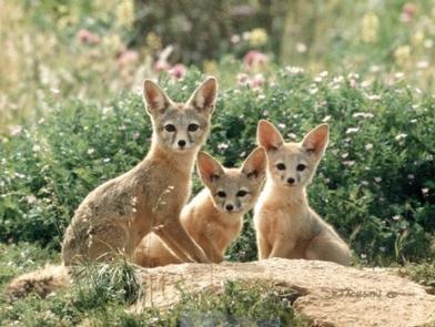
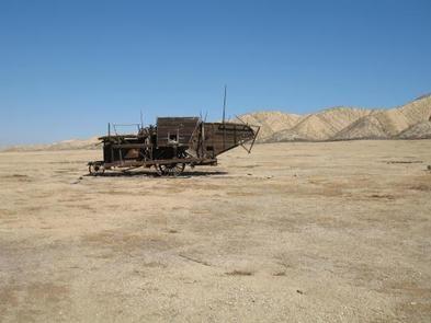
The Carrizo Plain National Monument, located 100 airline miles (160 km) from Los Angeles, is an area by-passed by time. Soda Lake, its centerpiece, is a glistening bed of white salt, set within a vast open grassland, rimmed by steep mountains. The plain is home to diverse communities of wildlife and plant species, is an area culturally important to Native Americans, and is traversed by the San Andreas fault, which has created and moved mountain ranges, carved valleys and is marked by a subtle alignment of ridges, ravines and pools.
Goodwin Education Center
Phone: 805-475-2131
Open: December 1 – May 31.
Hours: 9:00 a.m. – 4:00 p.m., Thursday – Sunday
Maps and brochures are available at the front door when the center is closed. Wheelchair accessible restrooms at the Education Center remain open 24 hours a day, seven days a week, throughout the year.
Contact the Education Center or make it your first stop to receive updated information about your visit to the Carrizo Plain National Monument.
Get permits for Guided and Self-Guided Tours
Download the Carrizo Plain National Monument Recreation Map and Guide
Find the latest 2019 wildflower updates on BLM California social media:

