BULL TROUT, ID Campground Reservation, Info, Images, Map, Directions

BULL TROUT, Idaho Campground Images, Info & Reservations

Listen

Directions

From Boise, Idaho, take State Street to Highway 55 north. At Banks, take Highway 17/Banks-Lowman Highway to Lowman. Take Highway 21 east to milepost 107. Turn left on Forest Road 520. Proceed on dirt road 2 miles to the campground.

Phone

208-259-3361

Activities

BIKING, BOATING, HISTORIC & CULTURAL SITE, CAMPING, FISHING, HIKING, HUNTING, WILDLIFE VIEWING

Keywords

BULL,BOISE NF – FS

Related Link(s)

Rec Area Info & Images

Idaho State Tourism

Idaho State Road Conditions

Overview

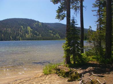
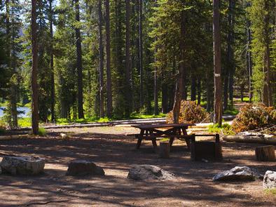
Bull Trout Campground is located on the shores of beautiful Bull Trout Lake at an elevation of 6,900 feet. The lake offers great fishing and canoeing opportunities. Many trails for hiking, biking, horseback and off-road vehicle riding are in the area.

Recreation

Bull Trout Lake offers excellent canoeing and kayaking opportunities, as the lake is for non-motorized watercraft only. Anglers fish for brook and rainbow trout. A primitive boat ramp is located on the west side of the lake.

Martin Lake is nearby, offering canoeing and fishing. The lake is stocked with rainbow trout.

Many miles of trails can be found in the area, including the 11-mile Warm Spring Trail for hikers. The 35-mile Kirkham Ridge Trail is open to hiking, mountain biking, horseback riding and dirt biking.

Facilities

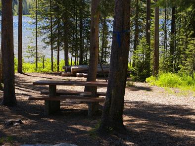
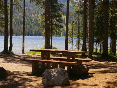
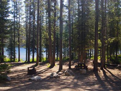
This campground contains group, equestrian and single and double campsites, many of which are accessible. The group sites can accommodate up to 50 people each. Equestrian sites each contain a corral and large parking spur. Some sites are on the waterfront and have direct lake access, others have lake views.

Vault toilets, drinking water and trash collection are provided. Roads and parking spurs within the campground are dirt. A campground host is on-site.

Natural Features

The campground is situated in a mixed-growth forest of Douglas fir and lodgepole pine, which offers partial shade. Summer wildflowers are abundant.

Reservation

More from CampingHiking.net:

ASPEN (UT), Utah Campground Images, Info & Reservations

Listen Directions From Duchesne, Utah: Take Highway 87 north to the junction with Highway 35. Turn west on Highway 35 towards Tabiona and travel about 28 miles to the campground in the North Fork Drainage. From Highway 40, turn north on Highway 208 towards Tabiona, then proceed northwest through Hanna

COYOTE POINT, California Campground Images, Info & Reservations

Listen Directions From Stockton California, take Highway 26 east for 30 miles. Turn right on Hogan Dam Road and continue for a mile, then follow signs to the campground. Park Headquarters: 2713 Hogan Dam Road Valley Springs, CA 95252 Coyote Point (located in Oak Knoll Campground): 3027 South Petersburg Road

GRIZZLY, California Campground Images, Info & Reservations

Listen Directions From Reno, travel north on Highway 395 to Highway 70 and turn west to Portola. From Portola, take County Road 126 north for 7 miles, then County Road 112 to the east side of Lake Davis. Continue approximately 1 mile to the campground, which is on the left.

TAILWATER REC AREA, Tennessee Campground Images, Info & Reservations

Listen Directions From I-40, take Exit 258, travel north on HWY 53/25, turn right on SR-26 and travel for 2 miles. Turn right on Corps Lane and follow signs into recreation area. Phone 615-735-1034 Activities BOATING, PICNICKING, WILDLIFE VIEWING, DAY USE AREA, MOTOR BOAT, WATER ACCESS Keywords TARA,CORDELL HULL LAKE,SHELTER

RECREATION POINT, California Campground Images, Info & Reservations

Listen Directions From Fresno, California, take Highway 41 north through Oakhurst. Turn right on Forest Road 222 toward Bass Lake. Keep right for 3.5 miles to the campground registration office. Phone 559-642-3212 Activities BOATING, CAMPING, INTERPRETIVE PROGRAMS, FISHING, HIKING, WATER SPORTS, DAY USE AREA, SWIMMING SITE Keywords RECR,BASS LAKE,OAKHURST,SIERRA NF