LEAD HILL, AR Campground Reservation, Info, Images, Map, Directions

LEAD HILL, Arkansas Campground Images, Info & Reservations

Listen

Directions

From Lead Hill, AR, travel 4 mi. on SR 7 N and follow signs into campground.

Phone

870-422-7555

Activities

BOATING, CAMPING, SWIMMING SITE

Keywords

LEAD,BULL SHOALS LAKE,BULL SHOALS LAKE

Related Link(s)

Rec Area Info & Images

Arkansas State Tourism

Arkansas State Road Conditions

Overview

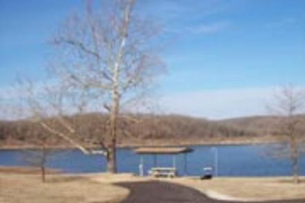
Lead Hill Campground is a splendid, sizable campground with plenty of waterfront sites along the shores of Bull Shoals Lake.

The lake, renowned as a haven for water sports enthusiasts, boasts nearly 1,000 miles of shoreline along the Arkansas and Missouri border.

Recreation

Year-round fishing tournaments keep fishermen active as they seek out 12-pound bass. The lake also attracts birders, naturalists, hikers, scuba divers and those who come for all types of motorboat sports.

Facilities

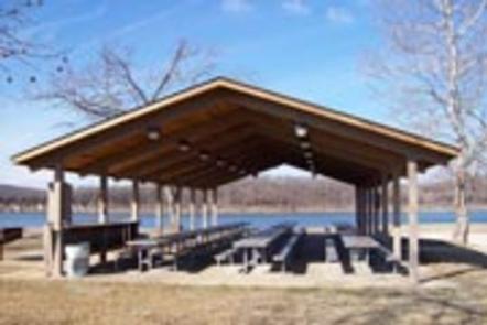
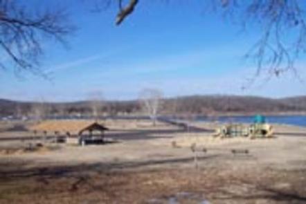
Most of the 75 campsites have canopies over picnic tables for cooling shade, and each one is equipped with electric hookups. The campground also has two group campsites, a playground, designated swim area and a marina.

Natural Features

Lead Hill is on the Arkansas side of Bull Shoals, which stretches across the border of Arkansas and Missouri. Bull Shoals Lake, formed by a dam built in 1951, stems from the White River in the Ozark Mountains, and eventually flows into the Mississippi.

Nearby Attractions

Cruise around the lake to see the many public parks operated by the Army Corps of Engineers. These parks cover additional swim areas, 11 marinas and several hundred miles of undeveloped land and coves.

Reservation

More from CampingHiking.net:

GROOM CREEK HORSE CAMP, Arizona Campground Images, Info & Reservations

Listen Directions From Phoenix, Arizona, Take I-17 north for 61.8 miles. Take exit 262 toward Cordes Junction/Prescott. Merge onto State Route 69 west and follow for 33.8 miles. At the split, take the ramp for Route 89 south. Turn slight left onto East Gurley Street/89 and follow for about 0.8-mile.

KINGS HILL CABIN, Montana Campground Images, Info & Reservations

Listen Directions From Great Falls, travel aproximately 23 miles east on Highway 87/89 and turn right (south) at the rest area/weigh station just past Belt, onto U.S. Highway 89 toward Monarch and Neihart. Drive approximately 50 miles to Kings Hill Pass. The cabin is on the left side of the

TWELVE MILE FLAT, Utah Campground Images, Info & Reservations

Listen Directions Travel east up Twelve Mile Canyon on Forest Development Road 22 for approximately 20 miles, or travel west up Ferron Canyon on Forest Development Road 22 for 31 miles. Phone 435-384-2372 Activities BIKING, CAMPING, HIKING, HUNTING, WILDLIFE VIEWING Keywords TWEM,MANTI-LASAL NF -FS Related Link(s) Rec Area Info &

WINNIE DAM CAMPGROUND, Minnesota Campground Images, Info & Reservations

Listen Directions From Deer River, Minnesota, take Highway 2 west for one mile. Turn right on Highway 46 and go 12 miles. Turn left on Itasca County 9 and continue 2 miles, then turn left at signs and follow to the campground. Phone 218-326-6128 Activities CAMPING Keywords LAKW,WINNI DAM CAMPGROUND,WINNI

Tinkham Campground, Washington Campground Images, Info & Reservations

Listen Directions From Seattle, Washington, go east on I-90 to Exit 42. Turn south and go approximately 1 mile to the campground. Phone 360-804-1103 Activities BIKING, CAMPING, FISHING, HIKING Keywords TINK,MT. BAKER-SNOQU NF – FS Related Link(s) Rec Area Info & Images Washington State Road Conditions Washington State Tourism Forest