

Directions
From Nashville, take I-65 North to TN-386/Vietnam Veterans Blvd. Continue East on TN-386/Vietnam Veterans Boulevard to exit 9. Merge onto US-31E N/Johnny Cash Pkwy/E Main St. and continue approximately 2.5 miles. Nat Caldwell Park will be on your left just before crossing over Station Camp Creek.
Phone
(615) 822-4846
Activities
FISHING, PICNICKING, KAYAKING, CANOEING
Keywords
NATC,OLD HICKORY LAKE,OLD HICKORY LAKE
Related Link(s)
Tennessee State Road Conditions
Overview
Nat Caldwell Park is located right off of US-31E/Nashville Pike. This park is an ideal place for a day of picnicking and other outdoor activities.
Recreation
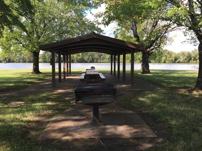
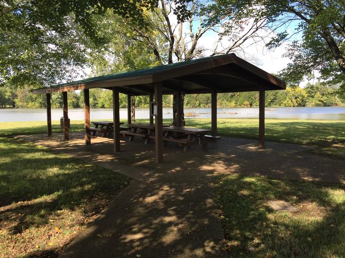
Nat Caldwell is smaller and not as busy as some of the other parks in the area making it a great place to relax and enjoy your day. It offers a reserveable group picnic shelter, grill, open grassy areas, and shoreline for fishing. It also serves as a great place to launch kayaks and canoes from the shoreline due to the fact is is in the headwaters of Station Camp Creek on Old Hickory Lake. If you need to launch a larger boat, Station Camp Creek is located straight across Nashville Pike just off of Douglas Bend Road.
Facilities
The group picnic shelter holds up to 50 guests with parking available for approximately 25 vehicles.
Natural Features
Old Hickory Lake is a 22,500 acre reservoir created by the Old Hickory Lock and Dam on the Cumberland River. The lake is named after former president Andrew Jackson, a Tennessee-native nicknamed “Old Hickory” for his tough and aggressive personality. The lake features 440 miles of scenic shoreline, surrounded by wooded flatlands and plenty of access points.
Nearby Attractions
Hikers may be interested in the nearby Lock 4 Park. It offers hiking trails as well as mountain bike trails.
Charges & Cancellations
If a customer cancels a group day use facility (shelter) reservation within 14 days of the scheduled arrival date, they will forfeit the total day use fee with no service fee charge.