Directions
From Pineland, TX, take FM 83 west 10 miles, then go south on FM 705 for 11 miles to FM 3127, then west for 1.5 miles and make a left into the park entrance.
Phone
409-384-5716
Activities
BOATING, CAMPING, FISHING, HIKING, HUNTING
Keywords
RAYB,SAM RAYBURN RESERVOIR,SAM RAYBURN LAKE,RAYBURN LAKE,SAM RAYBURN RESERVOIR
Related Link(s)
Overview
Rayburn Park lies on the north shore of Sam Rayburn Reservoir, a popular family destination with boating and fishing and access to hunting less than a mile away. Sam Rayburn Reservoir and the surrounding Angelina National Forest provide a wintering habitat for the bald eagle. During the winter months, forest visitors may see the bald eagle soaring over the lake, perched on a flooded snag or in a tall pine along the shoreline.
Recreation
Sam Rayburn Reservoir is well-known for its largemouth bass, with numerous tournaments hosted here each year. Among the most impressive catches ever recorded is a 74-pound Flathead catfish.
The lake is also popular for jet skiing, water skiing, swimming and birding. It’s used as a feeding and resting grounds for migratory birds on their path to the Gulf Coast. A resident population of wood ducks remains in the forest year-round.
Facilities
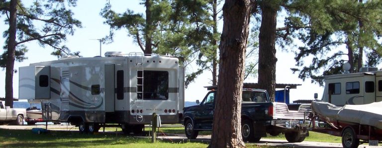
The park is open year-round and features 46 campsites with water and electric hookups ranging from 30 to 50 amps. A boat launch and playground are also available.
Natural Features
At 114,000 surface acres, Sam Rayburn is the largest man-made lake that is completely within the boundaries of Texas. The reservoir is fed by the Angelina River, a major tributary of the Neches River.
The piney woods region boasts native flora like orchids, insect-eating plants and scores of animal species.
Nearby Attractions
From the eastern edge of the lake, hikers can embark on a 28-mile trail that heads east to the Toledo Bend Reservoir.


