WAITSBORO CAMPGROUND, KY Campground Reservation, Info, Images, Map, Directions

WAITSBORO CAMPGROUND, Kentucky Campground Images, Info & Reservations

Listen

Directions

From Somerset Kentucky, take Highway 27 south for 5 miles. Turn right on Waitsboro Road and follow signs to the campground.

Phone

606-561-5513

Activities

BOATING, CAMPING, FISHING, DAY USE AREA

Keywords

WAIT,LAKE CUMBERLAND,WOLF CREEK DAM

Related Link(s)

Rec Area Info & Images

Kentucky State Road Conditions

Kentucky State Tourism

Overview

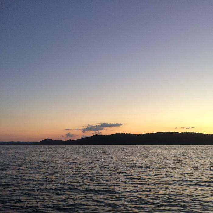
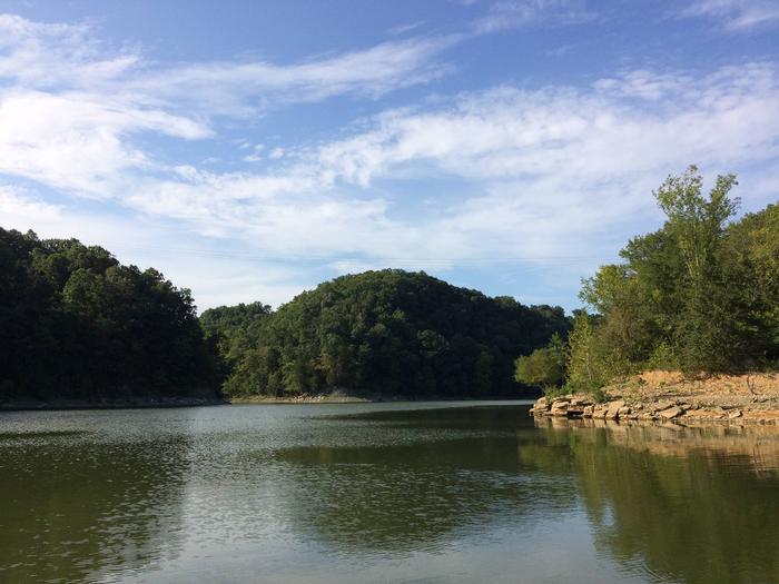
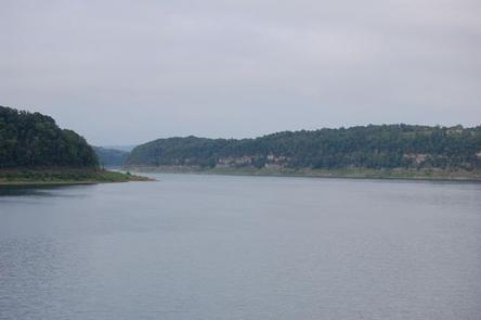
Waitsboro Campground is at 500 Waitsboro Road and is situated on beautiful Lake Cumberland in southern Kentucky.

Click here for the Lake Cumberland virtual tour.

Recreation

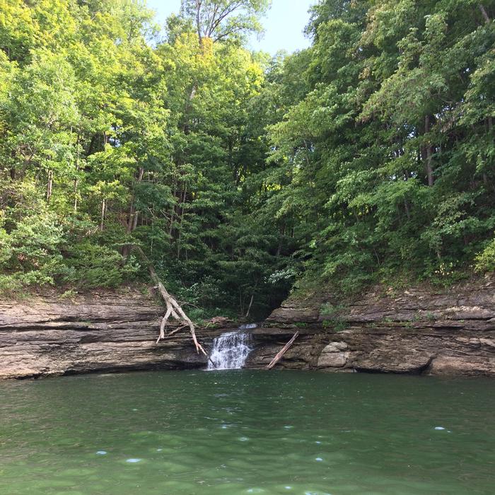
Lake Cumberland is the largest man-made lake east of the Mississippi River. Its large surface acreage and over 1,200 miles of shoreline provide a myriad of recreational activities. The lake has an abundance of largemouth, smallmouth, white and Kentucky bass, bluegill, crappie, rockfish and walleye, making it a favorite among anglers. The Black Walnut Nature Trail, located near the lake office, is a self-guided educational trail. The trail is open Monday through Friday 8:00am to 4pm EST.

Facilities

The campground offers 17 RV sites, all with electric hookups, and five tent-only sites. Eight of Waitsboro’s sites are on the waterfront, making them prime locations for weekend recreation.

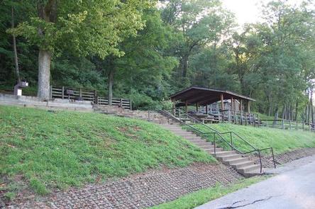
Amenities include flush toilets, showers, drinking water, laundry facilities and a dump station. A day-use area with a group picnic shelter and a parking area is also available.

Natural Features

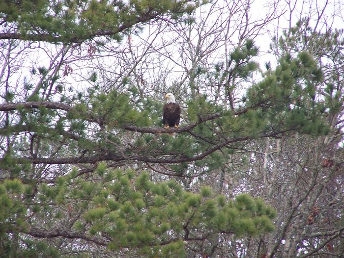
The campground overlooks the main body of the lake, offering sweeping scenic views. Dense stands of mature hardwoods forest the site, offering scenic views, pleasant shade and wildlife habitat.

Because of the temperate climate and relatively long recreation season, the lake provides varied outdoor recreational opportunities for millions of visitors each year.

Nearby Attractions

General Burnside Island State Park is nearby. It was named after Civil War General Ambrose Burnside, who led patrols along the Cumberland River, circling this 400-acre island to keep watch for Confederate soldiers. Visitors come today to enjoy boating, fishing, golfing and picnicking on Kentucky’s only island state park.

Burnside Marina is 10 minutes away, with boat rentals, a restaurant and general store.

Reservation

More from CampingHiking.net:

SANTA FE TRAIL, Kansas Campground Images, Info & Reservations

Listen Directions From I-70, take Highway 177 south for 30 miles. Continue west across the dam road, then right onto City Lake Road. After a mile turn right into the campground entrance. Phone 620-767-5195 Activities BOATING, CAMPING, FISHING, HIKING, HUNTING Keywords SANT,COUNCIL GROVE,COUNCIL GROVE LAKE Related Link(s) Rec Area Info

BLUE LAKE CAMPGROUND, Colorado Campground Images, Info & Reservations

Listen Directions From Colorado Highway 12 south of the Town of Cuchara, take FSR 422 4 miles west to the campground. Phone FOR RESERVATIONS CALL (877) 444-6777, FOR OTHER, NON REAL TIME INFORMATION, CALL (719) 269-8500. Activities BIKING, CAMPING, FISHING Keywords Related Link(s) Rec Area Info & Images Colorado State

SALT LICK CREEK, Tennessee Campground Images, Info & Reservations

Listen Directions From Carthage, go 4 miles west on SR-25, then north on SR-80, then east on SR-85 to Gladice. Turn right on Smith Bend Road and follow signs. Phone 931-678-4718 Activities BOATING, CAMPING, INTERPRETIVE PROGRAMS, FISHING, WILDLIFE VIEWING, WILDERNESS, SWIMMING SITE, PHOTOGRAPHY, PADDLING, SWIMMING, MOTOR BOAT, PADDLE BOATING, WATER

TIMPANOGAS, Oregon Campground Images, Info & Reservations

Listen Directions From I-5, take Exit 188A onto Highway 58 and proceed just past MP 37 (east of Oakridge), turning right onto Kitson Springs Road. Proceed 0.5 mile to junction with Forest Service Road (FSR) 21, also signed as Diamond Drive. Turn right onto FSR 21 and continue approximately 32

BERRY BEND EQUESTRIAN, Missouri Campground Images, Info & Reservations

Listen Directions From Z Highway, travel approximately 2 miles south on the Berry Bend Access Road. Phone 660-438-7317 Activities BOATING, CAMPING, FISHING, HIKING, HORSEBACK RIDING, FISH HATCHERY Keywords BERE,TRUMAN LAKE,BERRY BEND NORTH,HARRY S TRUMAN Related Link(s) Rec Area Info & Images Missouri State Road Conditions Missouri State Tourism Overview BERRY

CASCADE (COLORADO), Colorado Campground Images, Info & Reservations

Listen Directions From Buena Vista, Colorado, take Highway 285 south to Nathrop. Turn west on County Road 162 and travel 9 miles to the campground. Phone CAMPGROUNDS DO NOT HAVE PHONE SERVICE, CALLING TO CHECK AVAILABILITY PRIOR TO ARRIVAL IS NOT POSSIBLE. FOR RESERVATIONS CALL: 1-877-444-6777 Activities HISTORIC & CULTURAL