WHITTEN PARK, MS Campground Reservation, Info, Images, Map, Directions

WHITTEN PARK, Mississippi Campground Images, Info & Reservations

Directions

From Interstate 22 , take Highway 25 (exit 104). Then turn left at the first red light, then turn left onto Access Road at the next traffic light. Go north 4 miles. Campground is on the left side of the road within the Jamie L. Whitten Historical Center Park.

Phone

(662) 862-7070

Activities

CAMPING, FISHING, HIKING, VISITOR CENTER, SWIMMING SITE, DISC GOLF

Keywords

WHTT,TENNESSE-TOMBIGBEE WATERWAY,TENN-TOM,FULTON CAMPGROUND,TENNESSEE-TOMBIGBE

Related Link(s)

Rec Area Info & Images

Mississippi State Road Conditions

Mississippi State Tourism

Overview

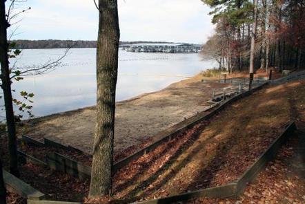
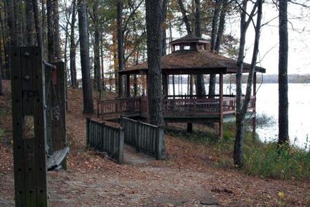
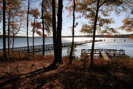
Whitten Park Campground attracts thousands of outdoor enthusiasts for picnicking, fishing and swimming on the Tennessee-Tombigbee Waterway. Easy access to three boat docks, nature trails and a sandy swimming beach with a gazebo overlooking the waterway, make Whitten Park a welcoming destination for campers.

Whitten Park is also referred to as Fulton Campground because of its location in Fulton, Mississippi.

Recreation

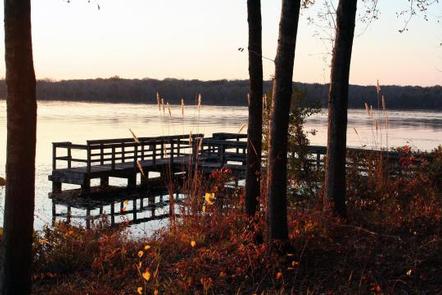
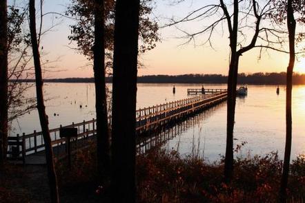
Anglers can try their luck on the fishing dock or go off-shore in search of bass and crappie. Hikers will enjoy many nature trails, which weave through wooded wildlife habitats.

Facilities

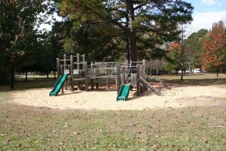
The campground offers 60 sites with electric and water hookups. The three camp loops provide easy access to playgrounds, laundry facilities and showers.

Natural Features

The Tennessee-Tombigbee Waterway extends 234 miles from the Tennessee River to the junction of the Tombigbee River in Alabama. The man-made waterway connects the nation’s midsection of commercial water transportation with the Gulf of Mexico. Features include ten lock and dams, Gainesville Lake, Aliceville Lake, Columbus Lake and Aberdeen Lake.

Nearby Attractions

Tupelo, Mississippi, known as the birthplace of Elvis Presley, is 15 miles west.

Reservation

More from CampingHiking.net:

LAKE HILL, Utah Campground Images, Info & Reservations

Directions Located approximately 5 miles east of Ephraim, Utah on Forest Highway 8 in Ephraim Canyon. Phone 435-283-4151 Activities BOATING, CAMPING, FISHING, HIKING Keywords LAKH,MANTI-LASAL NF -FS Related Link(s) Rec Area Info & Images Utah State Tourism Utah State Road Conditions Overview Lake Hill Campground is situated next to pretty

WHITE STAR, Colorado Campground Images, Info & Reservations

Directions From Leadville, travel 15 miles south on Highway 24 to Highway 82. Turn right and go west 5.5 miles on Highway 82, turn left into the White Star Campground. Phone 719-486-0749 (FOR INFORMATION ONLY, NO RESERVATIONS) Activities BOATING, CAMPING, FISHING, HIKING, MOUNTAIN BIKING Keywords WSTR,TWIN LAKES,PIKE AND SAN ISABEL

HUME LAKE, California Campground Images, Info & Reservations

Directions From Fresno, take Highway 180 east to the Park Wye. Go left and continue on Highway 180, past Grant Grove for 12.25 miles. Turn right on Hume Road and continue 3 miles to Y intersection. Take the road to the left 0.5 mile to Hume Lake Campground entrance. Phone

BUCKHORN PAVILION, Oklahoma Campground Images, Info & Reservations

Directions From I-35, take Exit #55 or #51 and drive towards the city of Davis, OK. Once in Davis, go east on Highway 7 to the Chickasaw National Recreation Area you desire. Watch for the Chickasaw National Recreation Area signs to direct you to your selected area: Campgrounds, Boat Ramps,

BIG PINE CANYON, California Campground Images, Info & Reservations

Directions From Highway 395 in Big Pine, California, turn west at flashing yellow traffic light and continue on Crocker Street/Big Pine Road for 9 miles. The group campground is just above Upper Sage Flat Campground on the left. Phone 760-935-4339 Activities CAMPING Keywords BIGP,PALISADE GLACIER GROUP,PASISADE GLACIER,CLYDE GLACIER GROUP,CLYDE GLACIER,INYO