RIVERSIDE (OR), OR Campground Reservation, Info, Images, Map, Directions

RIVERSIDE (OR), Oregon Campground Images, Info & Reservations

Directions

From Estacada, travel east on Highway 224 for approximately 26 miles, then keep right onto Highway 46 for approximately 2 miles to the campground.

Phone

503-630-5721

Activities

BIKING, CAMPING, FISHING, HIKING, WATER SPORTS, WILDLIFE VIEWING

Keywords

RIVX,MT. HOOD NF – FS

Related Link(s)

Rec Area Info & Images

Oregon State Road Conditions

Oregon State Tourism

Forest Service Concessionaire

Overview

Riverside Campground is a charming and rustic campground, situated alongside the Wild and Scenic Clackamas River in Mt. Hood National Forest. It provides access to a variety of hiking, mountain biking and horseback riding trails and is a great place to experience nature.

Recreation

Fishing is very popular in the Oak Fork and anglers can expect a catch of winter steelhead, spring Chinook and late summer Kokanee salmon, as well as other species of freshwater fish. The Clackamas River also provides miles of wild water as it bends through the scenic Cascade range, making whitewater rafting a popular activity.

The 5-mile Riverside National Recreation Trail, popular for hiking and mountain biking, is located not far from the campground. The surrounding area provides numerous additional opportunities for hiking.

Facilities

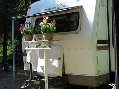
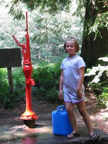
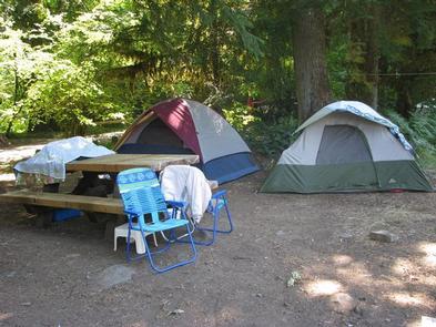
The campground offers more than a dozen single-family sites for tent and small RV camping. Each site is equipped with a table and campfire ring with grill. Accessible vault toilets and drinking water are provided, but no hookups are available. Parking surfaces are paved and gravel.

Natural Features

The campground is located in Mt. Hood National Forest along the Oak Grove Fork of the Clackamas River at an elevation of about 1,400 feet. Huge maple and Douglas fir trees cover the area, and dense shrubbery provides some privacy between campsites. The campground is not far from the Ripplebrook Ranger Station and Ripplebrook Pond.

The river provides habitat for the federally protected bald eagle and northern spotted owl, as well as an occasional peregrine falcon. A variety of wildlife makes its home in the area.

Nearby Attractions

Bagby Hot Springs is located about 14 miles southwest of the campground. A popular site for soaking and relaxing, the springs are in a heavily wooded area in the scenic Cascade Range. The available bathhouses are fed by three major hot water springs and several minor outlets in the area. A historic guard station was built there in 1913.

Reservation

More from CampingHiking.net:

GREEN VALLEY, California Campground Images, Info & Reservations

Directions From Running Springs, travel east on Highway 18 about 3 miles to Green Valley Lake Road. Turn left and continue about 6 miles to the campground. Phone 909-866-8550 Activities BOATING, CAMPING, FISHING, HIKING, SWIMMING SITE Keywords GREV,GREEN VALLEY San Bernardino,SAN BERNARDINO NF – FS Related Link(s) Rec Area Info

NORTH FORK (WY), Wyoming Campground Images, Info & Reservations

Directions From Centennial, Wyoming, take State Highway 130 west for 3.7 miles to Sand Lake Road/Forest Road 101. Turn right and drive 2 miles to the campground. Phone 307-745-2300 Activities BIKING, CAMPING, FISHING, HIKING Keywords NOR1,MEDICINE BOW-ROUTT NF-FS Related Link(s) Rec Area Info & Images Wyoming State Tourism Overview North

NAMEKAGON, Wisconsin Campground Images, Info & Reservations

Directions From Cable, Wisconsin, take County Highway M east for 11 miles. Turn left on County Highway D and proceed about 6 miles to Forest Service Road 209. Turn left at the campground sign and drive less than a mile to the campground entrance. Phone (715) 634-4821 OR (715) 264-2511

HOLIDAY, Georgia Campground Images, Info & Reservations

Directions From LaGrange, Georgia, take State Highway 109 west for 7 miles. After crossing the First Lake Bridge, continue another mile and turn left onto Thompson Road. At the next intersection, bear left and follow signs to the park. This county road leads directly into the campground. Phone 706-884-6818 Activities

DIAMOND BUTTE LOOKOUT, Montana Campground Images, Info & Reservations

Directions From Ashland, Montana: travel east on State Highway 212 for approximately 3 miles. Turn south onto Otter Creek Road hwy 484 and travel 20 miles. Just past the Fort Howes Work Center, turn east onto Taylor Creek Road and travel 12 miles to Sonnette Divide Road. Turn north onto

OAK GROVE CAMPGROUND, California Campground Images, Info & Reservations

Directions From Interstate 15 take the 79 East. The campground is on the north side of the highway, across from the fire station. From Temecula, take State Rt. 79 south 24.1 miles and turn left at campground sign. Phone (760) 788-0250 Activities HISTORIC & CULTURAL SITE, CAMPING, FISHING, HIKING, VISITOR