SUNSTRIP, OR Campground Reservation, Info, Images, Map, Directions

SUNSTRIP, Oregon Campground Images, Info & Reservations

Listen

Directions

From Estacada, travel east on Highway 224 for about 21 miles to the campground.

Phone

503-630-5721

Activities

CAMPING, FISHING, HIKING, WATER SPORTS, WILDLIFE VIEWING

Keywords

SUN1,MT. HOOD NF – FS

Related Link(s)

Rec Area Info & Images

Oregon State Tourism

Forest Service Concessionaire

Oregon State Road Conditions

Overview

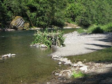
Sunstrip Campground is a primitive campground on the banks of the Clackamas Wild and Scenic River. It provides access to a variety of outdoor activities, but retains the look and feel of true nature, with only a few amenities.

Recreation

Fishing is very popular in the Clackamas and anglers can expect winter Steelhead, spring Chinook and late summer Kokanee salmon, as well as other species of freshwater fish.

Whitewater rafting is also a favorite activity among visitors. The Clackamas River provides miles of wild water as it snakes through the scenic Cascade range.

A hiking trail meanders along the riverbank, north and south of the campground. Scenic driving is available on the nearby West Cascades National Scenic Byway, which follows the river.

Facilities

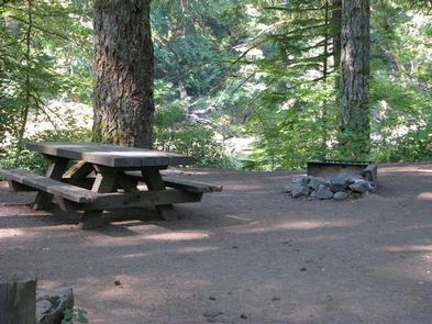
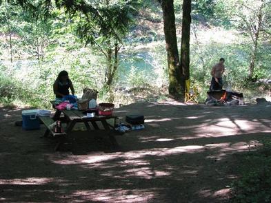
The campground offers about eight tent-only campsites, half of which are on the waterfront. Each site is equipped with a table and campfire ring with grill. Accessible vault toilets are provided. Drinking water is not available at the campground.

Natural Features

The campground is nestled in a wooded area of the Mt. Hood National Forest, thick with moss and greenery, at an elevation of about 1,000 feet.

The river provides habitat for the federally protected bald eagle and northern spotted owl, as well as the occasional peregrine falcon. A variety of wildlife make its home in the area.

Nearby Attractions

The Clackamas River, just below nearby Indian Henry Campground to the North Fork Reservoir, provides 12.5 miles of class III-IV whitewater. Outfitters are located in the town of Estacada.

Reservation

More from CampingHiking.net:

INDIAN CREEK (UT), Utah Campground Images, Info & Reservations

Listen Directions From Orangeville, Utah, travel northwest on State Route 29 for approximately seven miles. Turn onto Cottonwood Creek Road 040 and travel north for 12 miles, to Upper Joe’s Valley. Continue to the campground. Phone 435-384-2372 Activities BIKING, CAMPING, FISHING, HIKING Keywords IND1,MANTI-LASAL NF -FS Related Link(s) Rec Area

LOWER TWIN CAMPGROUND (VA), Virginia Campground Images, Info & Reservations

Listen Directions From John W. Flannagan Dam & Reservoir continue on RT. 739. Turn left on Rt. 611, travel 2 miles, turn left on to Corps Lower Twin Rd. Campground is .25 miles. Phone 276-835-9544 Activities BIKING, BOATING, CAMPING, FISHING, HIKING, WILDLIFE VIEWING Keywords Related Link(s) Rec Area Info &

SUPPLY PARK, Oklahoma Campground Images, Info & Reservations

Listen Directions From Woodward, Oklahoma, travel 9 miles northwest on Highway 3/270 to Fort Supply Lake sign. Turn west and follow for 3 miles, crossing Fort Supply Dam. Continue 3/4 mile to the four-way stop; turn left and follow access road into the campground. Phone 580-766-2001 Activities BOATING, CAMPING, HUNTING,

YOUNG LAKE (SOUTH) CABIN, Alaska Campground Images, Info & Reservations

Listen Directions Access is by float plane. It is about a 20-minute flight from Juneau. This cabin is in a designated Wilderness area, and access by helicopter is illegal. In fall, winter and early spring the cabin may be inaccessible due to frozen lake surface (float planes cannot land). The