VAN HOOK GLADE, NC Campground Reservation, Info, Images, Map, Directions

VAN HOOK GLADE, North Carolina Campground Images, Info & Reservations

Listen

Directions

From Highlands, North Carolina, follow Highway 64 west approximately 4.5 miles. The campground entrance is on the right.

Phone

828-526-5918

Activities

CAMPING, FISHING, HIKING, SWIMMING SITE

Keywords

VANH,HIGHLANDS,NFs IN NORTH CAROLINA – FS

Related Link(s)

Rec Area Info & Images

Forest Service Concessionaire

North Carolina State Tourism

North Carolina State Road Conditions

Overview

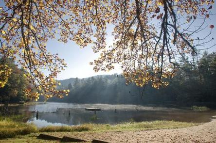
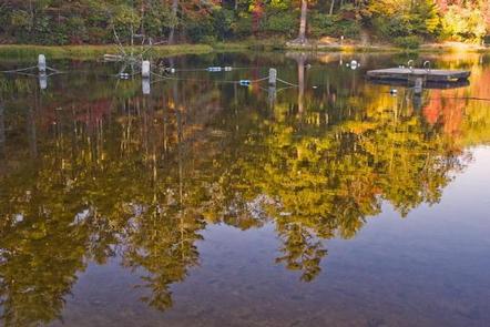
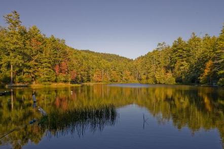
Van Hook Glade is a scenic, secluded campground in the heart of the Nantahala National Forest. Convenient for families and anglers, the campground is in close proximity to hiking trails, scenic views, waterfalls and a nearby lake.

Recreation

Campers can easily relax with a book or deck of cards in the shaded campsites, or seek out many activities close by. A short trail in the campground leads to the Cliffside Lake Recreation Area, which offers six hiking trails ranging from easy to moderate, as well as trout fishing, picnicking and swimming. Boating is not permitted.

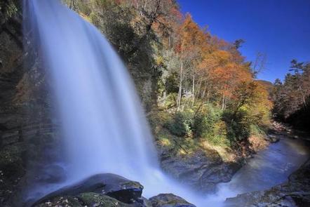
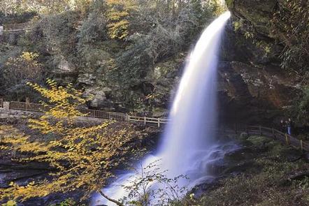
Van Hook glade is a short drive from Dry Falls and Whitewater Falls.

Facilities

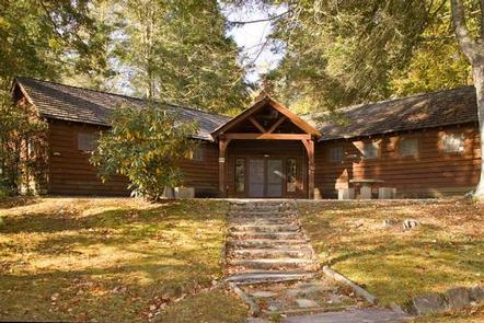
Van Hook Glade offers 18 secluded sites, all equipped with picnic tables, tent pads, lantern posts and campfire rings with grills. Hot showers and flush toilets are also provided, and firewood is available for purchase on-site.

Natural Features

The campground is located just 4 miles from the scenic and cultural attractions of Highlands, North Carolina, offering shady campsites in a heavily wooded and secluded area situated on rolling hills. The elevation is 4,118 feet, and the calm waters of Cliffside Lake sit adjacent.

Nearby Attractions

A morning or late afternoon drive down scenic Highway 64 is sure to present visitors with amazing views. The quaint town of Highlands has a general store and various attractions, while the larger town of Franklin has shopping, a casino, grocery stores and performing arts.

Reservation

More from CampingHiking.net:

QUINN SPRINGS PAVILION, Tennessee Campground Images, Info & Reservations

Listen Directions The Quinn Springs Pavilion is located on Highway 30 about 6 miles south of Etowah, TN, and 6 miles north of Benton, TN. From Highway 411, turn on to Highway 30; pavilion is 0.3 miles on the right. Phone 423-338-3300 Activities CAMPING, FISHING, HIKING, WILDLIFE VIEWING, KAYAKING, CANOEING,

DYERS CREEK, Tennessee Campground Images, Info & Reservations

Listen Directions From Nashville, Tenn, take I-24 West to the Clarksville Exit 8. Take US-79S for 46 miles to Dyers Creek Recreation Area. Phone 931-232-7724 DOVER OFFICE; 270-362-4236 LAKE BARKLEY RESOURCE MANAGERS OFFICE Activities BOATING, HISTORIC & CULTURAL SITE, FISHING, VISITOR CENTER, DAY USE AREA Keywords DYER,LAKE BARKLEY,BARKLEY LOCK &

COLD SPRINGS CAMPGROUND (OR), Oregon Campground Images, Info & Reservations

Listen Directions From Sisters, OR: Travel 4.2 miles west on Highway 242 (McKenzie Pass Highway). Phone 541-323-1746 Activities CAMPING Keywords Related Link(s) Rec Area Info & Images Oregon State Tourism Oregon State Road Conditions Overview A pleasant, small spring runs through the center of this popular, shaded campground. Located just

SAILOR LAKE, Wisconsin Campground Images, Info & Reservations

Listen Directions From Fifield, follow State Highway 70 east for about 7 miles and turn right (south) on Forest Road 139 and continue for 3 miles. Phone 715-762-2461 Activities BOATING, CAMPING, FISHING, HIKING, HUNTING, WILDLIFE VIEWING, CANOEING, HISTORIC SITES Keywords SAIL,CHEQUAMEGON-NICOLET NF – FS Related Link(s) Rec Area Info &

WILLOW FLAT CAMPGROUND, Utah Campground Images, Info & Reservations

Listen Directions From Preston, Idaho, head south on U.S. Highway 91 for approximately 3 miles. Turn east on the Cub River Road (Forest Road 406) and travel 3 miles past the Cache National Forest boundary to the intersection of Forest Road 406 and Forest Road 407. Bear right at the