

Directions
From Truckee, Calif., travel east on Highway 80 for 10 miles, to the Hirschdale Road exit. Follow Hirschdale Road/Stampede Dam Road north for eight miles, to the Stampede Reservoir. Take a left on Dog Valley Road to go over Stampede Dam. In a quarter mile the campground will be on the left. Alternate Access: From Truckee, go north on Hwy 89 for 5 miles and take a right on Hobart Mills Road. Follow Hobart Mills Road to Dog Valley Road and take a left. In approximately 3 miles, pass the boat ramp road and Logger Campground Entrance, and in a quarter mile Emigrant Group will be on the left.
Phone
(530)587-3558. FOR RESERVATIONS, PLEASE CALL: 1 (877) 444-6777.
Activities
BIKING, BOATING, CAMPING, FISHING, HIKING, WATER SPORTS, SWIMMING, KAYAKING
Keywords
EMIG,STAMPEDE GROUP CAMP,TRUCKEE,TAHOE NF – FS
Related Link(s)
California State Road Conditions
Overview
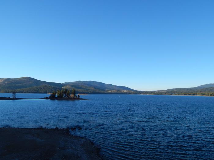
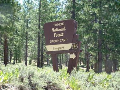
Emigrant Group Campground is located alongside the beautiful Stampede Reservoir. The campground is located approximately 30 minutes from the town of Truckee, Calif. Visitors enjoy the area for its boating, fishing and abundant hiking and off-road trails. This facility is operated and maintained by the Tahoe National Forest.
Recreation
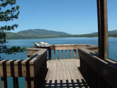
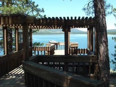
Boating, water skiing, swimming and fishing are popular activities on the reservoir. Anglers will find rainbow and brown trout and kokanee salmon. A boat ramp is located a half-mile away. Many miles of hiking and off-road vehicle trails crisscross through the surrounding area. The nearby Overland Emigrant Commemorative Trail is open to hiking and mountain biking.
Facilities
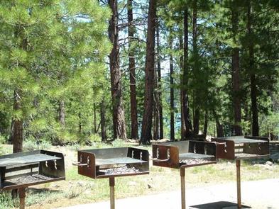
The campground offers four group sites, the largest of which are called the Woodsman and Prospector sites. They each can accommodate up to 50 people. The Rancher and Trapper sites can accommodate up to 25 people. Each group site has a central cooking and picnic area, equipped with a large campfire ring. Approximately six tables and four grills are provided at each site as well. Horseshoe pits are located at the Woodsman site.
Natural Features
The campground is situated on the south side of Stampede Reservoir, which is located on the Little Truckee River, approximately eight miles above the confluence of the Little Truckee and Truckee Rivers. A forest of ponderosa pine, Jeffrey pine and fir trees covers the area providing ample shade.
Nearby Attractions
Boca Reservoir is 10 minutes south of the campground, offering additional boating, water skiing, swimming and fishing opportunities. Truckee, 10 minutes south, offers all the amenities of a year round recreational mountain town including interstate highway connectivity, top notch restaurants, resorts and hotels, grocery stores, gas stations, shopping, and historic sites. Lake Tahoe is located 45 minutes south and offers excellent boating, kayaking, fishing, hiking and scenic driving opportunities, as well as dining, shopping and lodging options. Other recreational opportunities include Boca Townsite Interpretive Trail, Donner Camp Interpretive Trail, Overland Emigrant Commemorative Trial, Prosser Pits OHV area, and numerous hiking, mountain biking, and OHV trails.