
Directions
Access to the cabin is by float plane or boat with anchor. It is about a 1-hour flight from Juneau or 30 minutes from Petersburg. Access by boat via Stephens Passage is approximately 70 miles from Juneau. Tides affect access to the cabin, click here for local tide tables. The steep beach provides a good boat anchorage. There is no mooring facility on-site.
Phone
907-586-8800
Activities
BOATING, CAMPING, FISHING, WILDLIFE VIEWING
Keywords
CIGH,GAMBIER BAY,TONGASS NF – FS
Related Link(s)
Overview
Church Bight Cabin offers guests recreation, relaxation and a unique wilderness lodging experience on the southeast side of Admiralty Island in the Tongass National Forest. The remote site offers a scenic setting for fishing, boating, and wildlife viewing, all within the vicinity of the cabin.
Access to the cabin is float plane or boat. Visitors are responsible for their own travel arrangements and safety, and must bring several of their own amenities.
Recreation
Anglers will enjoy saltwater and freshwater fishing in the area. Fly fishing for Dolly Varden and rainbow trout is popular in nearby streams. Halibut and rockfish are found in further open waters.
Wildlife viewing is abundant on land and in water. Gambier Bay is quite remote, yet a good place for bear and humpback whale sightings.
Facilities
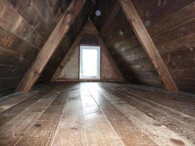
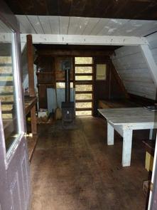
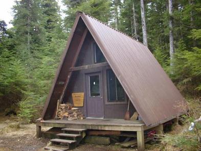
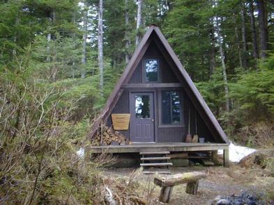
The primitive, log cabin ( A-frame style ) is furnished with wooden bunks, without mattresses, and a loft, and can accommodate up to seven people. The cabin is equipped with a table, benches, a wood stove for heat and an outside toilet. Firewood is generally provided in a wood shed at the salt water beach, but it is not guaranteed. Other amenities include cooking counters, an axe, splitting maul and a broom. The cabin does not have running water or electricity. Guests must bring their own food, water, sleeping bags, sleeping pads, cook stove, matches, cooking gear/utensils, light source toilet paper, first aid kit and garbage bags. The water source from a nearby stream is intermittent. A boat is necessary to get water from other drainages, so it may be necessary for guests to bring a sufficient amount of water for drinking, cleaning and washing. Water from any natural site must be filtered, boiled or chemically treated before drinking. Click here for more cabin details.
Natural Features
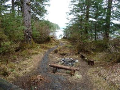
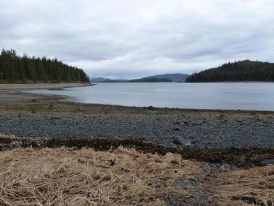
The cabin sits on level ground, only a few steps from Church Bight, a small tidal saltwater cove within Gambier Bay. The shoreline is surrounded by a thick temperate rainforest of old-gowth spruce and hemlock trees, shrubs and grasses.
Wildlife in the area abounds, including migratory waterfowl and shorebirds, Sitka black-tailed deer and brown bears (learn more about bear safety).