ROBINSON CREEK SOUTH, CA Campground Reservation, Info, Images, Map, Directions

ROBINSON CREEK SOUTH, California Campground Images, Info & Reservations

Directions

Take U.S. Highway 395 through Bridgeport. Turn south on Twin Lakes Road at the Shell gas station. Travel 9.3 miles on Twin Lakes Road. Turn left into the campground.

Phone

760-932-7092

Activities

CAMPING, FISHING, HIKING, WILDLIFE VIEWING, DAY USE AREA

Keywords

ROBS,HUMBOLDT-TOIYABE NF-FS

Related Link(s)

Rec Area Info & Images

California State Tourism

Forest Service Concessionaire

California State Road Conditions

Overview

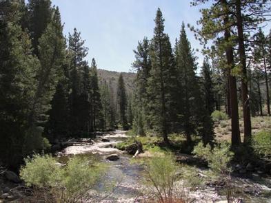
Robinson Creek South Campground is located just 9 miles from Bridgeport, California, next to Robinson Creek at an elevation of 7,000 feet. The Twin Lakes area is close by, offering boating, fishing, hiking and horseback riding opportunities.

Recreation

Robinson Creek offers good rainbow trout fishing and can be easily accessed from within the campground. Numerous hiking trails are in the vicinity, including the popular Robinson Creek Trail.

Facilities

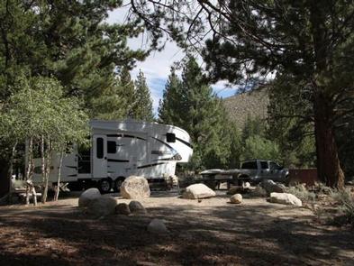
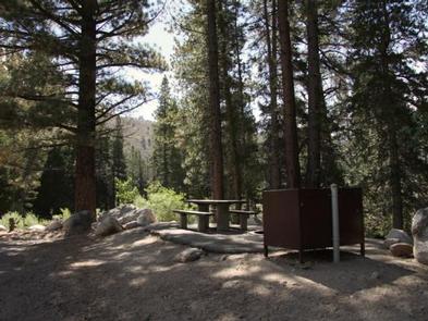
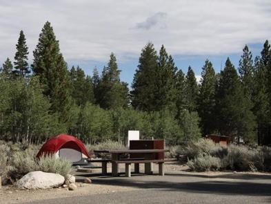
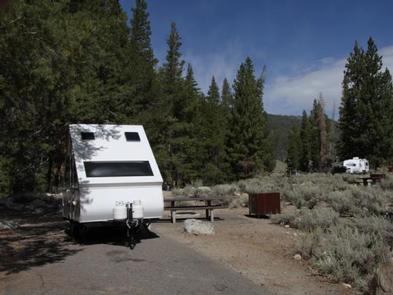
The campground contains single sites with picnic tables, food storage lockers and campfire rings with grills. Vault toilets, drinking water and trash collection are provided. Firewood is available for purchase from the host.

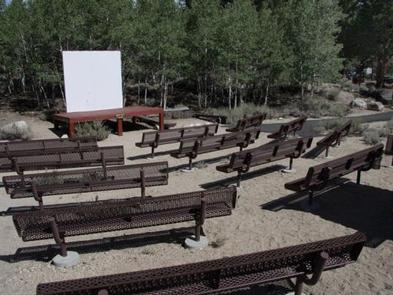
Educational programs are held at the campground’s amphitheater on weekends from July 4 through Labor Day. Robinson Creek North Campground is adjacent.

Natural Features

The campground is situated alongside its namesake creek, where a forest of massive Jeffrey pines towers over the site, offering partial shade. Lodgepole pines, sagebrush and summer wildflowers dot the landscape.

Nearby Attractions

Upper and Lower Twin Lakes are nearby, offering beautiful mountain scenery, boating, canoeing and fishing for Kokanee salmon and rainbow and brown trout. The rugged and scenic Hoover Wilderness Area can be accessed from the Twin Lakes area and offers additional hiking and horseback riding trails.

Reservation

More from CampingHiking.net:

Esswine Group Camp, Washington Campground Images, Info & Reservations

Directions From Seattle, Washington, go north on I-5 to Everett. Take exit 194 onto Highway 2, then at Highway 204 go north toward Lake Stevens. Turn north on Highway 9, then east on Highway 92 to Granite Falls. The campground is approximately 16 miles east of Granite Falls on Highway

SHOSHONE PARK KITCHEN, Idaho Campground Images, Info & Reservations

Directions From Mullan, drive east on Friday Ave, which turns into Larson Road. Total trip is about 3 miles. Look for signs to Shoshone Park. The West Kitchen is the first shelter when entering the park. Phone 208-783-2363 Activities BIKING, CAMPING, FISH HATCHERY Keywords SHOS,IDAHO PANHANDLE NF – FS Related

SHOUSE FORD, Arkansas Campground Images, Info & Reservations

Directions From Interstate 30, take exit 78 and merge onto State Highway 7 north to Bismarck. Turn left on State Highway 84 and go 9 miles west to Point Cedar. Turn left onto Shouse Ford road and continue 4 miles to the campground. Phone 870-246-5501 Activities BOATING, CAMPING, FISHING, HIKING,

BOISE CREEK, California Campground Images, Info & Reservations

Directions From Willow Creek, California, take State Route 299 for 2 miles west. Enter the campground directly from the highway. Phone 530-629-2118 Activities BIKING, BOATING, HISTORIC & CULTURAL SITE, CAMPING, FISHING, HIKING, HUNTING, VISITOR CENTER, WATER SPORTS, WILDLIFE VIEWING, SWIMMING SITE Keywords BOCR,Boise Creek Campground Related Link(s) Rec Area Info