
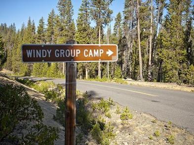


Directions
Take Highway 58 approximately 8 miles east of Willamette Pass to the Crescent Lake Junction. Turn west on Forest Road 60 and continue approximately 7 miles to the campground.
Phone
541-323-1746
Activities
BOATING, CAMPING, FISHING, HIKING, SWIMMING SITE
Keywords
WING,DESCHUTES NF – FS
Related Link(s)
Overview
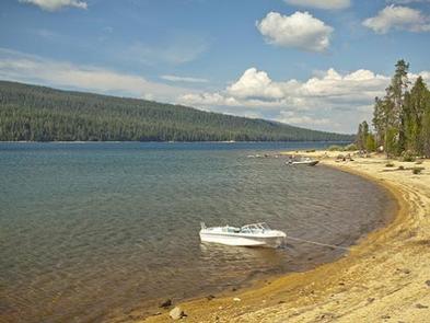
Located on the southwest end of spectacular Crescent Lake in Deschutes National Forest, Windy Group Campground offers visitors the opportunity to experience the beauty and recreational opportunities of the Cascade region in a rustic and secluded setting.
A large group site sits at the lake’s edge. Visitors enjoy hiking nearby trails and water activities on the lake.
Recreation
Boating, swimming and fishing are popular activities enjoyed by visitors during spring, summer and fall months. Anglers have the opportunity to fish from boat or shoreline for abundant salmon and trout. Summer months offer the best fishing.
Crescent Lake Snowpark offers skiers and snowmobilers a base camp for winter excursions. Open to snowmobiling, Summit Lake Trail, about 9 miles one-way, follows the road leading from Crescent Lake to Summit Lake, offering excellent views across Crescent Lake and showcasing Diamond Peak.
Facilities
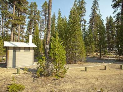
This large group site can accommodate up to 40 people.
Amenities are minimal at this campground. There is one wooden style vault toilet. Picnic tables and a barbeque pit are available.
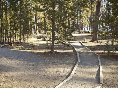
The roads are unpaved, and RVs will have plenty of space to park.
Natural Features
Crescent Lake, nestled in a naturally glaciated basin behind a moraine dam, lies east of the towering Cascade Mountain Range. Its brilliant blue-green water, sandy beaches and water temperature are exceptional for a high-elevation lake.
Towering lodgepole pine trees provide the backdrop for this area, with mountain hemlock, fir, and spruce also in the mix.
Volcanic activity throughout the surrounding area of Deschutes National Forest is evident in its landscape, showcasing cinder cones, calderas and lava flows.
Nearby Attractions
Visitors can explore wilderness areas, wild and scenic rivers, lakes and reservoirs and approximately 1,600 miles of trails that comprise nearly 2.5 million acres the Deschutes National Forest and the adjacent Ochoco National Forest.
Lava Lands Visitor Center in nearby Bend, Oregon, and the Newberry National Volcanic Monument draw visitors to the region as well.
Visitors will also enjoy traveling the Cascade Lakes Scenic Byway, known as Oregon’s Highway in the Sky, which climbs into the clouds on a 66-mile drive through the Cascade Mountain range, weaving through snow-capped peaks and alpine lakes.
A nearby resort on Crescent Lake offers lodging and a general store where supplies and equipment rentals are available.