

Directions
Located 7 miles northeast of Sitka at the end of Halibut Point Road, about 3/4 mile from the local Alaska Marine Highway ferry terminal. There are no roads to Sitka.
Access is via the Alaska Marine Highway or Alaska Airlines. Upon exiting the Ferry Terminal parking lot, turn left. Drive 3/4 mile on the state highway, also known as Halibut Point Road, or walk the same distance on the separate pedestrian walkway. The Estuary Loop, where this cabin is located (in Campsite 6), is accessed from the last right turn before the end of the state highway.
From the airport, go across the O’Connell Bridge through downtown Sitka to the intersection of Sawmill Creek Road and Halibut Point Road, which is a roundabout. Turn onto Halibut Point Road and travel 7 miles north to Starrigavan Recreation Area.
Phone
907-747-6671
Activities
BIKING, BOATING, CAMPING, FISHING, HIKING, WILDLIFE VIEWING
Keywords
STGC,Starrigavan Recreation Area,Starrigavan Campground,Starrigavan,Starrigavan Campsites,Starrigavin,Starrgavin,Sitka,TONGASS NF – FS,Alaska,STARRIGAVAN CREEK CABIN (AK),Starrigavan Creek Cabin
Related Link(s)
Overview
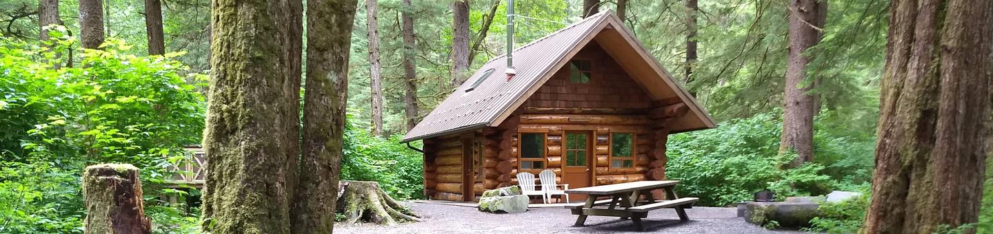
Starrigavan Creek Cabin is a drive-up, high-use, seasonally accessible log cabin within the Starrigavan Recreation Area. The cabin was constructed in 2008 from young Sitka spruce trees harvested around Starrigavan Creek to improve wildlife and fish habitat. The cabin is an experiment in the longevity of young spruce logs for construction purposes, making it the first young-growth cabin and also the first cabin within a recreation area in the Tongass National Forest.
Access to Sitka is only by ferry or airplane. The cabin is a two-minute drive from the Alaska Marine Highway Sitka Ferry Terminal or a 7-mile drive from downtown Sitka or the airport. Visitors are responsible for their own travel arrangements and safety, and must bring some of their own amenities.
Recreation
Starrigavan offers saltwater and freshwater fishing opportunities. Visitors also enjoy kayaking, photography, hiking and birding. Hiking options include the Estuary Life Trail, Forest and Muskeg Trail, Mosquito Cove Trail and numerous intertwining paths and roadways within the recreation area.
For information about fishing permits and seasons, visit the Alaska Department of Fish and Game website.
Facilities
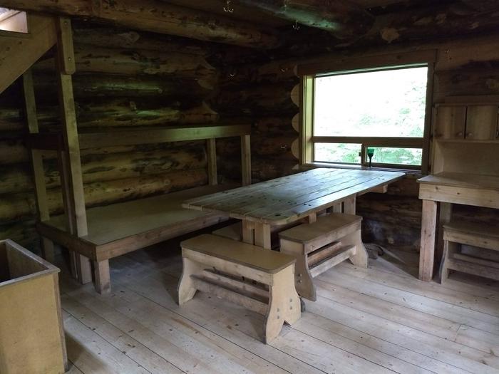
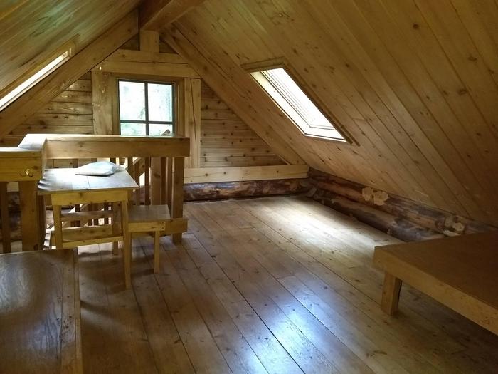
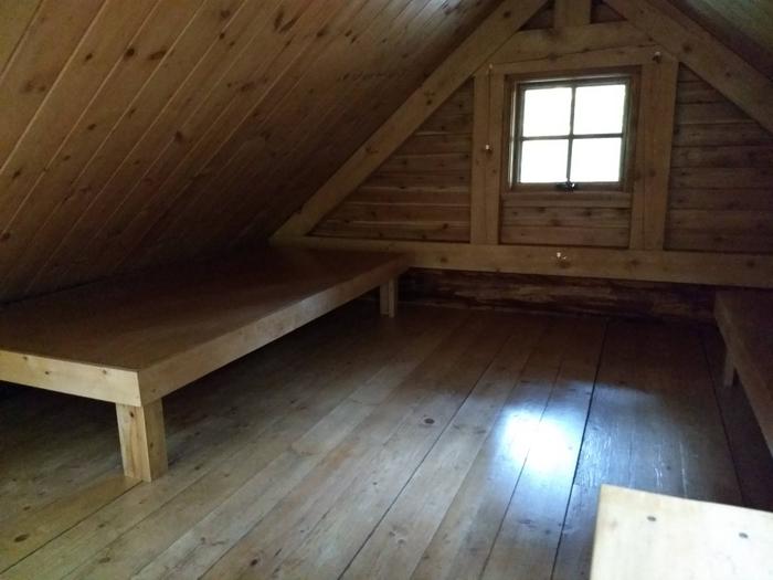
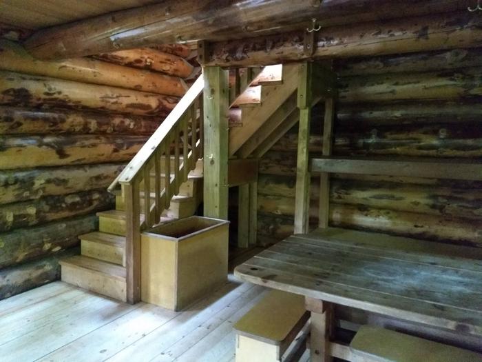
The popular cabin is equipped with beds for six adults, but can accommodate a maximum of eight people if younger children are involved. The cabin is available solely for overnight camping. See restrictions on maximum number of persons below. The main level of the cabin has one single bunk over an accessible bunk, a table with benches, a wood stove for heat, a cooking counter, a broom and dustpan. A stairway leads to the upstairs sleeping loft, which offers two double-size bunks, a table, two chairs and a lamp table. The cabin does not have electricity or indoor plumbing. A bench overlooks Starrigavan Creek. A picnic table and a combination campfire ring/grill with log benches are provided outside. A vault toilet is located 200 feet from the cabin; artesian well water is 300 feet from the cabin. Parking space is provided for up to four standard vehicles. Visitors must bring sleeping bags and pads, garbage bags, matches, fire starter, a tablecloth to protect cedar tabletop, a cooking stove, pots, pans, food and coolers, eating and cooking utensils, lanterns and flashlights (candles are discouraged). This is a locked cabin that requires visitors to pre-arrange access. See Need to Know section for details of cabin and gate access. Click here for more cabin information.
Natural Features
The cabin is situated next to Starrigavan Creek and is surrounded by a temperate rainforest of hemlock and spruce trees with salmonberry bushes, low shrubs and mosses covering the forest floor. The cabin occupies an old campsite and is located within the major camping loop of Starrigavan Recreation Area.
Starrigavan Recreation Area houses a diverse range of forest, estuary and marine habitats. Depending on the season, visitors may view brown bear, spawning coho and pink salmon, common merganser, bald eagle, great blue heron, bufflehead, kingfisher, river otter or Sitka black-tailed deer. Brown bear frequent the area.