


Directions
From Colorado Springs, travel on US Highway 24 approximately 18 miles to Woodland Park. Take Highway 67 north about 7 miles. Manitou Lake is on the right (east) side of the highway 1 mile north of Colorado Campground.
Phone
719-636-1602 (INFORMATION ONLY, NO RESERVATIONS TAKEN AT THIS NUMBER)
Activities
BIKING, BOATING, CAMPING, FISHING, HIKING
Keywords
MNLP,Manitou Lake Pavilion,Manitou Lake,Manitou
Related Link(s)
Colorado State Road Conditions
Overview
Manitou Lake Picnic Area, is located 7 miles north of Woodland Park, Colorado,. The Manitou Lake Pavilion is located inside the picnic area and is a wonderful group day use picnic area for groups up to 50 people. The scenic spot sits on the west side of Manitou Lake and provides great opportunities for hiking, biking and fishing.
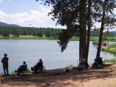
Fishing in the lake is welcomed.
Recreation
The paved Centennial Bike Trail can be accessed from the picnic area and a hiking trail loops around the lake. The paved trail connects to nearby Painted Rocks, Colorado, and South Meadows Campgrounds. Manitou Lake is a popular birding area with a diversity of waterfowl and land bird species.
Facilities
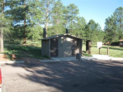
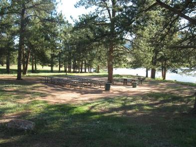
The open-air pavilion is accessible. Adjacent to the pavilion are water hydrants, a large cooking grill, vault toilets, and group picnic tables. A grassy meadow allows for plenty of outdoor sports. The pavilion can accommodate approximately 25 people if tables are set up, and 50 people if only chairs are set up. Drinking water is available during peak season only.
Natural Features
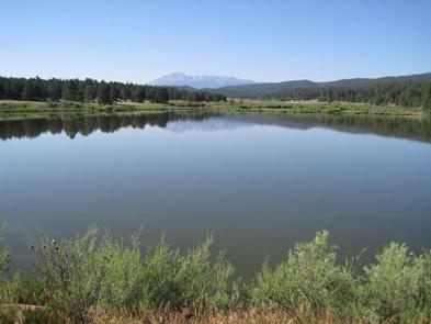
The small Manitou Lake is a 5-acre reservoir fed by Trout Creek. At a 7,700 foot elevation, the terrain is a combination of grassy meadows and ponderosa pines.
Nearby Attractions
Hike to the top of Pikes Peak or visit Garden of the Gods Park, a registered National Natural Landmark. The park and visitor center are free to the public.